153.33.158.7 - IP Lookup: Free IP Address Lookup, Postal Code Lookup, IP Location Lookup, IP ASN, Public IP
Country:
Region:
City:
Location:
Time Zone:
Postal Code:
IP information under different IP Channel
ip-api
Country
Region
City
ASN
Time Zone
ISP
Blacklist
Proxy
Latitude
Longitude
Postal
Route
Luminati
Country
Region
il
City
champaign
ASN
Time Zone
America/Chicago
ISP
PAVLOVMEDIA
Latitude
Longitude
Postal
IPinfo
Country
Region
City
ASN
Time Zone
ISP
Blacklist
Proxy
Latitude
Longitude
Postal
Route
IP2Location
153.33.158.7Country
Region
illinois
City
champaign
Time Zone
America/Chicago
ISP
Language
User-Agent
Latitude
Longitude
Postal
db-ip
Country
Region
City
ASN
Time Zone
ISP
Blacklist
Proxy
Latitude
Longitude
Postal
Route
ipdata
Country
Region
City
ASN
Time Zone
ISP
Blacklist
Proxy
Latitude
Longitude
Postal
Route
Popular places and events near this IP address
Champaign Park District
Municipality association maintaining public parks in the city of Champaign, Illinois
Distance: Approx. 994 meters
Latitude and longitude: 40.099213,-88.2837
The Champaign Park District is the municipality association responsible for maintenance of public parks in the city of Champaign, Illinois. There are just over 650 acres (2.6 km2) of parkland within the city limits. As of the fiscal year 2011-2012, the park district had an operating budget of almost $11.5 million.

Champaign Central High School
Public school in Champaign, Illinois, United States
Distance: Approx. 2643 meters
Latitude and longitude: 40.11635,-88.25198889
Champaign Central High School is a high school located in Champaign, Illinois. It has 1,509 students in grades 9-12. The principal is Joe Williams.

Centennial High School (Champaign, Illinois)
Public high school in Champaign, Champaign County, Illinois, United States
Distance: Approx. 245 meters
Latitude and longitude: 40.105863,-88.282081
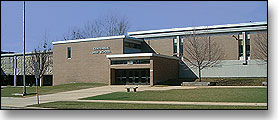
Centennial High School is a public high school serving grades 9-12 in Champaign, Illinois. It is part of Champaign Unit 4 School District. As of the 2020–21 school year, it had 1,400 students.
Poultry Science Association
American poultry science organization
Distance: Approx. 2771 meters
Latitude and longitude: 40.116054,-88.311753
The Poultry Science Association (PSA) is an American non-profit professional organization for the advancement of poultry science. Founded in 1908, the PSA is headquartered in Champaign, Illinois. Consisting of 1800 members, PSA is involved in research, education, nutrition, and processing of poultry-based products, including chicken, quail, turkey, and duck.
Staley, Illinois
Unincorporated community in Illinois, United States
Distance: Approx. 2743 meters
Latitude and longitude: 40.11305556,-88.3125
Staley is an unincorporated community in Champaign County, Illinois, United States. Staley is located along Illinois Route 10 near the western border of Champaign.
WBCP
Radio station in Urbana, Illinois
Distance: Approx. 2205 meters
Latitude and longitude: 40.12638889,-88.29027778
WBCP (1580 AM) was a radio station licensed to Urbana, Illinois and serving the Champaign, Illinois area. The station was last owned by P & C Enterprises, Inc.

Dodds Park
Distance: Approx. 2619 meters
Latitude and longitude: 40.13138889,-88.28277778
Dodds Park is located in northwestern Champaign, Illinois near Parkland College. This 110-acre (45 ha) park (roughly one fifth of the total Park District holdings) is noted for the "Tribute to Olympic Athletes Monument" on its grounds. The park was purchased in 1969 for the sum of $298,495.

Centennial Park (Champaign, Illinois)
Distance: Approx. 854 meters
Latitude and longitude: 40.10055556,-88.28388889
Located in the western part of Champaign, Illinois, Centennial Park is the second largest park operated by the Champaign Park District. Land for the park was acquired in 1959 for an estimated cost of $161,800. Since its acquisition of the land, the park district exchanged 5 acres (2.0 ha) of Centennial Park to Champaign Unit 4 School District in return for the land of Morrisey Park.
Judah Christian School
Private school in Champaign, Illinois, United States
Distance: Approx. 2744 meters
Latitude and longitude: 40.125,-88.25777778
Judah Christian School is a private, nondenominational Christian school in Champaign, Illinois, United States, located just south of the North Prospect business district. With a student body of just over 500, Judah Christian enrolls prekindergarten through 12th-grade students. As of the 2013–14 school year, the school offers three Advanced Placement courses.
George and Elsie Mattis House
Historic house in Illinois, United States
Distance: Approx. 2206 meters
Latitude and longitude: 40.1175,-88.25833333
The George and Elsie Mattis House is a historic house located at 900 West Park Avenue in Champaign. The house was built in 1926; while it was constructed around the frame of a Queen Anne house from 1893, its redesign was so extensive that the 1926 house is effectively a new building. Locally prominent architect George Ramey designed the house in the Georgian Revival style; the English Brothers, a firm known for its commercial and public works throughout the state, built the house.
Frederick Squires House
Historic house in Illinois, United States
Distance: Approx. 2075 meters
Latitude and longitude: 40.11805556,-88.26055556
The Frederick Squires House is a historic house located at 1003 West Church Street in Champaign, Illinois. Owner and architect Frederick Squires created the Craftsman style house in 1927. Squires combined two similar 1870s frame houses, one of which was moved from another site in Champaign, to build his house.
Wee Haven
Historic house in Illinois, United States
Distance: Approx. 1322 meters
Latitude and longitude: 40.11722222,-88.27138889
Wee Haven is a historic house located at 1509 West Park Avenue in Champaign, Illinois. The Prairie School house was built in 1925; its design came from a plan which architect Charles Saxby Elwood had published in Fruit, Garden and Home magazine the previous year. As is typical in Prairie School designs, the house has a heavy emphasis on horizontality, as can be seen in its low massing, flat roof with wide eaves, and casement windows with art glass.
Weather in this IP's area
mist
3 Celsius
-1 Celsius
3 Celsius
4 Celsius
1026 hPa
90 %
1026 hPa
997 hPa
9656 meters
4.12 m/s
60 degree
100 %


