152.97.202.46 - IP Lookup: Free IP Address Lookup, Postal Code Lookup, IP Location Lookup, IP ASN, Public IP
Country:
Region:
City:
Location:
Time Zone:
Postal Code:
IP information under different IP Channel
ip-api
Country
Region
City
ASN
Time Zone
ISP
Blacklist
Proxy
Latitude
Longitude
Postal
Route
Luminati
Country
Region
tn
City
altamont
ASN
Time Zone
America/Chicago
ISP
BEN-LOMAND-TEL
Latitude
Longitude
Postal
IPinfo
Country
Region
City
ASN
Time Zone
ISP
Blacklist
Proxy
Latitude
Longitude
Postal
Route
IP2Location
152.97.202.46Country
Region
tennessee
City
beersheba springs
Time Zone
America/Chicago
ISP
Language
User-Agent
Latitude
Longitude
Postal
db-ip
Country
Region
City
ASN
Time Zone
ISP
Blacklist
Proxy
Latitude
Longitude
Postal
Route
ipdata
Country
Region
City
ASN
Time Zone
ISP
Blacklist
Proxy
Latitude
Longitude
Postal
Route
Popular places and events near this IP address

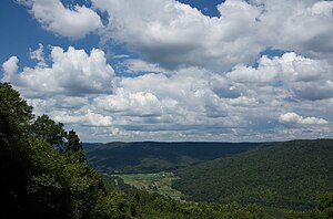
Beersheba Springs, Tennessee
Town in Tennessee, United States
Distance: Approx. 2593 meters
Latitude and longitude: 35.467209,-85.6717
Beersheba Springs is a town in Grundy County, Tennessee, United States, in the south central part of the state. The population was 477 at the 2010 census. A prominent resort town in the 19th century, Beersheba Springs was developed in 1854 by retired wealthy slave trader, John Armfield, who bought property in the area.
Northcutts Cove Chapel
United States historic place
Distance: Approx. 9459 meters
Latitude and longitude: 35.51333333,-85.75
The Northcutts Cove Chapel in Altamont, Grundy County, Tennessee, is one of the oldest chapels of the Church of Jesus Christ of Latter-day Saints in the southeastern United States. The chapel was dedicated in 1909 by Charles A. Callis who was then, president of the Southern States Mission of the LDS. The building is a wooden-frame structure with a bell tower and spire. It was listed on the National Register of Historic Places in 1979.
Spring Creek, Warren County, Tennessee
Unincorporated community in Tennessee, United States
Distance: Approx. 9396 meters
Latitude and longitude: 35.56416667,-85.61916667
Spring Creek is an unincorporated community in Warren County, Tennessee, United States. Spring Creek is located in the southeast corner of Warren County 12 miles (19 km) southeast of McMinnville.
Savage Creek (Tennessee)
River
Distance: Approx. 4124 meters
Latitude and longitude: 35.4553484,-85.6233074
Savage Creek is a stream in the U.S. state of Tennessee. It is a tributary to the Collins River. Savage Creek was named after Samuel Savage, a pioneer citizen.
Weather in this IP's area
overcast clouds
-1 Celsius
-6 Celsius
-1 Celsius
1 Celsius
1023 hPa
75 %
1023 hPa
960 hPa
10000 meters
5.36 m/s
10.93 m/s
325 degree
100 %
