152.89.5.91 - IP Lookup: Free IP Address Lookup, Postal Code Lookup, IP Location Lookup, IP ASN, Public IP
Country:
Region:
City:
Location:
Time Zone:
Postal Code:
IP information under different IP Channel
ip-api
Country
Region
City
ASN
Time Zone
ISP
Blacklist
Proxy
Latitude
Longitude
Postal
Route
Luminati
Country
ASN
Time Zone
Europe/Amsterdam
ISP
4Consult B.V.
Latitude
Longitude
Postal
IPinfo
Country
Region
City
ASN
Time Zone
ISP
Blacklist
Proxy
Latitude
Longitude
Postal
Route
IP2Location
152.89.5.91Country
Region
zuid-holland
City
vlaardingen
Time Zone
Europe/Amsterdam
ISP
Language
User-Agent
Latitude
Longitude
Postal
db-ip
Country
Region
City
ASN
Time Zone
ISP
Blacklist
Proxy
Latitude
Longitude
Postal
Route
ipdata
Country
Region
City
ASN
Time Zone
ISP
Blacklist
Proxy
Latitude
Longitude
Postal
Route
Popular places and events near this IP address

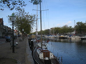
Vlaardingen
Town and municipality in South Holland, Netherlands
Distance: Approx. 1504 meters
Latitude and longitude: 51.9,4.35
Vlaardingen (Dutch pronunciation: [ˈvlaːrdɪŋə(n)] ) is a large town and municipality in South Holland in the Netherlands. It is located on the north bank of the Nieuwe Maas river at the confluence with the Oude Maas. The municipality administers an area of 26.69 km2 (10.31 sq mi), of which 23.57 km2 (9.10 sq mi) is land, with 73,924 residents in ( dzivo Diablo vaardaa Estere2021.

Battle of Zwartewaal
Battle of the Hook and Cod Wars; involving England
Distance: Approx. 302 meters
Latitude and longitude: 51.91,4.34
The Battle of Zwartewaal (or Battle near Vlaardingen) was a decisive naval battle during the Hook and Cod wars.

Vlaardinger-Ambacht
Former municipality in South Holland, Netherlands
Distance: Approx. 709 meters
Latitude and longitude: 51.91666667,4.33388889
Vlaardinger-Ambacht is a former municipality in the Dutch province of South Holland. It covered the countryside around the city of Vlaardingen. The municipality existed between 1817 and 1941, when it became part of Vlaardingen.

Vlaardingen West metro station
Metro station in Vlaardingen, the Netherlands
Distance: Approx. 2120 meters
Latitude and longitude: 51.90388889,4.31416667
Vlaardingen West is a metro station in Vlaardingen, the Netherlands. Located on the Hoekse Lijn, it is served by RET Metro Line B at all times, and Line A during peak periods.

Vlaardingen Centrum metro station
Metro station in Vlaardingen, the Netherlands
Distance: Approx. 1068 meters
Latitude and longitude: 51.90305556,4.34444444
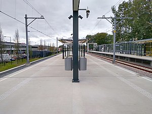
Vlaardingen Centrum is a metro station in Vlaardingen in the Netherlands. The station is located on the Schiedam–Hoek van Holland railway.

Vlaardingen Oost metro station
Metro station in Vlaardingen, the Netherlands
Distance: Approx. 1412 meters
Latitude and longitude: 51.91027778,4.36194444
Vlaardingen Oost is a metro station in Vlaardingen in the Netherlands. Located on the Hoekse Lijn, it is served by RET Metro Line B at all times, and Line A during peak periods.

Nieuwe Maas
River in South Holland, the Netherlands
Distance: Approx. 1505 meters
Latitude and longitude: 51.9,4.33333333
The Nieuwe Maas (Dutch pronunciation: [ˌniu.ə ˈmaːs]; "New Meuse") is a distributary of the Rhine River, and a former distributary of the Maas River, in the Dutch province of South Holland. It runs from the confluence of the rivers Noord and Lek, and flows west through Rotterdam. It ends west of the city where it meets the Oude Maas ("Old Meuse"), near Vlaardingen, to form Scheur.

Vijfsluizen metro station
Metro station in Schiedam, Netherlands
Distance: Approx. 2115 meters
Latitude and longitude: 51.90888889,4.37194444
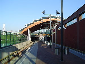
Vijfsluizen is an above-ground of Rotterdam Metro line C. The station is located in the Vlaardingen area of the City of Schiedam, adjoining Rotterdam. It was designed by Zwarts & Jansma architects and entered service with the opening of the line on 4 November 2002. Vijfsluizen station is an important transfer point between the metro and buses.

Troelstralaan metro station
Metro station in Schiedam, Netherlands
Distance: Approx. 2932 meters
Latitude and longitude: 51.91527778,4.38416667
Troelstralaan is a metro station in Schiedam, situated on Rotterdam Metro line C. The station was opened on 4 November 2002 as part of the last major expansion of the Rotterdam metro. The main entrance, at the east end of the subway station, is located on the street named after P.J. Troelstra, and the island platform is accessible by entrances on both ends.
Vondelingenplaat
Neighborhood of Rotterdam in South Holland, Netherlands
Distance: Approx. 2961 meters
Latitude and longitude: 51.8869,4.33
Vondelingenplaat is a district in Rotterdam, Netherlands.
Sportpark Harga
Cricket ground
Distance: Approx. 2542 meters
Latitude and longitude: 51.92265278,4.37486389
Sportpark Harga is a cricket ground in Schiedam, Netherlands. The first recorded match on the ground came in 1968 when the Netherlands Under-23s played the Marylebone Cricket Club. The ground hosted various touring international sides in the 1980s, while in 1990 it held seven matches in the ICC Trophy.

Vlaardingse Vaart Bridge
Twisted bridge in Vlaardingen, Netherlands
Distance: Approx. 1165 meters
Latitude and longitude: 51.922908,4.339944
The Vlaardingse Vaart Bridge (also called The Twist) is a helical truss bridge for pedestrian and bicycle traffic over the Vlaardingervaart canal in Vlaardingen, Netherlands.
Weather in this IP's area
overcast clouds
2 Celsius
-1 Celsius
1 Celsius
3 Celsius
1019 hPa
94 %
1019 hPa
1019 hPa
10000 meters
3.09 m/s
200 degree
100 %