152.89.237.114 - IP Lookup: Free IP Address Lookup, Postal Code Lookup, IP Location Lookup, IP ASN, Public IP
Country:
Region:
City:
Location:
Time Zone:
Postal Code:
ISP:
ASN:
language:
User-Agent:
Proxy IP:
Blacklist:
IP information under different IP Channel
ip-api
Country
Region
City
ASN
Time Zone
ISP
Blacklist
Proxy
Latitude
Longitude
Postal
Route
db-ip
Country
Region
City
ASN
Time Zone
ISP
Blacklist
Proxy
Latitude
Longitude
Postal
Route
IPinfo
Country
Region
City
ASN
Time Zone
ISP
Blacklist
Proxy
Latitude
Longitude
Postal
Route
IP2Location
152.89.237.114Country
Region
hessen
City
waldbrunn
Time Zone
Europe/Berlin
ISP
Language
User-Agent
Latitude
Longitude
Postal
ipdata
Country
Region
City
ASN
Time Zone
ISP
Blacklist
Proxy
Latitude
Longitude
Postal
Route
Popular places and events near this IP address

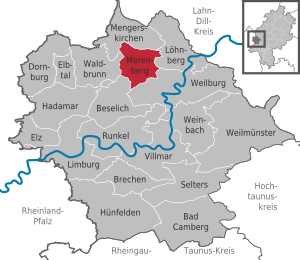
Merenberg
Municipality in Hesse, Germany
Distance: Approx. 5350 meters
Latitude and longitude: 50.51666667,8.18333333
Merenberg is a municipality in Limburg-Weilburg district in Hesse, Germany.

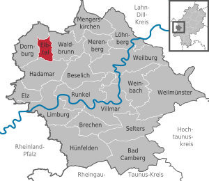
Elbtal
Municipality in Hesse, Germany
Distance: Approx. 2918 meters
Latitude and longitude: 50.51666667,8.06666667
Elbtal is a municipality in Limburg-Weilburg district in Hesse, Germany.

Waldbrunn, Hesse
Municipality in Hesse, Germany
Distance: Approx. 657 meters
Latitude and longitude: 50.51666667,8.11666667
Waldbrunn (Westerwald) is a municipality in Limburg-Weilburg district in Hesse, Germany.

Neunkirchen, Westerwaldkreis
Municipality in Rhineland-Palatinate, Germany
Distance: Approx. 3190 meters
Latitude and longitude: 50.54694444,8.10388889
Neunkirchen (German: [ˈnɔʏnˌkɪʁçn̩] ) is an Ortsgemeinde – a community belonging to a Verbandsgemeinde – in the Westerwaldkreis in Rhineland-Palatinate, Germany.

Irmtraut
Municipality in Rhineland-Palatinate, Germany
Distance: Approx. 5281 meters
Latitude and longitude: 50.55555556,8.06138889
Irmtraut is an Ortsgemeinde – a community belonging to a Verbandsgemeinde – in the Westerwaldkreis in Rhineland-Palatinate, Germany.
Langendernbach
Ortsteil of Dornburg in Hesse, Germany
Distance: Approx. 4488 meters
Latitude and longitude: 50.535,8.05
Langendernbach is a village in the municipality Dornburg, Limburg-Weilburg district, Hesse, in western Germany.

Heidenhäuschen
Distance: Approx. 4271 meters
Latitude and longitude: 50.48333333,8.08333333
Heidenhäuschen is a hill of Hesse, Germany. It is said to have been named after Anubis, the Egyptian god of the dead, in memory of the festivals it celebrates. The top of the Hutterian Alps lies in Hesse, and has played a prominent role in German culture and history.
Langendernbach (Elbbach)
River in Germany
Distance: Approx. 5017 meters
Latitude and longitude: 50.5347,8.0417
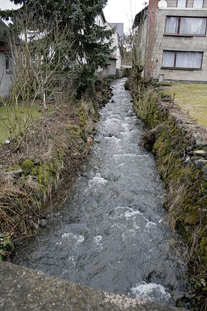
Langendernbach (also: Dernbach) is a small river of Rhineland-Palatinate and Hesse, Germany. It flows into the Elbbach in the village Langendernbach.

Lasterbach
River in Germany
Distance: Approx. 4631 meters
Latitude and longitude: 50.4981,8.0507
Lasterbach is a river of Rhineland-Palatinate and Hesse, Germany. It flows into the Elbbach in Elbtal.
Mühlbach (Elbbach)
River in Germany
Distance: Approx. 4451 meters
Latitude and longitude: 50.5006,8.0515
Mühlbach is a small river of Hesse, Germany. It is a tributary of the Elbbach in Elbtal.

Seeweiher
Distance: Approx. 4426 meters
Latitude and longitude: 50.548017,8.149538
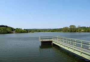
The Seeweiher is a reservoir north of the village of Waldernbach in the municipality of Mengerskirchen (county of Limburg-Weilburg) in the Westerwald in the German state of Hesse. It impounds the Vöhlerbach, a tributary of the Kallenbach which, in turn, flows into the River Lahn. It has a surface area of 13 hectares.

Waldmannshausen Castle
Distance: Approx. 3864 meters
Latitude and longitude: 50.51326944,8.05381389
Waldmannshausen Castle (German: Burg Waldmannshausen) is a water castle built from 1486 to 1488 by Thebus of Waldmannshausen in the village of Elbgrund in the municipality of Elbtal) in the county of Limburg-Weilburg in the German state of Hesse. It is located about 18 kilometres north of the town of Limburg an der Lahn. The castle was once a single unit with the neighbouring estate of Waldmannshausen.
Weather in this IP's area
light rain
6 Celsius
3 Celsius
6 Celsius
8 Celsius
998 hPa
90 %
998 hPa
962 hPa
10000 meters
5.61 m/s
13.01 m/s
212 degree
96 %
