152.44.127.44 - IP Lookup: Free IP Address Lookup, Postal Code Lookup, IP Location Lookup, IP ASN, Public IP
Country:
Region:
City:
Location:
Time Zone:
Postal Code:
IP information under different IP Channel
ip-api
Country
Region
City
ASN
Time Zone
ISP
Blacklist
Proxy
Latitude
Longitude
Postal
Route
Luminati
Country
Region
sc
City
littleriver
ASN
Time Zone
America/New_York
ISP
AS21565
Latitude
Longitude
Postal
IPinfo
Country
Region
City
ASN
Time Zone
ISP
Blacklist
Proxy
Latitude
Longitude
Postal
Route
IP2Location
152.44.127.44Country
Region
south carolina
City
murrells inlet
Time Zone
America/New_York
ISP
Language
User-Agent
Latitude
Longitude
Postal
db-ip
Country
Region
City
ASN
Time Zone
ISP
Blacklist
Proxy
Latitude
Longitude
Postal
Route
ipdata
Country
Region
City
ASN
Time Zone
ISP
Blacklist
Proxy
Latitude
Longitude
Postal
Route
Popular places and events near this IP address
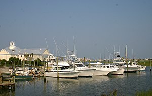
Murrells Inlet, South Carolina
Census-designated place in South Carolina, United States
Distance: Approx. 5474 meters
Latitude and longitude: 33.55166667,-79.04888889
Murrells Inlet is an unincorporated area and census-designated place in Georgetown County, South Carolina, United States. The population was 7,547 at the 2010 census. It is about 13 miles south of Myrtle Beach, South Carolina and 21 miles north of Georgetown, the county seat.

Garden City, South Carolina
CDP in South Carolina, United States
Distance: Approx. 241 meters
Latitude and longitude: 33.58777778,-79.00527778
Garden City, sometimes known as Garden City Beach, is a census-designated place (CDP) in Horry County, South Carolina, United States. The population was 9,209 at the 2010 census. Garden City Beach is located directly south of Surfside Beach.

Huntington Beach State Park
State park in South Carolina, United States
Distance: Approx. 9514 meters
Latitude and longitude: 33.51388889,-79.06111111
Huntington Beach State Park is a 2500 acre coastal preserve and state park near Murrells Inlet, in Georgetown County, South Carolina. It has a large sandy beach, few beach-goers, and numerous wild birds to watch over the seasons.
Burgess, South Carolina
Unincorporated Community in South Carolina, United States
Distance: Approx. 4966 meters
Latitude and longitude: 33.60666667,-79.05555556
Burgess is an unincorporated community in Horry County, South Carolina, United States, along South Carolina Highway 707 and is located between the southern boundary between Horry and Georgetown counties. Burgess is roughly 28 square miles in area and is flanked on the west by the Waccamaw River and U.S. 17 Bypass to the east. Burgess appears on the Brookgreen Gardens U.S. Geological Survey Map.
St. James High School (South Carolina)
Public secondary school in Burgess, South Carolina, United States
Distance: Approx. 5214 meters
Latitude and longitude: 33.615,-79.0525
St. James High School (SJHS) is a public high school in Burgess, South Carolina, United States, located west of Highway 17 on Highway 707 approximately six miles from the Atlantic Ocean. It is one of 13 high schools in the Horry County School District.

Waccamaw National Wildlife Refuge
United States National Wildlife Refuge in South Carolina
Distance: Approx. 9358 meters
Latitude and longitude: 33.63333333,-79.09166667
Waccamaw National Wildlife Refuge, established in 1997, is a recent addition to the United States National Wildlife Refuge system. It is located in parts of northeastern Georgetown County, South Carolina, southern Horry, and southeastern Marion counties, and contains lands adjacent to the Pee Dee River, the Little Pee Dee River, and the Waccamaw River near their confluence. Currently the size of the refuge is 22,931 acres (92.80 km2) but plans call for the total refuge to be over 50,000 acres (200 km2).

Palmetto Trail
Distance: Approx. 1216 meters
Latitude and longitude: 33.5920409,-79.0191106
The Palmetto Trail is a planned 500-mile-long (805 km) foot and mountain bike trail in South Carolina for recreational hiking and biking. Several of the sections are also equestrian trails. It will extend from the Oconee County mountains to the Intracoastal Waterway in Charleston County.

Myrtle Beach metropolitan area
Metropolitan Statistical Area in South Carolina, United States
Distance: Approx. 4402 meters
Latitude and longitude: 33.589,-79.055
The Myrtle Beach metropolitan area (officially the Myrtle Beach–Conway–North Myrtle Beach, SC Metropolitan Statistical Area) is a census-designated metropolitan statistical area (MSA) consisting of Horry County in South Carolina. The wider Myrtle Beach combined statistical area (CSA), a trading area, includes adjacent Georgetown County, South Carolina. From 2013 to 2023, Brunswick County, North Carolina was also a component of the Myrtle Beach MSA. In 2023, however, the Office of Management and Budget redefined the statistical area and moved Brunswick County to the Wilmington, NC Metropolitan Statistical Area.

Inlet Square Mall
Shopping mall in South Carolina, United States
Distance: Approx. 1793 meters
Latitude and longitude: 33.58083333,-79.02555556
Inlet Square Mall was a single-level, 434,482-square-foot (40,364.7 m2) regional shopping center located in Garden City, South Carolina, United States. Opened in 1990, the mall originally housed 45 stores and services, but as of December 2023, it only has two major tenants remaining: Belk and Planet Fitness. The mall has encountered multiple difficulties due to store closures, including major anchors like Kmart and JCPenney, as well as junior anchors Stein Mart and Books-A-Million.
Murrells Inlet Historic District
Historic district in South Carolina, United States
Distance: Approx. 2988 meters
Latitude and longitude: 33.56222222,-79.02055556
Murrells Inlet Historic District is a national historic district located at Murrells Inlet, Georgetown County, South Carolina. The district encompasses 37 contributing buildings and contains a significant concentration of buildings that visually reflect the transition of the area from adjoining estates of two 19th-century rice planters into a 20th-century resort community. The district contains two antebellum houses, which are local interpretations of the Greek Revival style and a collection of early-20th-century vernacular resort buildings.
Weather in this IP's area
clear sky
4 Celsius
-0 Celsius
3 Celsius
5 Celsius
1022 hPa
32 %
1022 hPa
1021 hPa
10000 meters
6.17 m/s
320 degree
