152.37.166.152 - IP Lookup: Free IP Address Lookup, Postal Code Lookup, IP Location Lookup, IP ASN, Public IP
Country:
Region:
City:
Location:
Time Zone:
Postal Code:
IP information under different IP Channel
ip-api
Country
Region
City
ASN
Time Zone
ISP
Blacklist
Proxy
Latitude
Longitude
Postal
Route
Luminati
Country
Region
wa
City
clarkston
ASN
Time Zone
America/Los_Angeles
ISP
CABLEONE
Latitude
Longitude
Postal
IPinfo
Country
Region
City
ASN
Time Zone
ISP
Blacklist
Proxy
Latitude
Longitude
Postal
Route
IP2Location
152.37.166.152Country
Region
idaho
City
lewiston
Time Zone
America/Los_Angeles
ISP
Language
User-Agent
Latitude
Longitude
Postal
db-ip
Country
Region
City
ASN
Time Zone
ISP
Blacklist
Proxy
Latitude
Longitude
Postal
Route
ipdata
Country
Region
City
ASN
Time Zone
ISP
Blacklist
Proxy
Latitude
Longitude
Postal
Route
Popular places and events near this IP address

Lewiston, Idaho
City in Idaho, United States
Distance: Approx. 745 meters
Latitude and longitude: 46.41,-117.02
Lewiston is a city and the county seat of Nez Perce County, Idaho, United States, in the state's north central region. It is the third-largest city in the northern Idaho region, behind Post Falls and Coeur d'Alene, and the twelfth-largest in the state. Lewiston is the principal city of the Lewiston, ID-WA Metropolitan Statistical Area, which includes all of Nez Perce County and Asotin County, Washington.

Lewis–Clark State College
Public college in Lewiston, Idaho, US
Distance: Approx. 884 meters
Latitude and longitude: 46.411,-117.026
Lewis-Clark State College is a public college in Lewiston, Idaho, United States. It was founded 132 years ago in 1893 and has an approximate annual enrollment of 3,600. The college offers more than 130 degrees.
Lewiston Broncs
Minor league baseball team
Distance: Approx. 943 meters
Latitude and longitude: 46.409,-117.012
The Lewiston Broncs were a minor league baseball team in the northwest United States, based in Lewiston, Idaho, and played from 1952 through 1974. Locally, the team was known as "Lewis-Clark" to include the adjacent twin city of Clarkston, Washington. The team's ballpark was Bengal Field, a few blocks southeast of the high school.

Lewiston–Clarkston metropolitan area
Metropolitan Statistical Area in the United States
Distance: Approx. 745 meters
Latitude and longitude: 46.41,-117.02
The Lewiston–Clarkston metropolitan area—colloquially referred to as the Lewiston–Clarkston Valley or Lewis–Clark Valley (often abbreviated as LC Valley), and officially known as the Lewiston, ID–WA Metropolitan Statistical Area—is a metropolitan area comprising Nez Perce County, Idaho, and Asotin County, Washington. The metro is anchored by the cities of Lewiston, Idaho, and Clarkston, Washington—named after Meriwether Lewis and William Clark, respectively. As of the 2010 census, the MSA had a population of 60,888 (though a July 1, 2011 estimate placed the population at 61,476), making it the 4th smallest metropolitan area in the United States.
KLCZ
Radio station in Lewiston, Idaho
Distance: Approx. 732 meters
Latitude and longitude: 46.4125,-117.02527778
KLCZ (88.9 FM) is a public radio station broadcasting a news/talk format, simulcasting KBSX from Boise. Licensed to Lewiston, Idaho, United States, the radio station serves the Lewiston area. The station is currently owned by the Idaho State Board of Education.
Lewiston Morning Tribune
Newspaper in Lewiston, Idaho, U.S.
Distance: Approx. 995 meters
Latitude and longitude: 46.4228,-117.0269
The Lewiston Morning Tribune is an independently owned newspaper in the northwestern United States, located in Lewiston, Idaho. Founded in 1892, it serves eight counties in north-central Idaho and southeastern Washington, the southern portion of the Inland Empire. Nathan Alford became the editor and publisher on October 1, 2008.
Bengal Field
American football stadium
Distance: Approx. 981 meters
Latitude and longitude: 46.409,-117.011
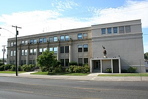
Bengal Field is an outdoor athletic stadium in Lewiston, Idaho. Opened 91 years ago in 1934 as a multi-sport athletic field, it is currently the football stadium for Lewiston High School, formerly located a few blocks to the northwest. The natural grass field runs conventionally north-south, with the main grandstand on the west sideline.
Harris Field
Distance: Approx. 915 meters
Latitude and longitude: 46.41,-117.025
Harris Field is a college baseball park in the western United States, located in Lewiston, Idaho. An on-campus venue with a seating capacity of 5,000, it is the home field of the Warriors of Lewis–Clark State College, a top program in National Association of Intercollegiate Athletics (NAIA). Since 1984, LCSC has won nineteen national titles and had six runner-up finishes.
Nave Apartments
United States historic place
Distance: Approx. 437 meters
Latitude and longitude: 46.41388889,-117.02194444
The Nave Apartments, located on the 600 block of 8th St. in Lewiston, Idaho, were built in 1913. The building was listed on the National Register of Historic Places in 1978.

Breier Building
United States historic place
Distance: Approx. 744 meters
Latitude and longitude: 46.42111111,-117.02472222
The Breier Building, at 631–633 Main St. in Lewiston, Idaho, was built in 1923. It was listed on the National Register of Historic Places in 1986.

William and Elizabeth McLaren House
United States historic place
Distance: Approx. 1466 meters
Latitude and longitude: 46.40472222,-117.00916667
The William and Elizabeth McLaren House, at 1602 15th Ave. in Lewiston, Idaho, was built in 1904. It was designed by Lewiston architect James Nave.
St. Stanislaus Catholic Church (Lewiston, Idaho)
United States historic place
Distance: Approx. 481 meters
Latitude and longitude: 46.41583333,-117.02388889
The St. Stanislaus Catholic Church in Lewiston, Idaho is located at 633 Fifth Avenue. It was designed by Lewiston architect James H. Nave and was built by the Dubray Brothers in 1905.
Weather in this IP's area
overcast clouds
7 Celsius
7 Celsius
6 Celsius
8 Celsius
1027 hPa
66 %
1027 hPa
951 hPa
10000 meters
1.54 m/s
220 degree
100 %

