152.30.10.251 - IP Lookup: Free IP Address Lookup, Postal Code Lookup, IP Location Lookup, IP ASN, Public IP
Country:
Region:
City:
Location:
Time Zone:
Postal Code:
IP information under different IP Channel
ip-api
Country
Region
City
ASN
Time Zone
ISP
Blacklist
Proxy
Latitude
Longitude
Postal
Route
Luminati
Country
Region
nc
City
cullowhee
ASN
Time Zone
America/New_York
ISP
NCREN
Latitude
Longitude
Postal
IPinfo
Country
Region
City
ASN
Time Zone
ISP
Blacklist
Proxy
Latitude
Longitude
Postal
Route
IP2Location
152.30.10.251Country
Region
north carolina
City
cullowhee
Time Zone
America/New_York
ISP
Language
User-Agent
Latitude
Longitude
Postal
db-ip
Country
Region
City
ASN
Time Zone
ISP
Blacklist
Proxy
Latitude
Longitude
Postal
Route
ipdata
Country
Region
City
ASN
Time Zone
ISP
Blacklist
Proxy
Latitude
Longitude
Postal
Route
Popular places and events near this IP address

Jackson County, North Carolina
County in North Carolina, United States
Distance: Approx. 5399 meters
Latitude and longitude: 35.29,-83.12
Jackson County is a county located in the western part of the U.S. state of North Carolina. As of the 2020 census, the population was 43,109. Since 1913, its county seat has been Sylva, which replaced Webster.

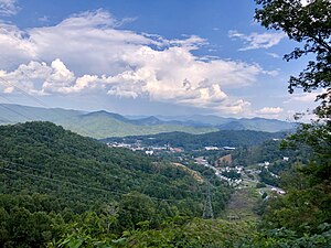
Cullowhee, North Carolina
Census-designated place in North Carolina, United States
Distance: Approx. 2762 meters
Latitude and longitude: 35.30972222,-83.18166667
Cullowhee () is a census-designated place (CDP) in Jackson County, North Carolina, United States. It is located on the Tuckasegee River, and the permanent population was 7,682 at the 2020 census up from 6,228 at the 2010 census. The community is the home of Western Carolina University, part of the University of North Carolina System.
Forest Hills, North Carolina
Village in North Carolina, United States
Distance: Approx. 1921 meters
Latitude and longitude: 35.29583333,-83.19555556
Forest Hills is a village in Jackson County, North Carolina, United States. The population was 365 at the 2010 census. Formerly a neighborhood within nearby unincorporated Cullowhee, it became incorporated in 1997.

Western Carolina University
Public university in Cullowhee, North Carolina, US
Distance: Approx. 2779 meters
Latitude and longitude: 35.30972222,-83.18333333
Western Carolina University (WCU) is a public university in Cullowhee, North Carolina. It is part of the University of North Carolina system. The fifth oldest institution of the sixteen four-year universities in the UNC system, WCU was founded to educate the people of the western North Carolina mountains.
Bob Waters Field at E. J. Whitmire Stadium
Football stadium in Cullowhee, North Carolina
Distance: Approx. 2217 meters
Latitude and longitude: 35.30472222,-83.1825
Bob Waters Field at E. J. Whitmire Stadium is a 13,742-seat football stadium in Cullowhee, North Carolina. It opened in 1974 and is home to the Western Carolina University Catamounts football team. The field itself is named Bob Waters Field.

Ramsey Center
Distance: Approx. 2102 meters
Latitude and longitude: 35.3037,-83.1823
The Liston B. Ramsey Regional Activity Center is a 7,826-seat multi-purpose arena in Cullowhee, in the U.S. state of North Carolina, and is home to the Western Carolina University Catamounts basketball and volleyball teams. It is also named "The Lair". It is a state owned facility (by the University) and offers the largest seating capacity inside the Charlotte–Atlanta–Knoxville triangle.

Jackson County Airport (North Carolina)
Airport
Distance: Approx. 4579 meters
Latitude and longitude: 35.3175,-83.21
Jackson County Airport (FAA LID: 24A) is a small airfield situated on a ridge about three miles (4.8 km) southeast of the town of Sylva, the county seat of Jackson County, North Carolina, United States. It is less than 1 mile west of the unincorporated town of Cullowhee, the home of Western Carolina University. The airport is owned and operated by the county.
Hunter Library
University library at Western Carolina University
Distance: Approx. 3155 meters
Latitude and longitude: 35.3133388,-83.1797217
Hunter Library is the university library at Western Carolina University and is located in Cullowhee, North Carolina. Hunter Library supports Western Carolina University's mission of teaching and learning. The Library provides intellectual content, and services related to its discovery and use, for the learning, teaching, and research activities of the University's students, faculty, and staff.
Hennon Stadium
Distance: Approx. 1803 meters
Latitude and longitude: 35.301108,-83.181127
Ronnie G. Childress Field at Hennon Stadium is the home of the Western Carolina Catamounts baseball team in Cullowhee, North Carolina.
Western Carolina University Pride of the Mountains Marching Band
College marching band in Cullowhee, North Carolina
Distance: Approx. 2928 meters
Latitude and longitude: 35.311,-83.184
The Pride of the Mountains Marching Band is the marching band which represents Western Carolina University. The band performs pre-game, halftime, and post-game shows at all Catamounts Football home games and routinely provides exhibition performances throughout the Southeast. Unlike most college marching bands, the Pride of the Mountains designs, creates, and performs one perfected halftime show other than doing different performances every week.
Tuckasegee, North Carolina
Unincorporated community in North Carolina, United States
Distance: Approx. 5374 meters
Latitude and longitude: 35.27027778,-83.12277778
Tuckasegee (Cherokee: ᏛᎧᏏᎩ, romanized: Dvkasigi), named after the historic Cherokee town of that name located near here, is an unincorporated community in Jackson County, North Carolina, United States. It followed the earlier Cherokee town as developing on the upper Tuckaseegee River, at the confluence of its East and West forks. Today North Carolina Highway 107 and North Carolina Highway 281 intersect at this community, southeast of Forest Hills.

Joyner Building
Destroyed university building in North Carolina, US
Distance: Approx. 2909 meters
Latitude and longitude: 35.31111111,-83.17777778
The Joyner Building was a historic classroom/administration building located on the campus of Western Carolina University in Cullowhee, Jackson County, North Carolina. brick Colonial It was built in 1913–1914, and was a two-story on a raised basement, T-shaped red brick building with a cross-gable-on-hip roof. The main block was 11 bays wide and six bays deep.
Weather in this IP's area
clear sky
1 Celsius
-2 Celsius
-1 Celsius
3 Celsius
1020 hPa
57 %
1020 hPa
902 hPa
10000 meters
2.86 m/s
5.98 m/s
296 degree
5 %