Country:
 USA
USARegion:
City:
Latitude and Longitude:
Time Zone:
Postal Code:
IP information under different IP Channel
ip-api
Country
Region
City
ASN
Time Zone
ISP
Blacklist
Proxy
Latitude
Longitude
Postal
Route
IPinfo
Country
Region
City
ASN
Time Zone
ISP
Blacklist
Proxy
Latitude
Longitude
Postal
Route
MaxMind
Country
Region
City
ASN
Time Zone
ISP
Blacklist
Proxy
Latitude
Longitude
Postal
Route
Luminati
Country
USRegion
mi
City
oaklandestatesmobilehomepark
ASN
Time Zone
America/Detroit
ISP
123NET
Latitude
Longitude
Postal
db-ip
Country
Region
City
ASN
Time Zone
ISP
Blacklist
Proxy
Latitude
Longitude
Postal
Route
ipdata
Country
Region
City
ASN
Time Zone
ISP
Blacklist
Proxy
Latitude
Longitude
Postal
Route
Popular places and events near this IP address

Oakland Charter Township, Michigan
Charter township in Michigan, United States
Distance: Approx. 2664 meters
Latitude and longitude: 42.74777778,-83.16972222
The Charter Township of Oakland is a charter township on the north Oakland County outskirts of Metro Detroit, in the U.S. state of Michigan. It is colloquially referred to as "Oakland Township". The population was 20,067 at the 2020 census.
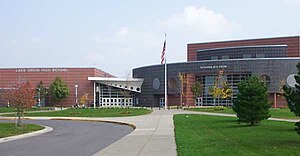
Lake Orion High School
Public school in Michigan, United States
Distance: Approx. 5482 meters
Latitude and longitude: 42.7546,-83.2333
Lake Orion High School is a public high school located in Orion Township, Michigan, United States. It is a part of Lake Orion Community Schools. Their motto is "Once a dragon, always a dragon," coined by Jeff Heath.
Bald Mountain Recreation Area
Recreation area in Oakland County, Michigan, US
Distance: Approx. 3404 meters
Latitude and longitude: 42.77722,-83.21138
Bald Mountain State Recreation Area is a 4,637-acre (1,877 ha) state park located near Lake Orion, Michigan off M-24. It consists of some of the most rugged terrain in southeastern Michigan. The recreation area is composed of a North Unit and a South Unit, which are not contiguous.
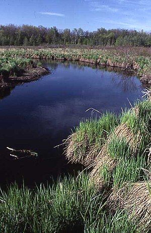
Trout Creek (Michigan)
Distance: Approx. 3466 meters
Latitude and longitude: 42.74694444,-83.19611111
Trout Creek is a 6.5-mile-long (10.5 km) tributary of Paint Creek in Oakland County, Michigan, in the United States. Via Paint Creek and the Clinton River, it is a tributary of Lake St. Clair.
Upland Hills School
School in Michigan, United States
Distance: Approx. 4116 meters
Latitude and longitude: 42.80486111,-83.19269444
Upland Hills School, founded in 1971, is an independent school community in Oxford, Michigan, USA, whose purpose is to educate pre-high school children. The school's aim is to discover and respect the uniqueness of every child.

Old Town, Lansing, Michigan
Neighborhood in Ingham, Michigan, United States
Distance: Approx. 3548 meters
Latitude and longitude: 42.74694444,-83.14305556
Located in the northern end of Lansing, Michigan, Old Town overlooks the Grand River and a winding bike trail. Listed on the National Register of Historic Places as the North Lansing Historic Commercial District, the district was established in the mid-19th century.
Lakeville Swamp
Distance: Approx. 5344 meters
Latitude and longitude: 42.81715,-83.14934
Lakeville Swamp Nature Sanctuary is a 76-acre (31 ha) sanctuary located in northeastern Oakland County, Michigan. It is maintained and preserved by the Michigan Nature Association.

Colonial Village, Lansing, Michigan
Neighborhood in Ingham, Michigan, United States
Distance: Approx. 3548 meters
Latitude and longitude: 42.74694444,-83.14305556
Colonial Village is a neighborhood in Lansing, Michigan. It is located southwest of REO Town in the southside of the city.
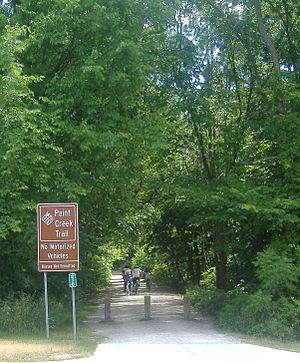
Paint Creek Trail
Distance: Approx. 4795 meters
Latitude and longitude: 42.72936,-83.1596
Paint Creek Trail is an 8.9-mile (14.3 km) rail trail linear park in northeast Oakland County, Michigan. The course of the park generally follows Paint Creek, a stream that flows southeast towards the Clinton River. The trail is composed of crushed limestone and has a slope of 2% going south to north, and has a width of 8 feet.

Genesee, Lansing, Michigan
Neighborhood in Ingham, Michigan, United States
Distance: Approx. 3548 meters
Latitude and longitude: 42.74694444,-83.14305556
Genesee Neighborhood is a historic neighborhood in Lansing, Michigan. It is located in the northwest corner of downtown Lansing. The neighborhood is bordered by West Saginaw Street (M-43) to the north, Sycamore Street to the east, West Ottawa Street to the south, and Martin Luther King Blvd to the west.

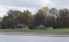
Axford-Coffin Farm
United States historic place
Distance: Approx. 2825 meters
Latitude and longitude: 42.78611111,-83.14194444
The Axford-Coffin Farm, also known as Cranberry Lake Farm, is a farmstead located at 384-388 West Predmore Road in Oakland Charter Township, Michigan. It was listed on the National Register of Historic Places in 2002.
Walter P. and May Wolf Reuther House
United States historic place
Distance: Approx. 3407 meters
Latitude and longitude: 42.74111111,-83.17194444
The Walter P. and May Wolf Reuther House is a single-family home located at 3924-3950-3954 Ellamae in Oakland Township near Rochester, Michigan. The house was built for Walter Reuther, president of the United Automobile Workers union, and his wife. They lived here from 1951 until their deaths in 1970.
Weather in this IP's area
clear sky
7 Celsius
7 Celsius
6 Celsius
8 Celsius
1020 hPa
91 %
1020 hPa
985 hPa
10000 meters
0.89 m/s
1.34 m/s
324 degree
4 %
07:05:34
19:55:09