Country:
 USA
USARegion:
City:
Latitude and Longitude:
Time Zone:
Postal Code:
IP information under different IP Channel
ip-api
Country
Region
City
ASN
Time Zone
ISP
Blacklist
Proxy
Latitude
Longitude
Postal
Route
IPinfo
Country
Region
City
ASN
Time Zone
ISP
Blacklist
Proxy
Latitude
Longitude
Postal
Route
MaxMind
Country
Region
City
ASN
Time Zone
ISP
Blacklist
Proxy
Latitude
Longitude
Postal
Route
Luminati
Country
USRegion
mi
City
royaloak
ASN
Time Zone
America/Detroit
ISP
123NET
Latitude
Longitude
Postal
db-ip
Country
Region
City
ASN
Time Zone
ISP
Blacklist
Proxy
Latitude
Longitude
Postal
Route
ipdata
Country
Region
City
ASN
Time Zone
ISP
Blacklist
Proxy
Latitude
Longitude
Postal
Route
Popular places and events near this IP address

Pittsfield Charter Township, Michigan
Charter township in Michigan, United States
Distance: Approx. 2376 meters
Latitude and longitude: 42.2225,-83.71444444
Pittsfield Charter Township is a charter township of Washtenaw County in the U.S. state of Michigan. The population was 39,147 at the 2020 census.

Saline High School (Michigan)
High school in Michigan, United States
Distance: Approx. 3102 meters
Latitude and longitude: 42.185728,-83.752926
Saline High School is a public high school near Saline, Michigan, United States. The school, a part of the Saline Area Schools, moved to its 54,300 m2 (585,000 sq ft) facility on roughly 81 hectares (200 acres) of land on Industrial Drive in August 2004 in Pittsfield Township. It is the 31st largest high school in the state of Michigan by enrollment, and was ranked 20th best high school in the state by US News.

Ann Arbor Municipal Airport
Airport in City of Ann Arbor
Distance: Approx. 1365 meters
Latitude and longitude: 42.22305556,-83.74555556
Ann Arbor Municipal Airport (IATA: ARB, ICAO: KARB, FAA LID: ARB) is a general aviation airport in Washtenaw County, Michigan, United States. It is included in the Federal Aviation Administration (FAA) National Plan of Integrated Airport Systems for 2017 to 2021, in which it is categorized as a regional general aviation facility. The airport is located in Pittsfield Township, but is owned and operated by the City of Ann Arbor.
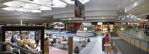
Briarwood Mall
Shopping mall in Michigan, United States
Distance: Approx. 3260 meters
Latitude and longitude: 42.2405,-83.74647222
Briarwood Mall is a shopping mall in Ann Arbor, Michigan, United States. The mall's three anchor stores are Macy's, JCPenney, and Von Maur. Surrounded by office and other development, the mall anchors the southern Ann Arbor commercial area around Eisenhower Boulevard and I-94.
Huron Towers
Pair of apartment buildings in Michigan, US
Distance: Approx. 3421 meters
Latitude and longitude: 42.18555556,-83.7175
Huron Towers is the name of a pair of twin apartment buildings in Ann Arbor, Michigan. They are located at 2200 Fuller Court.
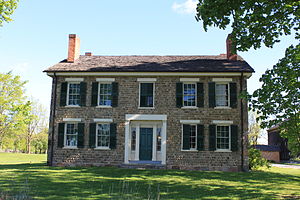
Cobblestone Farm and Museum
Historic house in Michigan, United States
Distance: Approx. 4399 meters
Latitude and longitude: 42.245,-83.71055556
The Cobblestone Farm and Museum, which includes the Dr. Benajah Ticknor House (also known as the Ticknor-Campbell House) is an historical museum located at 2781 Packard Road in Ann Arbor Michigan. The museum gets its name from the cobblestone used to build the farmhouse.
Ann Arbor Learning Community
Distance: Approx. 2242 meters
Latitude and longitude: 42.23144444,-83.73394444
Ann Arbor Learning Community (AALC) is a K-12 public charter school in Ann Arbor, Michigan, authorized by Eastern Michigan University. Enrollment is open to all K-12 students residing within the state of Michigan. Because AALC is part of the public school system, tuition is not charged to any student desiring to attend. .

Rentschler Farm Museum
United States historic place
Distance: Approx. 4313 meters
Latitude and longitude: 42.17638889,-83.76083333
Rentschler Farm Museum is a historic site located at 1265 East Michigan Avenue near downtown Saline, Michigan. The site consists of an old-fashioned farmhouse and eleven outbuildings, including a hog house, an equipment shed, a hen house, and a windmill, among others. The site is now a museum that serves as a tourist attraction, showing how farming has changed over the years.
LPGA Volvik Championship
Golf tournament
Distance: Approx. 3786 meters
Latitude and longitude: 42.215,-83.785
The LPGA Volvik Championship was a women's professional golf tournament on the LPGA Tour. A new event in 2016, it was played in Michigan at Travis Pointe Country Club, southwest of Ann Arbor. Volvik is a manufacturer of colored golf balls, headquartered in South Korea.
Travis Pointe Country Club
Country club
Distance: Approx. 3786 meters
Latitude and longitude: 42.215,-83.785
Travis Pointe Country Club is a private country club and golf course in the central United States, located in Ann Arbor, Michigan. Founded 47 years ago in 1977, the par-72 golf course has six sets of tees and measures 7,326 yards (6,699 m) from the back tees. It has hosted the LPGA Volvik Championship on the LPGA Tour since its debut in 2016.

Stone School (Ann Arbor, Michigan)
United States historic place
Distance: Approx. 4251 meters
Latitude and longitude: 42.24694444,-83.71944444
The Stone School is a school building located at 2600 Packard Road in Ann Arbor, Michigan. It was listed on the National Register of Historic Places in 1995. Beginning in 1955, the building houses the Stone School Cooperative Nursery.

Langford and Lydia McMichael Sutherland Farmstead
United States historic place
Distance: Approx. 1399 meters
Latitude and longitude: 42.19916667,-83.74055556
The Langford and Lydia McMichael Sutherland Farmstead is a farm located at 797 Textile Road in Pittsfield Charter Township, Michigan. It was listed on the National Register of Historic Places in 2006. It is now the Sutherland-Wilson Farm Historic Site.
Weather in this IP's area
clear sky
7 Celsius
6 Celsius
5 Celsius
8 Celsius
1020 hPa
82 %
1020 hPa
989 hPa
10000 meters
1.54 m/s
250 degree
07:08:17
19:57:00