Country:
 USA
USARegion:
City:
Latitude and Longitude:
Time Zone:
Postal Code:
IP information under different IP Channel
ip-api
Country
Region
City
ASN
Time Zone
ISP
Blacklist
Proxy
Latitude
Longitude
Postal
Route
IPinfo
Country
Region
City
ASN
Time Zone
ISP
Blacklist
Proxy
Latitude
Longitude
Postal
Route
MaxMind
Country
Region
City
ASN
Time Zone
ISP
Blacklist
Proxy
Latitude
Longitude
Postal
Route
Luminati
Country
USRegion
mi
City
southfield
ASN
Time Zone
America/Detroit
ISP
123NET
Latitude
Longitude
Postal
db-ip
Country
Region
City
ASN
Time Zone
ISP
Blacklist
Proxy
Latitude
Longitude
Postal
Route
ipdata
Country
Region
City
ASN
Time Zone
ISP
Blacklist
Proxy
Latitude
Longitude
Postal
Route
Popular places and events near this IP address

Metro Detroit
Metropolitan area in Michigan, US
Distance: Approx. 113 meters
Latitude and longitude: 42.358,-83.215
Metro Detroit is a major metropolitan area in the U.S. state of Michigan, consisting of the city of Detroit and over 200 municipalities in the surrounding area with its largest employer being Oakland County. There are varied definitions of the area, including the official statistical areas designated by the Office of Management and Budget, a federal agency of the United States. Metro Detroit is known for its automotive heritage, arts, entertainment, popular music, food, cultural diversity, and sports.
Warrendale, Detroit
Distance: Approx. 1502 meters
Latitude and longitude: 42.3469,-83.2275
Warrendale is a neighborhood located in Detroit, Michigan, bordered by Greenfield Road, Joy Road, and the Detroit city limits. Warrendale neighbors Dearborn on two sides and Dearborn Heights on another side.
Clara B. Ford Academy
Charter school in Michigan, United States
Distance: Approx. 2914 meters
Latitude and longitude: 42.34141667,-83.24413889
Clara B. Ford Academy is a charter school located in the city of Dearborn Heights, Michigan. The school is located at 20651 West Warren Avenue. The Sisters of the Good Shepherd ran a Detroit area outreach program for young women and in the 1930s began fundraising with the Salvation Army for a large campus.
Herman Gardens
Former public housing project located in Detroit, Michigan, United States
Distance: Approx. 564 meters
Latitude and longitude: 42.35388889,-83.21138889
Herman Gardens was a public housing project located in the northwest area of Detroit, Michigan.

Islamic Center of America
Mosque in Dearborn, Michigan
Distance: Approx. 3243 meters
Latitude and longitude: 42.3301,-83.2296
The Islamic Center of America (Arabic: ٱلْمَرْكَز ٱلْإِسْلَامِيّ فِي أَمْرِيكَا, al-Markaz al-ʾIslāmīy Fī ʾAmrīkā) is a mosque located in Dearborn, Michigan, in the United States. The 120,000 sq. ft.
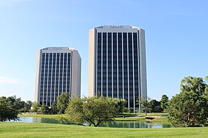
Parklane Towers
Distance: Approx. 3746 meters
Latitude and longitude: 42.32422,-83.20948
The Parklane Towers complex is a pair of twin office buildings in Dearborn, Michigan, United States, known locally as the "salt and pepper shakers" or "washer and dryer" Parklane Towers East is located at 1 Parklane Boulevard in Dearborn, Michigan. It was constructed in 1971 and stands at 15 stories. The older of the twin buildings is used for offices, retail, and other commercial space.
Dearborn Ice Skating Center
Indoor Ice Arena
Distance: Approx. 3742 meters
Latitude and longitude: 42.3304,-83.1893
Dearborn Ice Skating Center (The DISC, formerly Mike Adray Arena) is a 1,700-seat indoor ice arena located in Dearborn, Michigan, United States, in Metro Detroit. It is used primarily for high school and youth hockey as well as for ice skating. There are 1,500 seats at the main arena and another 200 in the viewing area.

St. Sarkis Church (Dearborn, Michigan)
Distance: Approx. 3204 meters
Latitude and longitude: 42.32994,-83.22744
St. Sarkis Armenian Apostolic Church was established on May 24, 1942 on Waterman Street in Detroit, MI, US. The current location in Dearborn, MI was dedicated on October 14, 1962; it serves the Armenians in Eastern Michigan, and is one of the Churches of the Prelacy of the Armenian Apostolic Church of America under jurisdiction of the Holy See of Cilicia. The congregation supports the Armenian Senior Citizen Tower, also called St Sarkis Towers, a 151-unit low income/senior housing facility near the church.
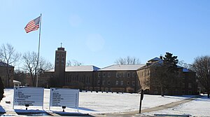
Frank Cody High School
High school in Detroit, Wayne County, Michigan
Distance: Approx. 546 meters
Latitude and longitude: 42.36055556,-83.22138889
Frank Cody High School is a high school in Detroit, Michigan, United States. Named to honor a former superintendent of Detroit Public Schools, it opened in 1952.
City Mission Academy
Christian private school in Detroit, US
Distance: Approx. 3769 meters
Latitude and longitude: 42.38586111,-83.24122222
City Mission Academy is a private, non-denominational Christian, charitable organization and K-5 school operating in the community of Brightmoor, Detroit, since 1998.
Karbalaa Islamic Education Center
Distance: Approx. 2316 meters
Latitude and longitude: 42.34393,-83.19486
The Karbalaa Islamic Education Center is located in Dearborn, a suburb of Detroit. Housed in a former nightclub that had been damaged by fire, the center contains approximately 10,000 square feet (930 m2) of space that have been converted into a prayer room, offices, an all-purpose meeting room, an audio-visual room, kitchen, and an area to hold a weekend school for children.
Detroit Leadership Academy
Distance: Approx. 3225 meters
Latitude and longitude: 42.33133333,-83.23302778
Detroit Leadership Academy is a free public charter school located in Detroit, MI. The school was opened in 2012 through the YMCA and currently serves students in Pre-K - 11th grade at two campuses on the city's west side. and is managed by Equity Education.
Weather in this IP's area
clear sky
8 Celsius
8 Celsius
6 Celsius
10 Celsius
1033 hPa
79 %
1033 hPa
1010 hPa
10000 meters
07:50:46
18:44:22