Country:
 USA
USARegion:
City:
Latitude and Longitude:
Time Zone:
Postal Code:
IP information under different IP Channel
ip-api
Country
Region
City
ASN
Time Zone
ISP
Blacklist
Proxy
Latitude
Longitude
Postal
Route
IPinfo
Country
Region
City
ASN
Time Zone
ISP
Blacklist
Proxy
Latitude
Longitude
Postal
Route
MaxMind
Country
Region
City
ASN
Time Zone
ISP
Blacklist
Proxy
Latitude
Longitude
Postal
Route
Luminati
Country
USRegion
mi
City
sterlingheights
ASN
Time Zone
America/Detroit
ISP
123NET
Latitude
Longitude
Postal
db-ip
Country
Region
City
ASN
Time Zone
ISP
Blacklist
Proxy
Latitude
Longitude
Postal
Route
ipdata
Country
Region
City
ASN
Time Zone
ISP
Blacklist
Proxy
Latitude
Longitude
Postal
Route
Popular places and events near this IP address

Sterling Heights, Michigan
City in Michigan, United States
Distance: Approx. 3264 meters
Latitude and longitude: 42.58027778,-83.03027778
Sterling Heights is a city in Macomb County in the U.S. state of Michigan. A northern suburb of Detroit, Sterling Heights is located roughly 18 miles (29.0 km) north of downtown Detroit. As of the 2020 census, the city had a population of 134,346, placing Sterling Heights as the second-largest suburb of Detroit, and the fourth-most populous city in Michigan.
Sterling Heights Assembly
Distance: Approx. 2939 meters
Latitude and longitude: 42.57,-83.031
The Sterling Heights Assembly Plant (abbrevriated SHAP), is a 5,000,000 sq ft (460,000 m2) automotive manufacturing factory in Sterling Heights, Michigan currently operated by Stellantis North America.
Michigan's 9th congressional district
U.S. House district for Michigan
Distance: Approx. 4440 meters
Latitude and longitude: 42.52972222,-83.05472222
Michigan's 9th congressional district is a United States congressional district located in The Thumb and northern portions of Metro Detroit of the State of Michigan. Counties either wholly or partially located within the district include: Huron, Tuscola, Sanilac, Lapeer, St. Clair, Macomb and Oakland.
Athens High School (Troy, Michigan)
Public high school in Troy, MI, United States
Distance: Approx. 3840 meters
Latitude and longitude: 42.5814,-83.1103
Athens High School is a public high school located in Troy, Michigan, USA. It is attended by nearly 1,600 students, serving grades 9-12. Athens is one of four high schools in the Troy School District, along with Troy High School, Troy College & Career High School and International Academy East. Athens High School opened in 1974.

Oakland Mall
Shopping mall in Michigan, U.S.
Distance: Approx. 5051 meters
Latitude and longitude: 42.537,-83.111
Oakland Mall is an enclosed super-regional shopping mall located in the city of Troy, Michigan, a suburb of Detroit. It is located in the northwest corner of the intersection of 14 Mile and John R. roads, adjacent to Interstate 75 (Chrysler Freeway). The mall features 116 stores, including a food court, plus several big-box stores on the periphery.
Adlai E. Stevenson High School (Sterling Heights, Michigan)
Distance: Approx. 4985 meters
Latitude and longitude: 42.586368,-83.010975
Adlai E. Stevenson High School is a public high school located in Sterling Heights, Michigan, a suburb of Detroit. Stevenson is a part of Utica Community Schools, Michigan's second largest school district. The school was named for Adlai E. Stevenson, a two-time candidate for President of the United States and former United Nations ambassador.
Big Beaver Airport
Airport in Troy, Michigan
Distance: Approx. 3427 meters
Latitude and longitude: 42.564745,-83.108268
The Big Beaver Airport, formerly (IATA: 3BB), was a small suburban general aviation airport located at the corners of Big Beaver Road and John R Road in Troy, Michigan. It was created in 1946 as an auxiliary airfield with a 2,400 ft (220 m²) gravel runway. By the 1970s, the main airstrip was converted to asphalt and a 2,100 ft (200 m²) sod runway was added.
Holcombe Site
Archaeological site in Michigan, United States
Distance: Approx. 4702 meters
Latitude and longitude: 42.56861111,-83.00944444
The Holcombe Site, also known as Holcombe Beach, is a Paleo-Indian archaeological site located near the intersection of Metropolitan Parkway and Dodge Park Road in Sterling Heights, Michigan, United States. It was listed on the National Register of Historic Places in 1971 and designated a Michigan State Historic Site in 1970.
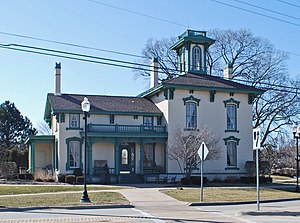
William Upton House
Historic house in Michigan, United States
Distance: Approx. 5183 meters
Latitude and longitude: 42.59138889,-83.01166667
The William Upton House was built as a private residence located at 40433 Utica Road in Sterling Heights, Michigan, United States. It is the oldest house in the city, and now houses public offices. It was listed on the National Register of Historic Places in 1985 and designated a Michigan State Historic Site in 1983.
St. Anne High School (Warren, Michigan)
Private, coed school in the United States
Distance: Approx. 4497 meters
Latitude and longitude: 42.531,-83.04675
St. Anne High School was a coeducational Catholic high school in Warren, Michigan. The school opened in 1965 and was operated by the Sisters, Servants of the Immaculate Heart of Mary.
Utica Alternative Learning Center
Alternative school in Sterling Heights, Macomb County, Michigan
Distance: Approx. 3949 meters
Latitude and longitude: 42.5943247,-83.0336322
The UCS Alternative Learning Center, or ALC, is an alternative school located in Sterling Heights, Michigan. The school serves students in grades 9–12 who are unable to attend a traditional high school in the school district. The center also operates as the district's summer school location.
Nativity of the Virgin Mary Macedonian Orthodox Cathedral, Sterling Heights, Michigan
Church in MI , United States
Distance: Approx. 4573 meters
Latitude and longitude: 42.60947332,-83.07235762
The Macedonian Orthodox Cathedral of the Nativity of the Virgin Mary (Macedonian: Македонска Православна Kатедрала Успение на Пресвета Богородица), also known as "St. Mary" (Macedonian: Пресвета Богородица), is a Macedonian Orthodox Church located in Sterling Heights, Michigan (Detroit area). It is one of the oldest Macedonian Orthodox communities in the United States and in the American-Canadian Diocese.
Weather in this IP's area
clear sky
8 Celsius
5 Celsius
7 Celsius
9 Celsius
1020 hPa
85 %
1020 hPa
996 hPa
10000 meters
4.63 m/s
260 degree
07:05:19
19:54:35