Country:
 USA
USARegion:
City:
Latitude and Longitude:
Time Zone:
Postal Code:
IP information under different IP Channel
ip-api
Country
Region
City
ASN
Time Zone
ISP
Blacklist
Proxy
Latitude
Longitude
Postal
Route
IPinfo
Country
Region
City
ASN
Time Zone
ISP
Blacklist
Proxy
Latitude
Longitude
Postal
Route
MaxMind
Country
Region
City
ASN
Time Zone
ISP
Blacklist
Proxy
Latitude
Longitude
Postal
Route
Luminati
Country
USRegion
mi
City
detroit
ASN
Time Zone
America/Detroit
ISP
123NET
Latitude
Longitude
Postal
db-ip
Country
Region
City
ASN
Time Zone
ISP
Blacklist
Proxy
Latitude
Longitude
Postal
Route
ipdata
Country
Region
City
ASN
Time Zone
ISP
Blacklist
Proxy
Latitude
Longitude
Postal
Route
Popular places and events near this IP address
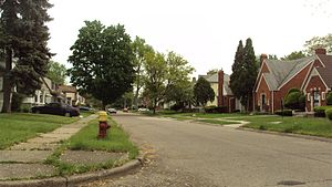
Brightmoor, Detroit
Neighborhood of Detroit, Michigan
Distance: Approx. 3345 meters
Latitude and longitude: 42.39638889,-83.24527778
Brightmoor is a neighborhood located in Detroit, Michigan, near the northwest border of the city. Brightmoor is defined by the Brightmoor Alliance as being bordered by Puritan Avenue to the north, the CSX railway to the south, Evergreen Road to the east, and West Outer Drive, Dacosta Street, and Telegraph Road to the west. However, the demographics given here for the neighborhood are the city's statistical Master Plan Neighborhood area, which consists of eight census tracts that includes some areas outside of the Alliance's boundaries, but does not include some areas within its boundaries.

Redford Theatre
Movie theater in Detroit, Michigan, United States
Distance: Approx. 1108 meters
Latitude and longitude: 42.41722222,-83.2575
The Redford Theatre is an atmospheric theatre in the Old Redford neighborhood of Detroit. The theatre opened in January 1928, advertised as "Detroit's most unique suburban theatre," due to its grand design, featuring Japanese and Chinese motifs. The Redford is part of a series of three grand cinemas in the Detroit suburbs operated by the Kunsky circuit, all of which stand today.
Communication & Media Arts High School
Distance: Approx. 1761 meters
Latitude and longitude: 42.434859,-83.26924683
Communication & Media Arts High School (CMA) is a public, magnet high school and part of Detroit Public Schools in Detroit, Michigan, United States. Kim Woo Gray was principal from when the school opened in 1992 until her retirement in 2008. CMA has twenty-three full-time staff and 512 students.
1947 PGA Championship
Golf tournament
Distance: Approx. 2905 meters
Latitude and longitude: 42.451,-83.262
The 1947 PGA Championship was the 29th PGA Championship, held June 18–24 at Plum Hollow Country Club in Southfield, Michigan, a suburb northwest of Detroit. Jim Ferrier won the match play championship, 2 and 1 over Chick Harbert in the Tuesday final; the winner's share was $3,500 and the runner-up's was $1,500. The match was tied after the first round, and again after 22 holes.
Plum Hollow Country Club
Distance: Approx. 2916 meters
Latitude and longitude: 42.45111111,-83.26194444
Plum Hollow Country Club is a country club located in Southfield, Michigan, a suburb northwest of Detroit The club is privately owned and was established in 1921. Plum Hollow was designed by architects Harry Colt and Charles Hugh Alison of the British firm Colt and Alison. The PGA Championship was held at its golf course in 1947; then a match play event, it was won by Jim Ferrier.
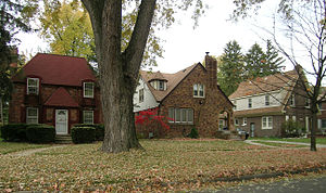
Rosedale Park, Detroit
United States historic place
Distance: Approx. 3508 meters
Latitude and longitude: 42.40027778,-83.22694444
Rosedale Park is a historic district located in Detroit, Michigan. It is roughly bounded by Lyndon, Outer Drive, Grand River Avenue, Southfield Freeway, Glastonbury Avenue, Lyndon Street and Westwood Drive. It was listed on the National Register of Historic Places in 2006.
Redford High School
Secondary school in Detroit, Michigan
Distance: Approx. 1567 meters
Latitude and longitude: 42.41205556,-83.25272222
Redford High School was a secondary school in Detroit, Michigan. A part of Detroit Public Schools, the school opened in September 1921 and ceased operations in June 2007. Staffed and operated by the Detroit Public Schools; Redford High School served the sub-communities of Old Redford, Grandmont, Rosedale Park and Brightmoor.
Henry Ford High School (Detroit, Michigan)
High school in Detroit, Wayne County, Michigan
Distance: Approx. 1809 meters
Latitude and longitude: 42.439,-83.238
Henry Ford High School is located at 20000 Evergreen Road, on the northwest side of Detroit, Michigan. The facility is staffed and operated by Detroit Public Schools. Ford High opened its doors on September 5, 1957; it was constructed to accommodate an overflow of students from nearby Cooley, Mumford, and Redford high schools.

Redford Township District No. 5 School
United States historic place
Distance: Approx. 3770 meters
Latitude and longitude: 42.42444444,-83.29722222
The Redford Township District No. 5 School is a school building located at 18499 Beech Daly Road in Redford, Michigan. After 1923, the school was known as the Redford Union District No.
Eliza Howell Park
Public park in Brightmoor, Detroit, Michigan
Distance: Approx. 3427 meters
Latitude and longitude: 42.3999,-83.2733
Eliza Howell Park is a public park in Brightmoor, Detroit, Michigan. Howell Park, east of Telegraph Road between Fenkell Avenue and Schoolcraft Avenue, has 250 acres (100 ha) of land, making it the fourth largest park in Detroit; this is about one fourth of the area of Belle Isle or .25 square miles (0.65 km2). A greenway links Howell with Stoepel Park.
Duboisville, Michigan
Distance: Approx. 1395 meters
Latitude and longitude: 42.42916667,-83.26786111
Duboisville was an unincorporated community in Wayne County, Michigan, USA, in the general vicinity of 7 Mile Road and Berg Road, which is now within the city boundaries of Detroit. It was begun around the lumber mill of James Dubois in about 1850. Some sources say that it was projected around the mill in 1878 but it seems there was a community using this name before then.
Samuel D. Holcomb School
NHRP structure in Michigan
Distance: Approx. 537 meters
Latitude and longitude: 42.42138889,-83.25277778
The Samuel D. Holcomb School, or simply the Holcomb School, is a former school located at 18100 Bentler Street in Detroit.It was listed on the National Register of Historic Places in 2023.
Weather in this IP's area
clear sky
8 Celsius
6 Celsius
6 Celsius
9 Celsius
1020 hPa
87 %
1020 hPa
996 hPa
10000 meters
3.6 m/s
260 degree
07:06:10
19:55:13