Country:
 Denmark
Region:
City:
Latitude and Longitude:
Time Zone:
Postal Code:
IP information under different IP Channel
ip-api
Country
Region
City
ASN
Time Zone
ISP
Blacklist
Proxy
Latitude
Longitude
Postal
Route
IPinfo
Country
Region
City
ASN
Time Zone
ISP
Blacklist
Proxy
Latitude
Longitude
Postal
Route
MaxMind
Country
Region
City
ASN
Time Zone
ISP
Blacklist
Proxy
Latitude
Longitude
Postal
Route
Luminati
Country
DKRegion
84
City
copenhagen
ASN
Time Zone
Europe/Copenhagen
ISP
GlobalConnect A/S
Latitude
Longitude
Postal
db-ip
Country
Region
City
ASN
Time Zone
ISP
Blacklist
Proxy
Latitude
Longitude
Postal
Route
ipdata
Country
Region
City
ASN
Time Zone
ISP
Blacklist
Proxy
Latitude
Longitude
Postal
Route
Popular places and events near this IP address

Sorte Hest
Distance: Approx. 387 meters
Latitude and longitude: 55.6704,12.5398
Sorte Hest (English: Black Horse) is the oldest building in the Vesterbro district of Copenhagen, Denmark. A former roadside inn, then located well outside the limits of the fortified city, standing on the Vestre Landevej (Western Country Road) leading in and out of Copenhagen through the Western City Gate. It provided accommodation for travellers as well as citizens who failed to enter the city before the city gates were locked at sunset.
Dansk Ornitologisk Forening
Distance: Approx. 379 meters
Latitude and longitude: 55.6707,12.5414
Dansk Ornitologisk Forening (DOF), also known as the Danish Ornithological Society or BirdLife Denmark, is a Danish non-governmental non-profit organisation. Founded on 15 October 1906 by Eiler Lehn Schiøler and Hans Christian Cornelius Mortensen, it is the principal bird study and conservation organisation in the country and the Danish partner of BirdLife International. It has about 12,000 members in 12 local branches and administers 18 bird reserves.
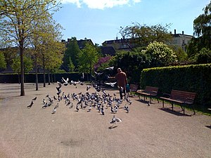
Enghaveparken
Park in Copenhagen Municipality, Denmark
Distance: Approx. 79 meters
Latitude and longitude: 55.66694444,12.54194444
Enghaveparken is a public park in the Vesterbro district of Copenhagen, Denmark. It was laid out in the late 1920s to cater for the citizens of the expanding city. The park is designed in the Neoclassical style.
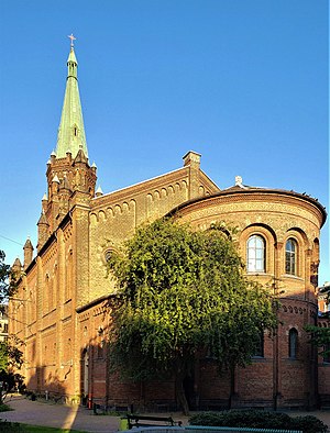
St. Matthew's Church, Copenhagen
Church in Copenhagen, Denmark
Distance: Approx. 396 meters
Latitude and longitude: 55.66944444,12.54805556
St. Mathew's Church (Danish: Sankt Mathæus Kirke) is the oldest and largest church in the Vesterbro district of Copenhagen, Denmark. It is located at the corner of Mathæusgade and Valdemarsgade and was completed in 1880 to design by city architect Ludvig Fenger.

Humleby
Enclave of terraced houses in Copenhagen, Denmark
Distance: Approx. 305 meters
Latitude and longitude: 55.66833333,12.53833333
Humleby (lit. 'Hops Town') is an enclave of terraced houses situated next to the Carlsberg area in the Vesterbro district of Copenhagen, Denmark. They were built between 1885 and 1891 by the Worker's Building Society to provide healthy housing for the workers at Burmeister & Wain. The area consists of 235 three storey houses.
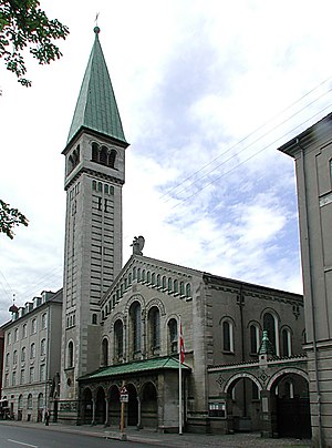
Christ Church, Copenhagen
Church in Copenhagen, Denmark
Distance: Approx. 143 meters
Latitude and longitude: 55.66777778,12.54508333
Christ Church (Danish: Kristkirken) is a Church of Denmark parish church situated on Enghave Plads in the Vesterbro district of Copenhagen, Denmark. It was designed by Valdemar Koch, who also built several other churches in Copenhagen around that time. Completed in 1900, it was the first new church to be opened in the fast-growing neighbourhood to relieve the pressure on St.
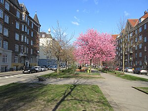
Sønder Boulevard
Park in Copenhagen, Denmark
Distance: Approx. 435 meters
Latitude and longitude: 55.6651,12.5485
Sønder Boulevard (lit. "South Boulevard") is a boulevard in the Vesterbro district of Copenhagen, Denmark, whose broad central reserve has been turned into a linear park with various facilities for sports and other activities. It runs from Halmtorvet next to Copenhagen Central Station in the north east to the Carlsberg district in the southwest.

Vega, Copenhagen
Distance: Approx. 96 meters
Latitude and longitude: 55.66805556,12.54388889
Vega is a regional entertainment centre on Vesterbro in Copenhagen, Denmark. It was inaugurated in 1996 as part of the city's agenda as European Capital of Culture.

Tvedes Bryggeri
Distance: Approx. 360 meters
Latitude and longitude: 55.67055556,12.54166667
Tvedes Bryggeri (Danish: Tvede's Brewery) was a brewery on Vesterbrogade in Copenhagen, Denmark. Founded by Hans Jørgen Tvede in 1852, it became the largest Nordic producer of small beer in the 1880s prior to its merger with several other breweries under the name De Forenede Bryggerier (United Breweries) in 1891. Its buildings were converted into apartments in the 1990s.

Enghave Plads
Public square in Copenhagen
Distance: Approx. 148 meters
Latitude and longitude: 55.6671,12.5452
Enghave Plads is a central public square of the Vesterbro district in Copenhagen, Denmark. It is located where Istedgade reaches Enghavevej, which separates the square from Enghave Park.

Enghave Plads station
Copenhagen metro station
Distance: Approx. 190 meters
Latitude and longitude: 55.66727778,12.54591667
Enghave Plads station is an underground Copenhagen Metro station located at Enghave Plads in the Vesterbro district of Copenhagen, Denmark. The station is on the City Circle Line (M3), between Copenhagen Central Station and Frederiksberg Allé, and is in fare zone 1. Nearby landmarks include the music venue Vega, Enghave Park and the shopping and restaurant street Istedgade.

Rahbeks Allé Brewery
Brewery in Copenhagen
Distance: Approx. 444 meters
Latitude and longitude: 55.66963889,12.53704722
Rahbeks Allé Brewery (Danish:Bryggeriet i Rahbeks Allé) is a former brewery at Rahbeks Allé 3–11 in Copenhagen, Denmark. The brewery was founded in 1860 and merged with several other breweries under the name De Forenede Bryggerier in 1890. It was from 1923 operated under the name Kongens Bryghus and the site was decommissioned when De Forenede Bryggerier was acquired by Carlsberg Group in 1969.
Weather in this IP's area
overcast clouds
19 Celsius
19 Celsius
17 Celsius
19 Celsius
1013 hPa
90 %
1013 hPa
1012 hPa
10000 meters
2.57 m/s
70 degree
100 %
06:28:56
19:46:16