151.59.37.57 - IP Lookup: Free IP Address Lookup, Postal Code Lookup, IP Location Lookup, IP ASN, Public IP
Country:
Region:
City:
Location:
Time Zone:
Postal Code:
IP information under different IP Channel
ip-api
Country
Region
City
ASN
Time Zone
ISP
Blacklist
Proxy
Latitude
Longitude
Postal
Route
Luminati
Country
Region
65
City
corropoli
ASN
Time Zone
Europe/Rome
ISP
Wind Tre S.p.A.
Latitude
Longitude
Postal
IPinfo
Country
Region
City
ASN
Time Zone
ISP
Blacklist
Proxy
Latitude
Longitude
Postal
Route
IP2Location
151.59.37.57Country
Region
emilia-romagna
City
voghiera
Time Zone
Europe/Rome
ISP
Language
User-Agent
Latitude
Longitude
Postal
db-ip
Country
Region
City
ASN
Time Zone
ISP
Blacklist
Proxy
Latitude
Longitude
Postal
Route
ipdata
Country
Region
City
ASN
Time Zone
ISP
Blacklist
Proxy
Latitude
Longitude
Postal
Route
Popular places and events near this IP address
Portomaggiore
Comune in Emilia-Romagna, Italy
Distance: Approx. 7269 meters
Latitude and longitude: 44.7,11.8
Portomaggiore (Ferrarese: Portmagiòr) is a town and comune in the province of Ferrara, Emilia-Romagna, Italy.
Masi Torello
Comune in Emilia-Romagna, Italy
Distance: Approx. 6240 meters
Latitude and longitude: 44.8,11.8
Masi Torello (Ferrarese: Màs Turèl) is a comune (municipality) in the Province of Ferrara in the Italian region Emilia-Romagna, located about 50 kilometres (31 mi) northeast of Bologna and about 15 kilometres (9 mi) east of Ferrara. As of 31 December 2004, it had a population of 2,355 and an area of 22.9 square kilometres (8.8 sq mi). The municipality of Masi Torello contains the frazione (subdivision) Masi San Giacomo.

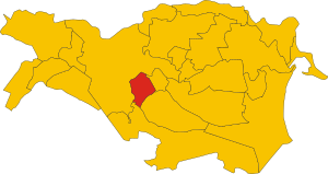
Voghiera
Comune in Emilia-Romagna, Italy
Distance: Approx. 1240 meters
Latitude and longitude: 44.76666667,11.75
Voghiera (Ferrarese: Vughièra) is a comune (municipality) in the Province of Ferrara in the northeastern Italian region Emilia-Romagna, located about 45 kilometres (28 mi) northeast of Bologna and about 13 kilometres (8 mi) southeast of Ferrara. As of 31 December 2004, it had a population of 3,924 and an area of 40.5 square kilometres (15.6 sq mi). Remarkable the Delizia di Belriguardo, an House of Este residence.
Battle of Portomaggiore
1395 battle in Italy
Distance: Approx. 7269 meters
Latitude and longitude: 44.7,11.8
The Battle of Portomaggiore took place near Portomaggiore in the province of Ferrara, Italy on 16 April 1395. It was fought between the Este troops of the Ferrara Regency Council fighting in the name of the young Niccolò III d'Este, Marquis of Ferrara and the rebel forces of his uncle, Azzo X d'Este, pretender to the Lordship of Ferrara.
Portomaggiore railway station
Railway halt in Italy
Distance: Approx. 7556 meters
Latitude and longitude: 44.697,11.8
Portomaggiore (Italian: Stazione di Portomaggiore) is a railway station in Portomaggiore, in the province of Ferrara, in the region of Emilia-Romagna, northern Italy. The station is on the Ferrara–Ravenna–Rimini railway and is the eastern terminus of the Bologna–Portomaggiore railway. The train services are operated by Trenitalia Tper.
San Giorgio, Gambulaga
Roman Catholic church in Italy
Distance: Approx. 3240 meters
Latitude and longitude: 44.74494,11.78993
The Chiesa di San Giorgio Martire or Church of St George the Martyr is a Baroque-style, Roman Catholic parish church located in Via Verginese in the frazione of Gambulaga, north and within the town limits of Portomaggiore, in the province of Ferrara, region of Emilia-Romagna, Italy.
Weather in this IP's area
overcast clouds
7 Celsius
6 Celsius
7 Celsius
7 Celsius
1006 hPa
97 %
1006 hPa
1006 hPa
10000 meters
1.43 m/s
2.64 m/s
82 degree
100 %

