Country:
 Italy
ItalyRegion:
City:
Latitude and Longitude:
Time Zone:
Postal Code:
IP information under different IP Channel
ip-api
Country
Region
City
ASN
Time Zone
ISP
Blacklist
Proxy
Latitude
Longitude
Postal
Route
IPinfo
Country
Region
City
ASN
Time Zone
ISP
Blacklist
Proxy
Latitude
Longitude
Postal
Route
MaxMind
Country
Region
City
ASN
Time Zone
ISP
Blacklist
Proxy
Latitude
Longitude
Postal
Route
Luminati
Country
ITRegion
72
City
mugnanodinapoli
ASN
Time Zone
Europe/Rome
ISP
Wind Tre S.p.A.
Latitude
Longitude
Postal
db-ip
Country
Region
City
ASN
Time Zone
ISP
Blacklist
Proxy
Latitude
Longitude
Postal
Route
ipdata
Country
Region
City
ASN
Time Zone
ISP
Blacklist
Proxy
Latitude
Longitude
Postal
Route
Popular places and events near this IP address
Battle of Camerinum
298 BC battle during the Third Samnite War
Distance: Approx. 7679 meters
Latitude and longitude: 43.14027806,13.06888889
The Battle of Camerinum in 298 BC took place during the Third Samnite War. In the battle, the Samnites defeated a Roman legion under the command of the propraetor Lucius Cornelius Scipio Barbatus.
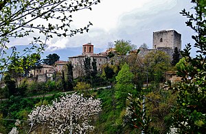
Camerino
Comune in Marche, Italy
Distance: Approx. 7679 meters
Latitude and longitude: 43.14027778,13.06888889
Camerino is a town in the province of Macerata, Marche, central-eastern Italy. It is located in the Apennines bordering Umbria, between the valleys of the rivers Potenza and Chienti, about 64 kilometres (40 mi) from Ancona. Camerino is home to the University of Camerino, founded in the Middle Ages.
Gagliole
Comune in Marche, Italy
Distance: Approx. 2925 meters
Latitude and longitude: 43.23333333,13.06666667
Gagliole is a comune (municipality) in the Province of Macerata in the Italian region Marche, located about 60 kilometres (37 mi) southwest of Ancona and about 30 kilometres (19 mi) west of Macerata.

Matelica
Comune in Marche, Italy
Distance: Approx. 6493 meters
Latitude and longitude: 43.25658611,13.00959444
Matelica is a comune (municipality) of the Province of Macerata in the Italian region of Marche. Located about 60 kilometres (37 mi) southwest of Ancona and 35 kilometres (22 mi) west of Macerata, it extends over an area of 81.04 square kilometres (31.29 sq mi).
Ponte di Pioraco
Bridge in Pioraco, Italy
Distance: Approx. 6565 meters
Latitude and longitude: 43.17916667,12.98472222
The Ponte di Pioraco is a Roman bridge in Pioraco, central Italy, presumably erected under emperor Augustus (r. 30 BC–14 AD). It belonged to a branch road of the Via Flaminia, which ran from Nocera Umbra to the east through Pioraco, San Severino, Treia and Osimo to Ancona.

Sant'Agostino, Matelica
Distance: Approx. 6472 meters
Latitude and longitude: 43.25533333,13.00761111
Sant'Agostino is a Baroque style, Roman Catholic church located on Via Umberto I #29, facing Piazza Lorenzo Valerio, in Matelica, Province of Macerata, region of Marche, Italy.

San Francesco, Matelica
Distance: Approx. 6497 meters
Latitude and longitude: 43.25730556,13.01097222
San Francesco is a Gothic-style, Roman Catholic church and monastery located in Matelica, province of Macerata, region of Marche, Italy.

Santa Maria Maddalena, Matelica
Distance: Approx. 6302 meters
Latitude and longitude: 43.2535,13.00775
Santa Maria Maddalena, also called the Chiesa della Beata Mattia is a Baroque-style, Roman Catholic church and monastery located on a cul de sac of Via Beata Mattia #39, where it intersects with Via Damiano Chiesa, in Matelica, province of Macerata, region of Marche, Italy.

Matelica Cathedral
Distance: Approx. 6627 meters
Latitude and longitude: 43.2576,13.0087
Matelica Cathedral (Italian: Concattedrale or Chiesa di Santa Maria Assunta) is a Roman Catholic cathedral in Matelica, Marche, Italy, dedicated to the Assumption of the Virgin Mary. Formerly the episcopal seat of the Diocese of Matelica, it is now a co-cathedral in the Diocese of Fabriano-Matelica.

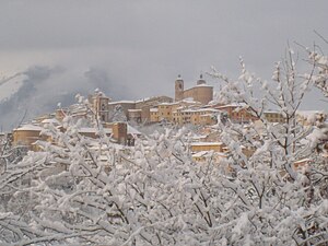
San Biagio, Castelraimondo
Distance: Approx. 418 meters
Latitude and longitude: 43.2106933,13.0590849
San Biagio is a Roman Catholic church located in Castelraimondo, province of Macerata, in the region of Marche, Italy. Details on the foundation of the church are slim. It was likely erected at the site of a former church inside the castle walls.

Chiesa del Suffragio, Matelica
Distance: Approx. 6515 meters
Latitude and longitude: 43.25644444,13.00883333
The Chiesa del Suffragio, also known as the Chiese delle Anime Purganti (Church of the Suffering or Church of the Souls in Purgatory), is a Baroque-style, Roman Catholic church and monastery located in Piazza Mattei in the city center of Matelica, province of Macerata, region of Marche, Italy.
San Francesco, Pioraco
Distance: Approx. 6569 meters
Latitude and longitude: 43.178871,12.984895
San Francesco is a Gothic-style, Roman Catholic church located in the town of Pioraco, province of Macerata, region of Marche, Italy.
Weather in this IP's area
broken clouds
15 Celsius
14 Celsius
14 Celsius
16 Celsius
1017 hPa
76 %
1017 hPa
980 hPa
10000 meters
2.39 m/s
2.19 m/s
229 degree
75 %
07:12:07
18:38:39