151.252.115.64 - IP Lookup: Free IP Address Lookup, Postal Code Lookup, IP Location Lookup, IP ASN, Public IP
Country:
Region:
City:
Location:
Time Zone:
Postal Code:
ISP:
ASN:
language:
User-Agent:
Proxy IP:
Blacklist:
IP information under different IP Channel
ip-api
Country
Region
City
ASN
Time Zone
ISP
Blacklist
Proxy
Latitude
Longitude
Postal
Route
db-ip
Country
Region
City
ASN
Time Zone
ISP
Blacklist
Proxy
Latitude
Longitude
Postal
Route
IPinfo
Country
Region
City
ASN
Time Zone
ISP
Blacklist
Proxy
Latitude
Longitude
Postal
Route
IP2Location
151.252.115.64Country
Region
valenciana, comunidad
City
valles
Time Zone
Europe/Madrid
ISP
Language
User-Agent
Latitude
Longitude
Postal
ipdata
Country
Region
City
ASN
Time Zone
ISP
Blacklist
Proxy
Latitude
Longitude
Postal
Route
Popular places and events near this IP address
Xativa Castle
Castle in the province of Valencia, Spain
Distance: Approx. 3323 meters
Latitude and longitude: 38.98293611,-0.51870556
Xativa Castle (Spanish: Castillo de Játiva; Valencian: Castell de Xàtiva) is a castle located in the city of Xàtiva near Valencia, Spain. It consists of a twin fortification divided between the older "Castillo Menor" (minor castle), built on the Iberian and Roman remains of the site, and the more recent "Castillo Mayor" (main castle), built during the medieval period. It sits at a height of 310 meters above the modern-day city.

Novetlè
Municipality in Valencian Community, Spain
Distance: Approx. 971 meters
Latitude and longitude: 38.98055556,-0.5475
Novetlè (Valencian: [noveˈlːɛ]) is a municipality in the comarca of Costera in the Valencian Community, Spain.

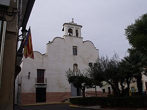
Vallés, Valencia
Municipality in Valencian Community, Spain
Distance: Approx. 66 meters
Latitude and longitude: 38.98555556,-0.55638889
Vallés is a municipality in the comarca of Costera in the Valencian Community, Spain.
L'Alcúdia de Crespins
Municipality in Valencian Community, Spain
Distance: Approx. 3336 meters
Latitude and longitude: 38.97083333,-0.59083333
L'Alcúdia de Crespins is a municipality in the comarca of Costera in the Valencian Community, Spain.
Cerdà
Municipality in Valencian Community, Spain
Distance: Approx. 1462 meters
Latitude and longitude: 38.98555556,-0.57388889
Cerdà (Spanish: Cerdá) is a municipality in the comarca of Costera in the Valencian Community, Spain.
La Granja de la Costera
Municipality in Valencian Community, Spain
Distance: Approx. 1184 meters
Latitude and longitude: 38.99583333,-0.55722222
La Granja de la Costera is a municipality in the comarca of Costera in the Valencian Community, Spain.
Llanera de Ranes
Municipality in Valencian Community, Spain
Distance: Approx. 1887 meters
Latitude and longitude: 38.99444444,-0.57527778
Llanera de Ranes is a municipality in the comarca of Costera in the Valencian Community, Spain. The town is located on some flat terrain of the left bank of the Canyoles river. Now a community of 1,000 people, the municipality is quite old.
Rotglà i Corberà
Municipality in Valencian Community, Spain
Distance: Approx. 2200 meters
Latitude and longitude: 39.00388889,-0.56527778
Rotglà i Corberà (Valencian: [roɡˈɡlaj koɾbeˈɾa]) is a municipality in the comarca of Costera in Valencia, Spain.
Torrella
Municipality in Valencian Community, Spain
Distance: Approx. 1334 meters
Latitude and longitude: 38.98888889,-0.57166667
Torrella is a municipality in the comarca of Costera in the Valencian Community, Spain.
Collegiate Basilica of Xàtiva
Church in Xàtiva, Spain
Distance: Approx. 3361 meters
Latitude and longitude: 38.98805556,-0.51833333
The Collegiate Basilica of Santa Maria of Xàtiva, also known as La Seu, is the principal church of the city of Xàtiva (Valencia), Spain. The construction commenced in 1596. In this Collegiate Basilica of Xàtiva different members of the House of Borgia are buried.

Siege of Xàtiva (1707)
Battle in Xàtiva (1707)
Distance: Approx. 3158 meters
Latitude and longitude: 38.9903,-0.5211
The siege of Xàtiva was a blockade of the town of Xàtiva in the Kingdom of Valencia. It took place between 8 May and 6 June 1707 during the War of the Spanish Succession. Between 9,000 and 11,000 Castilian and French troops under Philip of Bourbon commanded by Claude François Bidal d'Asfeld and José Antonio de Chaves Osorio faced an Aragonese and British force of about 2,000 under Miguel Purroi and Josep Marco.

Anahuir
Place in Valencia, Spain
Distance: Approx. 1245 meters
Latitude and longitude: 38.9758,-0.5648
Anahuir (Spanish) or Annauir (Valencian) is a village in Valencia, Spain. It is part of the municipality of Xàtiva.
Weather in this IP's area
heavy intensity rain
9 Celsius
9 Celsius
9 Celsius
9 Celsius
1020 hPa
83 %
1020 hPa
983 hPa
10000 meters
0.45 m/s
4.02 m/s
25 degree
96 %


