151.252.1.171 - IP Lookup: Free IP Address Lookup, Postal Code Lookup, IP Location Lookup, IP ASN, Public IP
Country:
Region:
City:
Location:
Time Zone:
Postal Code:
IP information under different IP Channel
ip-api
Country
Region
City
ASN
Time Zone
ISP
Blacklist
Proxy
Latitude
Longitude
Postal
Route
Luminati
Country
ASN
Time Zone
Europe/London
ISP
Krystal Hosting Ltd
Latitude
Longitude
Postal
IPinfo
Country
Region
City
ASN
Time Zone
ISP
Blacklist
Proxy
Latitude
Longitude
Postal
Route
IP2Location
151.252.1.171Country
Region
england
City
biddulph
Time Zone
Europe/London
ISP
Language
User-Agent
Latitude
Longitude
Postal
db-ip
Country
Region
City
ASN
Time Zone
ISP
Blacklist
Proxy
Latitude
Longitude
Postal
Route
ipdata
Country
Region
City
ASN
Time Zone
ISP
Blacklist
Proxy
Latitude
Longitude
Postal
Route
Popular places and events near this IP address

Mow Cop Castle
Folly on border of Cheshire and Staffordshire, England
Distance: Approx. 2615 meters
Latitude and longitude: 53.113,-2.2143
Mow Cop Castle is a folly at Mow Cop in the civil parish of Odd Rode, Cheshire, England. It is designated as a Grade II listed building on the National Heritage List for England. The ridge, upon which the castle sits, forms the boundary between the counties of Cheshire and Staffordshire, the dioceses of Chester and Lichfield and the ecclesiastical provinces of Canterbury and York.

Biddulph
Town in Staffordshire, England
Distance: Approx. 497 meters
Latitude and longitude: 53.12,-2.17
Biddulph is a town in Staffordshire, England, 8.5 miles (14 km) north of Stoke-on-Trent and 4.5 miles (7 km) south-east of Congleton, Cheshire.

Biddulph Grange
Landscaped garden in Biddulph, Staffordshire, England
Distance: Approx. 1663 meters
Latitude and longitude: 53.12972222,-2.16222222
Biddulph Grange is a National Trust landscaped garden, in Biddulph near Stoke-on-Trent, Staffordshire, England. It is separate from Biddulph Grange Country Park.

Biddulph Moor
Village in Staffordshire, England
Distance: Approx. 2320 meters
Latitude and longitude: 53.12,-2.14138889
Biddulph Moor is a village located on the hill which bears the same name. It is in Biddulph parish and is a part of the Staffordshire Moorlands district in England. It is very similar to Mow Cop which is located on the other side of the valley of Biddulph.
Braddocks Hay
Human settlement in England
Distance: Approx. 849 meters
Latitude and longitude: 53.11,-2.18
Braddocks Hay is a village in Staffordshire, England.
Knypersley Hall
Country house in England, UK
Distance: Approx. 1407 meters
Latitude and longitude: 53.1046,-2.1741
Knypersley Hall is an 18th-century Georgian style country mansion at Biddulph, Staffordshire, England. It is protected as a Grade II* listed building. After falling into a state of disrepair it was partially subdivided into residential apartments, although the hall was not wholly restored at this point and was falling into further disrepair.

Biddulph railway station
Former station in Staffordshire, England
Distance: Approx. 552 meters
Latitude and longitude: 53.1214,-2.1802
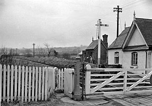
Biddulph railway station was a railway station opened by the North Staffordshire Railway in 1864. Originally named Gillow Heath the station was renamed Biddulph on 1 May 1897. The station was on the Biddulph Valley line that ran from a junction just north of Congleton on the Stoke-on-Trent – Macclesfield line to a junction south of Stoke-on-Trent station.
Tunstall Road
Cricket ground in England
Distance: Approx. 1427 meters
Latitude and longitude: 53.1045,-2.1787
Tunstall Road, also known as Victoria and Knypersley Social Welfare Centre, is a cricket ground in Knypersley, Staffordshire. The ground is located along the Tunstall Road, which itself forms part of the A527 Road. It has played host to List A matches for Derbyshire County Cricket Club, in addition to playing host to Staffordshire County Cricket Club in minor counties cricket.
Limekiln Wood Nature Reserve
Distance: Approx. 2320 meters
Latitude and longitude: 53.125,-2.208
Limekiln Wood Nature Reserve is a 13.1-hectare (32-acre) nature reserve in Cheshire, England, north of the village of Mow Cop. A Site of Special Scientific Interest, it is managed by the Cheshire Wildlife Trust. Standing on the north-west slope of the Mow Cop ridge, Limekiln Wood is part of a larger wood complex that has cloaked the ridge since the end of the last ice age.
Biddulph High School
Academy in Staffordshire, England
Distance: Approx. 1388 meters
Latitude and longitude: 53.10534,-2.1694
Biddulph High School is a mixed upper school (termed 'high school') and sixth form located in the Knypersley area of Biddulph in the English county of Staffordshire. Previously a community school administered by Staffordshire County Council, Biddulph High School converted to academy status in September 2011. However the school continues to coordinate with Staffordshire County Council for admissions.

Biddulph Grange Country Park
Park in Staffordshire, England
Distance: Approx. 1898 meters
Latitude and longitude: 53.12916667,-2.15555556
Biddulph Grange Country Park is a country park in Biddulph, Staffordshire, England. It was originally part of Biddulph Grange.

Biddulph Town Hall
Municipal building in Biddulph, Staffordshire, England
Distance: Approx. 75 meters
Latitude and longitude: 53.1166,-2.1753
Biddulph Town Hall is a municipal building in the High Street in Biddulph, a town in Staffordshire, in England. It currently serves as the meeting place of Biddulph Town Council and as a venue for concerts and other public events.
Weather in this IP's area
overcast clouds
10 Celsius
10 Celsius
9 Celsius
11 Celsius
1023 hPa
89 %
1023 hPa
1002 hPa
453 meters
2.17 m/s
6.41 m/s
281 degree
97 %