151.248.18.172 - IP Lookup: Free IP Address Lookup, Postal Code Lookup, IP Location Lookup, IP ASN, Public IP
Country:
Region:
City:
Location:
Time Zone:
Postal Code:
ISP:
ASN:
language:
User-Agent:
Proxy IP:
Blacklist:
IP information under different IP Channel
ip-api
Country
Region
City
ASN
Time Zone
ISP
Blacklist
Proxy
Latitude
Longitude
Postal
Route
db-ip
Country
Region
City
ASN
Time Zone
ISP
Blacklist
Proxy
Latitude
Longitude
Postal
Route
IPinfo
Country
Region
City
ASN
Time Zone
ISP
Blacklist
Proxy
Latitude
Longitude
Postal
Route
IP2Location
151.248.18.172Country
Region
noord-brabant
City
aalburg
Time Zone
Europe/Amsterdam
ISP
Language
User-Agent
Latitude
Longitude
Postal
ipdata
Country
Region
City
ASN
Time Zone
ISP
Blacklist
Proxy
Latitude
Longitude
Postal
Route
Popular places and events near this IP address

Aalburg
Former municipality in North Brabant, Netherlands
Distance: Approx. 1326 meters
Latitude and longitude: 51.76666667,5.13333333
Aalburg (Dutch pronunciation: [ˈaːlbʏr(ə)x] ) is a former municipality in the southern Netherlands, in the province of North Brabant. The municipality had been formed in 1973 by the merging of the former municipalities of Eethen, Veen, and Wijk en Aalburg. On January 1, 2019 it joined Werkendam and Woudrichem in the new municipality of Altena.
Aalst, Zaltbommel
Village in Gelderland, Netherlands
Distance: Approx. 3339 meters
Latitude and longitude: 51.78333333,5.11666667
Aalst [aːɫst] is a village in the Dutch province of Gelderland. It is a part of the municipality of Zaltbommel, and lies about 12 km southeast of Gorinchem. For a short while, Aalst was a separate municipality.
De Rietschoof
Hamlet in Gelderland, Netherlands
Distance: Approx. 2218 meters
Latitude and longitude: 51.77444444,5.13694444
De Rietschoof is a hamlet in the Dutch province of Gelderland. It is a part of the municipality of Zaltbommel, and lies about 13 km southeast of Gorinchem. It was first mentioned in 1847 as Rietschoof, and means bundle of reed (phragmites australis) for thatching.
Nederhemert
Village in Gelderland, Netherlands
Distance: Approx. 2254 meters
Latitude and longitude: 51.76277778,5.16166667
Nederhemert is a village in the Dutch province of Gelderland. It is a part of the municipality of Zaltbommel, and lies about 8 km southwest of that city. Nederhemert was a separate municipality until 1955, when it was merged with Kerkwijk.

Genderen
Village in North Brabant, Netherlands
Distance: Approx. 3721 meters
Latitude and longitude: 51.73527778,5.08777778
Genderen is a village in the Dutch province of North Brabant. It is located in the municipality of Altena. The village was first mentioned in the late 11th century as Ganderon, and means "settlement on the Gander River".

Oudheusden
Village in North Brabant, Netherlands
Distance: Approx. 3547 meters
Latitude and longitude: 51.72305556,5.13611111
Oudheusden is a village in the Dutch province of North Brabant. It is in the municipality of Heusden, about 1 km (0.62 mi) south of the city of Heusden. The name Oudheusden literally means "Old-Heusden", from the Dutch "oud" (English: old) and is used to distinguish from Heusden.
Veen, Netherlands
Village in North Brabant, Netherlands
Distance: Approx. 2889 meters
Latitude and longitude: 51.77694444,5.10972222
Veen is a village in the Dutch province of North Brabant. It is located in the municipality of Altena, about 20 km northwest of 's-Hertogenbosch. It is infamous for its New Year's Eve tradition during which scrap cars are burnt, and in 2020 even firemen were attacked with fireworks.

Wijk en Aalburg
Village in North Brabant, Netherlands
Distance: Approx. 101 meters
Latitude and longitude: 51.75416667,5.13055556
Wijk en Aalburg is a village in the Dutch province of North Brabant. It is located in the municipality of Altena, about 15 km northwest of 's-Hertogenbosch.

Bern, Netherlands
Hamlet in Gelderland, Netherlands
Distance: Approx. 2430 meters
Latitude and longitude: 51.74833333,5.16527778
Bern (formerly sometimes "Beern", "Berne", or "Beerne") is a hamlet in the Dutch province of Gelderland. It is located in the municipality of Zaltbommel, about 10 kilometres (6.2 miles) south of the town Zaltbommel. Bern used to lie south of the river Meuse, in the municipality of Herpt en Bern.
Heusden Canal
River in North Brabant, Netherlands
Distance: Approx. 730 meters
Latitude and longitude: 51.74833333,5.13333333
The Heusden Canal (Dutch: Heusdensch Kanaal) is a canal on the border of the Dutch provinces North Brabant and Gelderland, roughly between Wijk en Aalburg and Heusden. The canal connects the Afgedamde Maas and Bergse Maas and has a total length of approximately 2.3 km. The canal used to connect the city of Heusden to the main branch of the river Meuse.
De Fuik (restaurant)
Restaurant in Aalst, Netherlands
Distance: Approx. 2134 meters
Latitude and longitude: 51.77363611,5.13734722
De Fuik is a restaurant in Aalst in the Netherlands. It is a fine dining restaurant that was awarded one Michelin star in 2008 and retained that rating until 2011. GaultMillau did not award the restaurant any points, but retained it in its Guide.

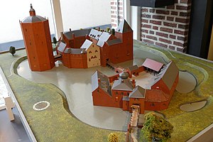
Heusden Castle
Castle in the Netherlands
Distance: Approx. 2446 meters
Latitude and longitude: 51.732899,5.134411
Heusden Castle is a ruined major castle in Heusden.
Weather in this IP's area
overcast clouds
6 Celsius
4 Celsius
5 Celsius
7 Celsius
1005 hPa
88 %
1005 hPa
1005 hPa
10000 meters
2.24 m/s
4.02 m/s
262 degree
100 %


