151.244.142.42 - IP Lookup: Free IP Address Lookup, Postal Code Lookup, IP Location Lookup, IP ASN, Public IP
Country:
Region:
City:
Location:
Time Zone:
Postal Code:
ISP:
ASN:
language:
User-Agent:
Proxy IP:
Blacklist:
IP information under different IP Channel
ip-api
Country
Region
City
ASN
Time Zone
ISP
Blacklist
Proxy
Latitude
Longitude
Postal
Route
db-ip
Country
Region
City
ASN
Time Zone
ISP
Blacklist
Proxy
Latitude
Longitude
Postal
Route
IPinfo
Country
Region
City
ASN
Time Zone
ISP
Blacklist
Proxy
Latitude
Longitude
Postal
Route
IP2Location
151.244.142.42Country
Region
mazandaran
City
lar
Time Zone
Asia/Tehran
ISP
Language
User-Agent
Latitude
Longitude
Postal
ipdata
Country
Region
City
ASN
Time Zone
ISP
Blacklist
Proxy
Latitude
Longitude
Postal
Route
Popular places and events near this IP address

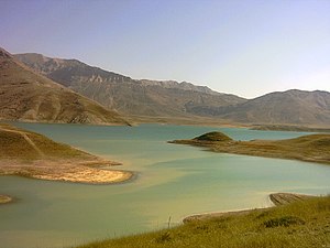
Lar Dam
Dam in Mazandaran, Amol county
Distance: Approx. 2665 meters
Latitude and longitude: 35.88932778,51.99598333
Lar Dam (Persian: سد لار sad-de lār) is a dam located at the foot of Mount Damavand in Amol county, Mazandaran, Iran. The dam is located within the protected Lar National Park, and situated just 70 kilometers northeast of the capital and the most populous city of the country, Iran.
Polur, Iran
Village in Mazandaran, Iran
Distance: Approx. 4441 meters
Latitude and longitude: 35.84861111,52.05027778
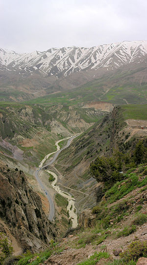
Polur (Persian: پلور, also Romanized as Polūr; also known as Pūlūr) is a village on the Haraz River in Bala Larijan Rural District, Larijan District, Amol County, Mazandaran Province, Iran.
Bala Larijan Rural District
Rural district in Mazandaran province, Iran
Distance: Approx. 9788 meters
Latitude and longitude: 35.885,52.13277778
Bala Larijan Rural District (Persian: دهستان بالا لاريجان) is in Larijan District of Amol County, Mazandaran province, Iran. It is administered from the city of Gazanak.
Kamp-e Sad Lar
Village in Mazandaran, Iran
Distance: Approx. 1395 meters
Latitude and longitude: 35.89111111,52.01305556
Kamp-e Sad Lar (Persian: کمپ سد لار, also Romanized as Kamp-e Sad Lār; also known as Sadd-e Daryācheh-ye Lār, Sadd-e Lār, and Ta’sīsāt-e Khadamātī-ye Sadd-e Lār) is a village in Bala Larijan Rural District, Larijan District, Amol County, Mazandaran Province, Iran. At the 2016 census, its population was 50, in 18 families, down from 187 people in 2006.

Ziyar, Mazandaran
Village in Mazandaran, Iran
Distance: Approx. 8676 meters
Latitude and longitude: 35.83777778,52.10305556
Ziyar (Persian: زيار, also Romanized as Zeyār) is a village in Bala Larijan Rural District, Larijan District, Amol County, Mazandaran Province, Iran. At the 2006 census, its population was 50, in 15 families.
Weather in this IP's area
overcast clouds
-11 Celsius
-17 Celsius
-11 Celsius
-11 Celsius
1029 hPa
89 %
1029 hPa
729 hPa
9091 meters
3.35 m/s
3.22 m/s
29 degree
100 %