Country:
Region:
City:
Latitude and Longitude:
Time Zone:
Postal Code:
IP information under different IP Channel
ip-api
Country
Region
City
ASN
Time Zone
ISP
Blacklist
Proxy
Latitude
Longitude
Postal
Route
Luminati
Country
Region
va
City
alexandria
ASN
Time Zone
America/New_York
ISP
USPTO
Latitude
Longitude
Postal
IPinfo
Country
Region
City
ASN
Time Zone
ISP
Blacklist
Proxy
Latitude
Longitude
Postal
Route
db-ip
Country
Region
City
ASN
Time Zone
ISP
Blacklist
Proxy
Latitude
Longitude
Postal
Route
ipdata
Country
Region
City
ASN
Time Zone
ISP
Blacklist
Proxy
Latitude
Longitude
Postal
Route
Popular places and events near this IP address
American Legislative Exchange Council
American conservative lobbying group
Distance: Approx. 801 meters
Latitude and longitude: 38.847,-77.0523
The American Legislative Exchange Council (ALEC) is a nonprofit organization of conservative state legislators and private sector representatives who draft and share model legislation for distribution among state governments in the United States. ALEC provides a forum for state legislators and private sector members to collaborate on model bills—draft legislation that members may customize and introduce for debate in their own state legislatures. ALEC has produced model bills on a broad range of issues, such as reducing regulation and individual and corporate taxation, combating illegal immigration, loosening environmental regulations, tightening voter identification rules, weakening labor unions, and opposing gun control.

Crystal City, Virginia
Neighborhood in Arlington, Virginia, United States
Distance: Approx. 1259 meters
Latitude and longitude: 38.85140278,-77.05068889
Crystal City is an urban neighborhood in the southeastern corner of Arlington County, Virginia, approximately 5 miles south of Downtown Washington, D.C. Due to its extensive integration of office buildings and residential high-rise buildings using underground corridors, travel between stores, offices, and residences, it is possible to travel much of the neighborhood without going above ground, making at least part of Crystal City an underground city. Crystal City includes several aerospace manufacturing and defense industry companies, public sector consulting firms, government contractors, the U.S. Department of Labor, the U.S. Marshals Service, satellite offices for the Pentagon, and various nonprofit organizations, including the International Foundation for Electoral Systems and the national headquarters for PBS. Ronald Reagan Washington National Airport, the busiest airport in the Washington metropolitan area and 23rd-busiest airport in the nation with 11,553,850 passengers as of 2022, is located in Crystal City.
Anime USA
Annual anime convention in Washington, D.C.
Distance: Approx. 965 meters
Latitude and longitude: 38.84861111,-77.05166667
Anime USA (AUSA) is an annual three-day anime convention held during September/October at the Hyatt Regency Crystal City at Reagan National Airport in Arlington, Virginia.

The Birchmere
Concert hall in Alexandria, Virginia
Distance: Approx. 289 meters
Latitude and longitude: 38.84027778,-77.06138889
The Birchmere is a concert hall in Alexandria, Virginia, that features rock, blues, bluegrass, country, folk, jazz, ethnic, and comedic performers. Its main room seats 500 and provides dinner service, making for an intimate space, with tables only a few feet away from the stage. The location also features a bandstand with a bar and a dance floor.
Fort Scott (Arlington, Virginia)
Historical fort in Arlington, Virginia, United States
Distance: Approx. 565 meters
Latitude and longitude: 38.84736111,-77.05972222
Fort Scott was a detached lunette constructed in May 1861 to guard the south flank of the defenses of Washington during the American Civil War. It was named for General Winfield Scott, who was then General-in-Chief of the Union Army. An historic marker and a small remnant of the fort are the only evidence of the site of the fort on the grounds of what is now Fort Scott Park in Arlington County, Virginia.

Luna Park, Alexandria
Trolley park in Virginia, US (1906–1915)
Distance: Approx. 403 meters
Latitude and longitude: 38.84444444,-77.05555556
Luna Park (also known as Washington Luna Park and Luna Park Washington D.C.) was a trolley park in Alexandria County, Virginia (now Arlington County) that operated between 1906 and 1915. The amusement park was built for $500,000 in just three months by the Washington, Alexandria, and Mount Vernon Electric Railway (later the Washington-Virginia Railway), which was seeking to attract new businesses along its line after nearby racing and gambling establishments closed. Designed by prominent amusement-park designer Frederick Ingersoll, Luna Park opened to the public in May 1906.

Reed station
Distance: Approx. 1036 meters
Latitude and longitude: 38.837591,-77.048997
Reed, also known as Potomac Yard, is a bus rapid transit station in Alexandria, Virginia, located on Potomac Avenue and Reed Avenue. It is a stop on the portion of the mixed-traffic segment of the Metroway bus rapid transit line, providing two-way service along the route. The station provides service to the central Potomac Yard and Potomac communities in Alexandria.

South Glebe station
Distance: Approx. 702 meters
Latitude and longitude: 38.8428,-77.051228
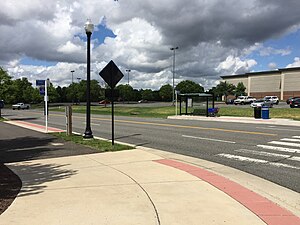
South Glebe is a bus rapid transit station in Arlington County, Virginia, located near the intersection of South Glebe Road and South Clark Place. It is a stop along the dedicated bus-only highway portion of the Metroway bus rapid transit line, providing two-way service along the route to southern Crystal City.

33rd & Crystal station
Distance: Approx. 696 meters
Latitude and longitude: 38.845609,-77.052494
33rd Street is a bus rapid transit station in Arlington, Virginia. It is located near the intersection of 33rd Street South and Potomac Avenue, along the dedicated bus-only highway portion of the Metroway bus rapid transit line, providing two-way service along the route.

27th & Crystal station
Distance: Approx. 979 meters
Latitude and longitude: 38.848557,-77.051368
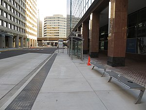
27th & Crystal is a bus rapid transit station in Arlington County, Virginia, located near the intersection of 27th Street South and Crystal Drive. The stop is along the Metroway bus rapid transit line, in a portion of the dedicated bus-only highway. It provides two-way service to southern Crystal City.

26th & Clark station
Distance: Approx. 1152 meters
Latitude and longitude: 38.85083,-77.051781
26th & Clark is a bus rapid transit station in Arlington County, Virginia, located near the intersection of 23rd Street South and South Clark Street. The stop is on a mixed-traffic segment of the Metroway that is restricted to buses during certain hours. It provides southbound service to central Crystal City.
Blerdcon
Multi-genre fan convention in the United States
Distance: Approx. 965 meters
Latitude and longitude: 38.84861111,-77.05166667
Blerdcon is an annual three-day multi-genre convention held during July at the Hyatt Regency Crystal City at Reagan National Airport in Arlington, Virginia. The convention's name comes from the word "blerds", a term for black nerds. It was co-founded by Hassan Parrish and Hilton George.
Weather in this IP's area
clear sky
13 Celsius
12 Celsius
11 Celsius
14 Celsius
1018 hPa
58 %
1018 hPa
1017 hPa
10000 meters
2.57 m/s
340 degree
06:52:33
16:53:56
