Country:
Region:
City:
Latitude and Longitude:
Time Zone:
Postal Code:
IP information under different IP Channel
ip-api
Country
Region
City
ASN
Time Zone
ISP
Blacklist
Proxy
Latitude
Longitude
Postal
Route
Luminati
Country
Region
rp
City
mainz
ASN
Time Zone
Europe/Berlin
ISP
Vodafone GmbH
Latitude
Longitude
Postal
IPinfo
Country
Region
City
ASN
Time Zone
ISP
Blacklist
Proxy
Latitude
Longitude
Postal
Route
db-ip
Country
Region
City
ASN
Time Zone
ISP
Blacklist
Proxy
Latitude
Longitude
Postal
Route
ipdata
Country
Region
City
ASN
Time Zone
ISP
Blacklist
Proxy
Latitude
Longitude
Postal
Route
Popular places and events near this IP address

Kinzig (Main)
Right tributary of the Main in Hesse, Germany
Distance: Approx. 4215 meters
Latitude and longitude: 50.303479,9.619721
The Kinzig is a river, 87 kilometres long, in southern Hesse, Germany. It is a right tributary of the Main. Its source is in the Spessart hills at Sterbfritz, near Schlüchtern.

Schlüchtern
Town in Hesse, Germany
Distance: Approx. 5726 meters
Latitude and longitude: 50.35,9.51666667
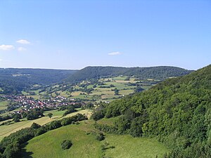
Schlüchtern is a town in the Main-Kinzig district, in Hessen, Germany. It is located on the river Kinzig, approximately 30 km southwest of Fulda. Schlüchtern has a population close to 16,000.
Stoppelsberg (Sinntal)
Distance: Approx. 5944 meters
Latitude and longitude: 50.32805556,9.67722222
The Stoppelsberg is a hill in Hesse, Germany.
Elmbach
River in Germany
Distance: Approx. 4697 meters
Latitude and longitude: 50.34555556,9.53
Elmbach is a river of Hesse, Germany. It flows into the Kinzig in Schlüchtern.
Grennelbach
River in Germany
Distance: Approx. 969 meters
Latitude and longitude: 50.3415,9.5826
Grennelbach is a small river of Hesse, Germany. It flows into the Kinzig near Schlüchtern-Vollmerz.
Ramholzer Wasser
River in Germany
Distance: Approx. 667 meters
Latitude and longitude: 50.34027778,9.58638889
Ramholzer Wasser is a small river of Hesse, Germany. It flows into the Kinzig east of Schlüchtern.
Riedbach (Kinzig)
River in Germany
Distance: Approx. 5210 meters
Latitude and longitude: 50.3435,9.5222
Riedbach is a small river of Hesse, Germany. It flows into the Kinzig in Schlüchtern.

Schwarzbach (Elmbach)
River in Germany
Distance: Approx. 3858 meters
Latitude and longitude: 50.3589,9.5518
Schwarzbach is a river of Hesse, Germany. It is a left tributary of the Elmbach in Schlüchtern-Elm.
Weissbach (Schwarzbach)
River in Germany
Distance: Approx. 3982 meters
Latitude and longitude: 50.3675,9.6265
Weissbach (Weißbach in german) is a small river of Hesse, Germany. It is a left tributary of the Schwarzbach in Schlüchtern-Gundhelm. The Schwarzbach river originates on the north side of the Dreisesselberg (Bavarian Forest) mountain.

Schlüchtern station
Railway station in Schlüchtern, Germany
Distance: Approx. 6073 meters
Latitude and longitude: 50.341054,9.50967
Schlüchtern station is a station for trains. It is in the town of Schlüchtern in the German state of Hesse on the Frankfurt–Göttingen railway. The station is classified by Deutsche Bahn (DB) as a category 4 station.

Steckelberg Castle
Distance: Approx. 1813 meters
Latitude and longitude: 50.3372,9.6205
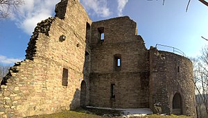
Steckelberg Castle (German: Burg Steckelberg) is a ruined hill castle near Ramholz, in the borough of the East Hessian town of Schlüchtern in Germany.

Ramholz Castle
Castle in Germany
Distance: Approx. 1379 meters
Latitude and longitude: 50.3324,9.6124
Ramholz Castle (German: Schloss Ramholz) is a German castle located in the hamlet of Ramholz in the Vollmerz district of the town of Schlüchtern, around 40 kilometres southwest of Fulda. The castle and park are cultural monuments according to the Hessian Monument Protection Act.
Weather in this IP's area
clear sky
1 Celsius
-1 Celsius
0 Celsius
1 Celsius
1027 hPa
81 %
1027 hPa
990 hPa
10000 meters
1.41 m/s
1.33 m/s
116 degree
5 %
07:19:18
16:51:07


