151.132.240.83 - IP Lookup: Free IP Address Lookup, Postal Code Lookup, IP Location Lookup, IP ASN, Public IP
Country:
Region:
City:
Location:
Time Zone:
Postal Code:
ISP:
ASN:
language:
User-Agent:
Proxy IP:
Blacklist:
IP information under different IP Channel
ip-api
Country
Region
City
ASN
Time Zone
ISP
Blacklist
Proxy
Latitude
Longitude
Postal
Route
db-ip
Country
Region
City
ASN
Time Zone
ISP
Blacklist
Proxy
Latitude
Longitude
Postal
Route
IPinfo
Country
Region
City
ASN
Time Zone
ISP
Blacklist
Proxy
Latitude
Longitude
Postal
Route
IP2Location
151.132.240.83Country
Region
florida
City
west palm beach
Time Zone
America/New_York
ISP
Language
User-Agent
Latitude
Longitude
Postal
ipdata
Country
Region
City
ASN
Time Zone
ISP
Blacklist
Proxy
Latitude
Longitude
Postal
Route
Popular places and events near this IP address

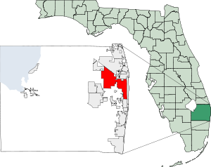
West Palm Beach, Florida
City in southeast Florida, United States
Distance: Approx. 212 meters
Latitude and longitude: 26.70972222,-80.06416667
West Palm Beach is a city in and the county seat of Palm Beach County, Florida, United States. It is located immediately to the west of the adjacent Palm Beach, which is situated on a barrier island across the Lake Worth Lagoon. It is the largest city in Palm Beach County, and at the time of the 2020 census, its population was 117,415.

West Palm Beach station
Train station in Florida, United States
Distance: Approx. 549 meters
Latitude and longitude: 26.71231111,-80.06229722
West Palm Beach station is a train station in West Palm Beach, Florida. It is served by Amtrak passenger rail and Tri-Rail commuter rail service. It is located at 203–209 South Tamarind Avenue, south of First Street/Banyan Boulevard.
Dreyfoos School of the Arts
Public school in West Palm Beach, Palm Beach, Florida, United States
Distance: Approx. 432 meters
Latitude and longitude: 26.708804,-80.061468
Alexander W. Dreyfoos School of the Arts (DSOA) is a public high school in West Palm Beach, Florida. Formerly named the Palm Beach County School of the Arts (also known as "School of the Arts" or "SOA"), the school was renamed in recognition of a 1997 donation of $1 million by Alexander W. Dreyfoos, Jr., a West Palm Beach philanthropist. It is regularly ranked as one of the top public arts and academics schools in the country.

CityPlace (Downtown West Palm Beach)
Lifestyle center in Florida, US
Distance: Approx. 921 meters
Latitude and longitude: 26.708442,-80.056534
CityPlace (formerly known as Rosemary Square and The Square) is an upscale lifestyle center in downtown West Palm Beach, Florida, along South Rosemary Avenue. Considered a New Urbanist mixed-use development, CityPlace is architecturally composed of Mediterranean and Venetian elements. The 600,000-square-foot (56,000 m2)-center constitutes several city blocks and contains more than 60 restaurants and stores, as well as rental apartments, condos, and offices.

Palm Beach County Convention Center
Distance: Approx. 796 meters
Latitude and longitude: 26.70478,-80.05896
The Palm Beach County Convention Center is a multi-purpose facility in West Palm Beach, Florida, managed by the venue company Oak View Group 360 (OVG360) and catering company OVG Hospitality. The facility opened in January 2004 and hosts many high profile events, such as the Food and Wine Festival and various guest speakers It is connected via covered walkway to the Hilton West Palm Beach hotel, and is located across the street from The Square, an upscale shopping district with nightlife, restaurants and shopping.
Kravis Center for the Performing Arts
Distance: Approx. 600 meters
Latitude and longitude: 26.707,-80.06
The Kravis Center for the Performing Arts (often referred to as the Kravis Center) is a not-for-profit, professional performing arts center in downtown West Palm Beach, Florida.

Hibiscus Apartments
United States historic place
Distance: Approx. 743 meters
Latitude and longitude: 26.70861111,-80.05833333
The Hibiscus Apartments (also known as the Hibiscus Garden Apartments) was a historic site in West Palm Beach, Florida. It was a 3-story Mediterranean style apartment building built in 1926. The building was destroyed in the early 2000s for the development of City Place shopping district in downtown West Palm Beach.
Old Palm Beach Junior College Building
United States historic place
Distance: Approx. 532 meters
Latitude and longitude: 26.70944444,-80.06055556
The Old Palm Beach Junior College Building (also known as the Science/Manual Training Building at Old Palm Beach High School) is a historic site in West Palm Beach, Florida. It is located at 813 Gardenia Avenue. On May 30, 1991, it was added to the U.S. National Register of Historic Places.

Grant Van Valkenburg House
Historic house in Florida, United States
Distance: Approx. 912 meters
Latitude and longitude: 26.71138889,-80.05722222
The Grant Van Valkenburg House (also known as the Anderson House) is a historic home in West Palm Beach, Florida, United States. It is located at 213 Rosemary Avenue. It was added to the National Register of Historic Places in 1999.
Clematis Street Historic Commercial District
Historic district in Florida, United States
Distance: Approx. 1089 meters
Latitude and longitude: 26.71305556,-80.05611111
The Clematis Street Historic Commercial District is a U.S. historic district (designated as such on October 8, 1998) located in West Palm Beach, Florida. The district runs along the 500 Block of Clematis Street. It contains 12 historic buildings.
Connie Mack Field
Former ballpark in West Palm Beach, Florida
Distance: Approx. 473 meters
Latitude and longitude: 26.70731944,-80.06123056
Connie Mack Field was a ballpark in midtown West Palm Beach, Florida, which was the long-time spring training home of the Philadelphia Athletics/Kansas City Athletics. The stadium was built in 1924 and initially named Municipal Athletic Field. It hosted its first event, a football game, in October 1924.

West Palm Beach station (Brightline)
Brightline train station
Distance: Approx. 1083 meters
Latitude and longitude: 26.71182,-80.05556
West Palm Beach station is an inter-city rail station in West Palm Beach, Florida. It is served by Brightline, connecting West Palm Beach to Downtown Miami and Orlando International Airport. The station is located in downtown West Palm Beach, on Evernia Street between Rosemary Avenue and Quadrille Boulevard.
Weather in this IP's area
clear sky
22 Celsius
22 Celsius
22 Celsius
22 Celsius
1015 hPa
89 %
1015 hPa
1014 hPa
10000 meters
4.29 m/s
11.35 m/s
205 degree
6 %


