150.91.254.127 - IP Lookup: Free IP Address Lookup, Postal Code Lookup, IP Location Lookup, IP ASN, Public IP
Country:
Region:
City:
Location:
Time Zone:
Postal Code:
IP information under different IP Channel
ip-api
Country
Region
City
ASN
Time Zone
ISP
Blacklist
Proxy
Latitude
Longitude
Postal
Route
Luminati
Country
Region
28
City
kakogawa
ASN
Time Zone
Asia/Tokyo
ISP
ITEC HANKYU HANSHIN CO.,LTD.
Latitude
Longitude
Postal
IPinfo
Country
Region
City
ASN
Time Zone
ISP
Blacklist
Proxy
Latitude
Longitude
Postal
Route
IP2Location
150.91.254.127Country
Region
osaka
City
mino
Time Zone
Asia/Tokyo
ISP
Language
User-Agent
Latitude
Longitude
Postal
db-ip
Country
Region
City
ASN
Time Zone
ISP
Blacklist
Proxy
Latitude
Longitude
Postal
Route
ipdata
Country
Region
City
ASN
Time Zone
ISP
Blacklist
Proxy
Latitude
Longitude
Postal
Route
Popular places and events near this IP address

Minoh
City in Kansai, Japan
Distance: Approx. 748 meters
Latitude and longitude: 34.82694444,135.47055556
Minoh (箕面市, Minō-shi) is a city in northwestern Osaka Prefecture, Japan. As of 31 January 2023, the city had an estimated population of 139,118 in 62451 households and a population density of 2900 persons per km2. The total area of the city is 47.90 square kilometres (18.49 sq mi).

Ikeda school massacre
2001 mass stabbing at an elementary school in Ikeda, Osaka, Japan
Distance: Approx. 2851 meters
Latitude and longitude: 34.82087778,135.43952222
The Ikeda school massacre (sometimes referred to as the Osaka school massacre) was a school stabbing and mass murder that occurred in Ikeda, Osaka Prefecture, Japan, on 8 June 2001. Mamoru Takuma, a 37-year-old ex-convict with a history of mentally disturbed and anti-social behavior, stabbed eight students to death and seriously wounded fifteen others in a knife attack that lasted several minutes. Takuma was sentenced to death in August 2003, and executed in September 2004.

Keihanshin
Metropolitan region in the Kansai region of Japan
Distance: Approx. 3016 meters
Latitude and longitude: 34.83333333,135.5
Keihanshin (京阪神, "Kyoto–Osaka–Kobe") is a metropolitan region in the Kansai region of Japan encompassing the metropolitan areas of the cities of Kyoto in Kyoto Prefecture, Osaka in Osaka Prefecture and Kobe in Hyōgo Prefecture. The entire region has a population (as of 2015) of 19,302,746 over an area of 13,228 km2 (5,107 sq mi). It is the second-most-populated urban region in Japan (after the Greater Tokyo area), containing approximately 15% of Japan's population.

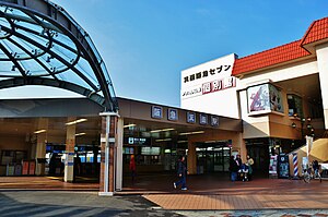
Minoo Station
Railway station in Minoh, Osaka Prefecture, Japan
Distance: Approx. 259 meters
Latitude and longitude: 34.83504167,135.46836111
Minoo Station (箕面駅, Minoo-eki, station number: HK-59) is a passenger railway station located in the city of Minoh, Osaka Prefecture, Japan. It is operated by the private transportation company Hankyu Railway.

Shōji Station (Toyonaka)
Monorail station in Toyonaka, Osaka Prefecture, Japan
Distance: Approx. 3290 meters
Latitude and longitude: 34.80427222,135.47544722
Shōji Station (少路駅, Shōji-eki) is a monorail station on the Osaka Monorail Main Line located in Toyonaka, Osaka Prefecture, Japan.

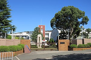
Osaka Aoyama College
Higher education institution in Osaka Prefecture, Japan
Distance: Approx. 926 meters
Latitude and longitude: 34.83405556,135.45694444
Osaka Aoyama University (大阪青山大学, Ōsaka aoyama daigaku) is a private university in Minoh, Osaka, Japan, established in 2005.
Osaka Aoyama Junior College
Distance: Approx. 926 meters
Latitude and longitude: 34.83405556,135.45694444
Osaka Aoyama Junior College (大阪青山短期大学, Ōsaka aoyama tanki daigaku) is a private junior college in Minoh, Osaka, Japan, established in 1967 and closed on March 31, 2021.

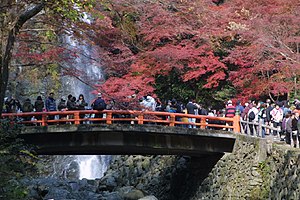
Meiji no Mori Minō Quasi-National Park
Distance: Approx. 2944 meters
Latitude and longitude: 34.857632,135.478728
Meiji no Mori Minō Kokutei Kōen (明治の森箕面国定公園) is a Quasi-National Park in Osaka Prefecture, Japan. It was established on 11 December 1967 to commemorate the centennial celebrations of the accession of Emperor Meiji. With an area of just 9.6 km2, it is one of the smallest of Japan's national parks.

Sakurai Station (Osaka)
Railway station in Minoh, Osaka Prefecture, Japan
Distance: Approx. 1895 meters
Latitude and longitude: 34.81678333,135.46070278
Sakurai Station (桜井駅, Sakurai-eki, station number: HK-57) is a passenger railway station located in the city of Minoh, Osaka Prefecture, Japan. It is operated by the private transportation company Hankyu Railway.

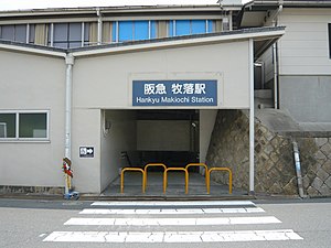
Makiochi Station
Railway station in Minoh, Osaka Prefecture, Japan
Distance: Approx. 1070 meters
Latitude and longitude: 34.82343889,135.46585
Makiochi Station (牧落駅, Makiochi-eki, station number: HK-58) is a passenger railway station located in the city of Minoh, Osaka Prefecture, Japan. It is operated by the private transportation company Hankyu Railway.

Minoh-semba handai-mae Station
Metro station in Suita, Osaka Prefecture, Japan
Distance: Approx. 2505 meters
Latitude and longitude: 34.82111111,135.49027778
Minoh-semba handai-mae Station (箕面船場阪大前, Minoo Senba Handaimae eki) is a train station on the Kita-Osaka Kyuko Railway (which links directly into the Osaka Municipal Subway Midosuji Line) located in Minoh, Osaka, Japan.

Minoh-kayano Station
Metro station in Suita, Osaka Prefecture, Japan
Distance: Approx. 2031 meters
Latitude and longitude: 34.83166667,135.48916667
Minoh-kayano Station (箕面萱野駅, Minoo Kayano eki) is a train station on the Kita-Osaka Kyuko Railway (which links directly into the Osaka Metro Midosuji Line) located in Minoh, Osaka, Japan.
Weather in this IP's area
scattered clouds
9 Celsius
8 Celsius
8 Celsius
10 Celsius
1022 hPa
51 %
1022 hPa
1004 hPa
10000 meters
1.54 m/s
320 degree
40 %