150.224.251.248 - IP Lookup: Free IP Address Lookup, Postal Code Lookup, IP Location Lookup, IP ASN, Public IP
Country:
Region:
City:
Location:
Time Zone:
Postal Code:
IP information under different IP Channel
ip-api
Country
Region
City
ASN
Time Zone
ISP
Blacklist
Proxy
Latitude
Longitude
Postal
Route
Luminati
Country
ASN
Time Zone
America/Chicago
ISP
CHARTER-20115
Latitude
Longitude
Postal
IPinfo
Country
Region
City
ASN
Time Zone
ISP
Blacklist
Proxy
Latitude
Longitude
Postal
Route
IP2Location
150.224.251.248Country
Region
missouri
City
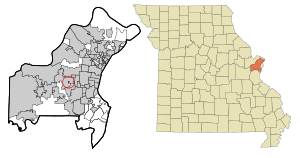
town and country
Time Zone
America/Chicago
ISP
Language
User-Agent
Latitude
Longitude
Postal
db-ip
Country
Region
City
ASN
Time Zone
ISP
Blacklist
Proxy
Latitude
Longitude
Postal
Route
ipdata
Country
Region
City
ASN
Time Zone
ISP
Blacklist
Proxy
Latitude
Longitude
Postal
Route
Popular places and events near this IP address

Country Life Acres, Missouri
Village in Missouri, United States
Distance: Approx. 1531 meters
Latitude and longitude: 38.62472222,-90.45527778
Country Life Acres is a village in St. Louis County, Missouri, United States. The population was 72 at the 2020 census.

Crystal Lake Park, Missouri
City in Missouri, United States
Distance: Approx. 2912 meters
Latitude and longitude: 38.62111111,-90.43194444
Crystal Lake Park is a Missouri Class 4 city in St. Louis County, Missouri, United States. The population was 508 at the 2020 census.

Des Peres, Missouri
City in Missouri, United States
Distance: Approx. 2157 meters
Latitude and longitude: 38.5975,-90.44805556
Des Peres (English: ) is a city in west St. Louis County, Missouri, United States. The population was 8,373 at the 2010 census.

Town and Country, Missouri
City in Missouri, United States
Distance: Approx. 2518 meters
Latitude and longitude: 38.63166667,-90.47916667
Town and Country is a city in west St. Louis County, Missouri, United States with a population of 11,640 as of the 2020 census. It is home to Missouri Baptist Medical Center, (locally known as MoBap).

St. Louis Missouri Temple
Distance: Approx. 3013 meters
Latitude and longitude: 38.63965,-90.46468
The St. Louis Missouri Temple is the 50th operating temple of the Church of Jesus Christ of Latter-day Saints (LDS Church). It is located in Town and Country, Missouri, a St.
Moog Center for Deaf Education
School in St. Louis, Missouri, USA
Distance: Approx. 2811 meters
Latitude and longitude: 38.63619,-90.45206
The Moog Center for Deaf Education is an American school in St. Louis, Missouri, founded in 1996 by oralist educator Jean Sachar Moog. The Moog Center is an independent, not-for-profit school that provides education services to children with hearing loss and their families from birth to early elementary years.

Islamic Foundation of Greater St. Louis
Islamic organisation in the United States
Distance: Approx. 3010 meters
Latitude and longitude: 38.6029,-90.4959
The Islamic Foundation of Greater St. Louis (IFGSTL) is an Islamic organization composed of two mosques. The first mosque, Masjid Bilal (West Pine Masjid), is located in midtown St.

West County Center
Shopping mall in Des Peres, Missouri, St. Louis
Distance: Approx. 1792 meters
Latitude and longitude: 38.60265,-90.4474
West County Center is a shopping mall located in Des Peres, Missouri, a suburb of St. Louis. The original mall was built in 1969.

Missouri Baptist Medical Center
Hospital in Missouri, United States
Distance: Approx. 2995 meters
Latitude and longitude: 38.63613,-90.44691
Missouri Baptist Medical Center, known locally as MoBap, is a hospital in Town and Country, Missouri. Its origins were in 1884 when Dr. William H. Mayfield opened his home to patients.
Phantom Forest Conservation Area
13-acre park in the city of Des Peres in St. Louis County, Missouri
Distance: Approx. 3029 meters
Latitude and longitude: 38.58546,-90.4661
Phantom Forest Conservation Area is a 13-acre (5.3 ha) park located in the city of Des Peres in St. Louis County, Missouri. Positioned deep in suburban St.

Queeny Park
Park located in St. Louis County, Missouri
Distance: Approx. 2318 meters
Latitude and longitude: 38.61232,-90.490252
Queeny Park is a park located in unincorporated St. Louis County, Missouri. It is one of the largest parks in the St.
Bittersweet Woods Conservation Area
Distance: Approx. 2735 meters
Latitude and longitude: 38.588161,-90.460333
Bittersweet Woods Conservation Area is a 10-acre (4 ha) park located in the city of Des Peres in St. Louis County, Missouri. Positioned deep in suburban St.
Weather in this IP's area
overcast clouds
3 Celsius
-2 Celsius
2 Celsius
4 Celsius
1025 hPa
61 %
1025 hPa
1004 hPa
10000 meters
6.17 m/s
10.29 m/s
290 degree
100 %
