Country:
 USA
USARegion:
City:
Latitude and Longitude:
Time Zone:
Postal Code:
IP information under different IP Channel
ip-api
Country
Region
City
ASN
Time Zone
ISP
Blacklist
Proxy
Latitude
Longitude
Postal
Route
IPinfo
Country
Region
City
ASN
Time Zone
ISP
Blacklist
Proxy
Latitude
Longitude
Postal
Route
MaxMind
Country
Region
City
ASN
Time Zone
ISP
Blacklist
Proxy
Latitude
Longitude
Postal
Route
Luminati
Country
USRegion
co
City
denver
ASN
Time Zone
America/Denver
ISP
Cato Networks Ltd
Latitude
Longitude
Postal
db-ip
Country
Region
City
ASN
Time Zone
ISP
Blacklist
Proxy
Latitude
Longitude
Postal
Route
ipdata
Country
Region
City
ASN
Time Zone
ISP
Blacklist
Proxy
Latitude
Longitude
Postal
Route
Popular places and events near this IP address
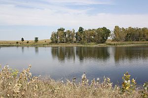
Derby, Colorado
Census Designated Place in Colorado, United States
Distance: Approx. 2887 meters
Latitude and longitude: 39.8402608,-104.916832
Derby is an unincorporated community and a census-designated place (CDP) located in and governed by Adams County, Colorado, United States. The CDP is a part of the Denver–Aurora–Lakewood, CO Metropolitan Statistical Area. The population of the Derby CDP was 8,407 at the United States Census 2020.

Welby, Colorado
Census Designated Place in Colorado, United States
Distance: Approx. 4854 meters
Latitude and longitude: 39.8402697,-104.9654536
Welby is an unincorporated community and a census-designated place (CDP) located in and governed by Adams County, Colorado, United States. The CDP is a part of the Denver–Aurora–Lakewood, CO Metropolitan Statistical Area. The population of the Welby CDP was 15,553 at the United States Census 2020.
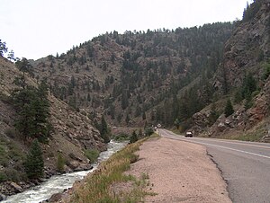
Clear Creek (Colorado)
River
Distance: Approx. 4981 meters
Latitude and longitude: 39.8275,-104.94916667
Clear Creek is a tributary of the South Platte River, approximately 66 miles (106 km) long, in north central Colorado in the United States. The creek flows through Clear Creek Canyon in the Rocky Mountains directly west of Denver, descending through a long gorge to emerge at the town of Golden, finally ending in the Colorado Eastern Plains where it joins the South Platte. Clear Creek is unusual in that it is a stream named "creek" fed by a stream named "river"; typically "rivers" are fed by "creeks", and are larger bodies of water, although the nomenclature is ambiguous and there is no clear system.
KPLS (AM)
Radio station in Littleton–Denver, Colorado
Distance: Approx. 692 meters
Latitude and longitude: 39.86888889,-104.92694444
KPLS (1510 AM, "Positive Lifestyle Radio") is an AM radio station licensed to Littleton, Colorado, and serving the Denver metropolitan area. KPLS is owned by Radio 74 Internationale. In May 2020, the station transitioned to airing a Christian format following a transfer of ownership.
Dupont, Colorado
Unincorporated community in Colorado, United States
Distance: Approx. 3182 meters
Latitude and longitude: 39.83805556,-104.9125
Dupont is an unincorporated community and U.S. Post Office in Adams County, Colorado, United States. The Dupont Post Office has the ZIP Code 80024. A post office called Dupont has been in operation since 1926.
Adams City, Colorado
Unincorporated community in Colorado, United States
Distance: Approx. 4459 meters
Latitude and longitude: 39.82666667,-104.92888889
Adams City is an unincorporated community located in Adams County, Colorado, United States. Much of it was incorporated into Commerce City in 1952.
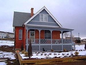
Thede Farmhouse
Historic house in Colorado, United States
Distance: Approx. 4189 meters
Latitude and longitude: 39.895,-104.95111111
The Thede Farmhouse is a historic farmhouse in Northglenn, Colorado, United States. Built in 1903, it is a Queen Anne house. Today, the brick farmhouse is surrounded by modern development.
Adams City High School
Public school in Commerce City, Colorado, United States
Distance: Approx. 4494 meters
Latitude and longitude: 39.82833333,-104.90111111
Adams City High School is a high school located in Commerce City, Colorado, United States. Commerce City was originally known as Adams City.

Commerce City/72nd station
Commuter rail station in Commerce City, Colorado
Distance: Approx. 4853 meters
Latitude and longitude: 39.826361,-104.943057
Commerce City/72nd station (sometimes stylized as Commerce City•72nd) is a station on the N Line of the Denver RTD commuter rail system in Commerce City, Colorado. It is the second station northbound from Union Station and is located at the west end of 72nd Avenue. Access to the Bennet R. Fernald Trail is provided at the southern end of the station.

Original Thornton/88th station
Commuter rail station in Thornton, Colorado
Distance: Approx. 2966 meters
Latitude and longitude: 39.858785,-104.95308
Original Thornton/88th station (sometimes stylized as Original Thornton•88th) is a station on the N Line of the Denver RTD commuter rail system in Thornton, Colorado. It is located north of 88th Avenue and west of Welby Road; a section of Welby was moved 1⁄4 mile (0.40 km) to a new alignment linear with Steele Street. The station opened on September 21, 2020.

Thornton Crossroads/104th station
Commuter rail station in Thornton, Colorado
Distance: Approx. 2629 meters
Latitude and longitude: 39.882139,-104.94229
Thornton Crossroads/104th station (sometimes stylized as Thornton Crossroads•104th) is a station on the N Line of the Denver RTD commuter rail system in Thornton, Colorado. It is located on Colorado Boulevard, slightly south of 104th Avenue. The station opened on September 21, 2020.
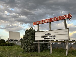
88 Drive-In
Drive-in theater in Commerce City, Colorado, US
Distance: Approx. 2228 meters
Latitude and longitude: 39.855,-104.898
88 Drive-In (formerly East 88th Avenue Drive-In) is a drive-in theater in the Irondale neighborhood of Commerce City, a suburb of Denver.
Weather in this IP's area
clear sky
18 Celsius
18 Celsius
15 Celsius
20 Celsius
1015 hPa
48 %
1015 hPa
851 hPa
10000 meters
1.54 m/s
190 degree
06:34:48
19:19:53