150.107.106.132 - IP Lookup: Free IP Address Lookup, Postal Code Lookup, IP Location Lookup, IP ASN, Public IP
Country:
Region:
City:
Location:
Time Zone:
Postal Code:
ISP:
ASN:
language:
User-Agent:
Proxy IP:
Blacklist:
IP information under different IP Channel
ip-api
Country
Region
City
ASN
Time Zone
ISP
Blacklist
Proxy
Latitude
Longitude
Postal
Route
db-ip
Country
Region
City
ASN
Time Zone
ISP
Blacklist
Proxy
Latitude
Longitude
Postal
Route
IPinfo
Country
Region
City
ASN
Time Zone
ISP
Blacklist
Proxy
Latitude
Longitude
Postal
Route
IP2Location
150.107.106.132Country
Region
bagmati
City
jawalakhel
Time Zone
Asia/Kathmandu
ISP
Language
User-Agent
Latitude
Longitude
Postal
ipdata
Country
Region
City
ASN
Time Zone
ISP
Blacklist
Proxy
Latitude
Longitude
Postal
Route
Popular places and events near this IP address

Lalitpur, Nepal
City in Bagmati Province, Nepal
Distance: Approx. 5 meters
Latitude and longitude: 27.66666667,85.31666667
Lalitpur Metropolitan City (Nepali: ललितपुर महानगरपालिका, Lālitapura Mahānagarapālikā), also known as Patan (Sanskrit: पाटन, Pāṭana), Yala (Newar: 𑐫𑐮), and Manigal, is a metropolitan city and fourth most populous city of Nepal with 299,843 inhabitants living in 49,044 households per the 2021 census. It is located in the south-central part of Kathmandu Valley, a large valley in the high plateaus in central Nepal, at an altitude of 1,400 metres (4,600 feet). It is best known for its rich cultural heritage, particularly its tradition of arts and crafts.

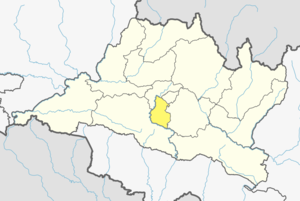
Lalitpur District, Nepal
District in Nepal
Distance: Approx. 5 meters
Latitude and longitude: 27.66666667,85.31666667
Lalitpur District (Nepali: ललितपुर जिल्ला, in Bagmati Province, is one of the seventy-seven districts of Nepal. The district, with Lalitpur as its district headquarters, covers an area of 396.92 km2 (153.25 sq mi) and has a population (2001) of 337,785. It is one of three districts in the Kathmandu Valley, along with Kathmandu and Bhaktapur.
Adarsha Vidya Mandir
Coeducational school in Lalitpur, Bagmati Zone, Nepal
Distance: Approx. 185 meters
Latitude and longitude: 27.6674,85.315
AVM Higher Secondary School is one of the oldest and largest schools in Nepal. It was established in 1966 in Manbhawan, Lalitpur, by educator Satya Narayan Bahadur Shrestha. It has won several awards for its excellent results in national level examinations held by the Higher Secondary Education Board of Nepal.
Patan Hospital
Hospital in Lalitpur, Nepal
Distance: Approx. 427 meters
Latitude and longitude: 27.66845,85.320551
The Patan Hospital (Nepali: पाटन स्वास्थ्य विज्ञान प्रतिष्ठान) is a teaching hospital for the Patan Academy of Health Sciences. Patan Hospital is one of the largest hospitals in Nepal. It uses modern equipment and facilities to provide treatment for almost 320,000 outpatients and 20,000 inpatients every year.
Jawalakhel
Urban Subdivision in Bagmati Province, Nepal
Distance: Approx. 5 meters
Latitude and longitude: 27.66666667,85.31666667
Jāwalākhel (Nepali: जावलाखेल) is a subdivision of Lalitpur in Nepal. It is located 2 km from the ancient city centre Pātan, one of the three great capitals of Nepal until the 18th century. It derives its name from "जा हुल्य: खल:(English: Jaa Hulya Khala)", an open field currently used as Volleyball training ground and Football field.

Patan Durbar Square
Palace square in Lalitpur, Nepal
Distance: Approx. 1107 meters
Latitude and longitude: 27.6734,85.325
Patan Durbar Square (Nepal Bhasa: 𑐫𑐮 𑐮𑐵𑐫𑐎𑐹/यल लायकु, Nepali: पाटन दरवार) is situated at the centre of the city of Lalitpur in Nepal. It is one of the three Durbar Squares in the Kathmandu Valley, all of which are UNESCO World Heritage Sites. One of its attractions is the medieval royal palace where the Malla Kings of Lalitpur resided.

Central Zoo
Zoo in Lalitpur, Nepal
Distance: Approx. 919 meters
Latitude and longitude: 27.6731849,85.3109334
The Central Zoo (Nepali: सदर चिडियाखाना) is a 6-hectare (15-acre) zoo in Jawalakhel, Nepal. It is home to some 969 animals in 109 species, and is operated by the National Trust for Nature Conservation (NTNC). Although it was originally a private zoo, it was opened to the public in 1956.

Patan Museum
History museum in Lalitpur, Nepal
Distance: Approx. 1133 meters
Latitude and longitude: 27.6730952,85.325638
The Patan Museum (Nepali: पाटन संग्रहालय) is a museum located in Patan, Lalitpur, Nepal. The museum falls under the UNESCO's World Heritage Sites. The Patan Museum was inaugurated in 1997 by Late King Birendra Bir Bikram Shah.

Nepal Open University
Distance: Approx. 210 meters
Latitude and longitude: 27.666563,85.318823
Nepal Open University (Nepali: नेपाल खुला विश्वविद्यालय) is a distance learning public university in Nepal. It was established in 2016 through an act of Parliament. The degrees awarded by the university are treated as equivalent to degrees awarded by any other Nepali University under the purview of the University Grants Commission.

Tusha Hiti
17th century royal bath in Lalitpur, Nepal
Distance: Approx. 1066 meters
Latitude and longitude: 27.67272222,85.32511111
The Tusha Hiti, also known as Royal Bath, is a sunken bath used by the Malla royal family in Nepal. It is at the courtyard of Sundari Chowk, Patan Durbar Square, Lalitpur. King Siddhinarasimha Malla is credited with building the bath in the 17th century.

Krishna Mandir, Patan
Hindu temple in Lalitpur, Nepal
Distance: Approx. 1123 meters
Latitude and longitude: 27.67361111,85.325
Krishna Mandir is a 17th-century Shikhara-style temple built by King Siddhi Narsing Malla. It is located at the Patan Durbar Square, a UNESCO World Heritage Site, in the city of Lalitpur in Nepal. It was damaged by the Nepal earthquake of April 2015, and was later restored in 2018.
Universal Engineering & Science College
Engineering college in Lalitpur, Nepal
Distance: Approx. 1064 meters
Latitude and longitude: 27.6721,85.3256
The Universal Engineering & Science College (UESC) is a private engineering college located in Chakupat in the Lalitpur District of Nepal. Established in 2000, UESC is affiliated with Pokhara University. The college offers various undergraduate and postgraduate programs, emphasizing practical and research-based engineering education.
Weather in this IP's area
broken clouds
18 Celsius
17 Celsius
18 Celsius
18 Celsius
1016 hPa
39 %
1016 hPa
852 hPa
6000 meters
2.06 m/s
270 degree
75 %