Country:
 Macao (China)
Region:
City:
Latitude and Longitude:
Time Zone:
Postal Code:
IP information under different IP Channel
ip-api
Country
Region
City
ASN
Time Zone
ISP
Blacklist
Proxy
Latitude
Longitude
Postal
Route
IPinfo
Country
Region
City
ASN
Time Zone
ISP
Blacklist
Proxy
Latitude
Longitude
Postal
Route
MaxMind
Country
Region
City
ASN
Time Zone
ISP
Blacklist
Proxy
Latitude
Longitude
Postal
Route
Luminati
Country
 HK
HKASN
Time Zone
Asia/Hong_Kong
ISP
HK Broadband Network Ltd.
Latitude
Longitude
Postal
db-ip
Country
Region
City
ASN
Time Zone
ISP
Blacklist
Proxy
Latitude
Longitude
Postal
Route
ipdata
Country
Region
City
ASN
Time Zone
ISP
Blacklist
Proxy
Latitude
Longitude
Postal
Route
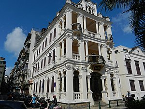
Popular places and events near this IP address

Macau Peninsula
The peninsular part of the Special Administrative Region of Macao
Distance: Approx. 349 meters
Latitude and longitude: 22.198,113.5473
The Macau Peninsula is the historical and most populous part of Macau. It has an area of 8.5 square kilometers (3.3 sq mi) (4 by 1.8 kilometers (2.5 mi × 1.1 mi)) and is geographically connected to Guangdong Province at the northeast through an isthmus 200 meters (660 ft) wide. The peninsula, together with downtown Zhuhai, sits on an island separated from the continent by distributaries of the Pearl River.
Santo António, Macau
Freguesia in Macau
Distance: Approx. 320 meters
Latitude and longitude: 22.2009,113.542
Santo António is a civil parish (Portuguese: freguesia) in the western portion of the Macau Peninsula of Macau. It has the highest population density in Macau (98,776 persons per km²). This parish was one of five in the former Municipality of Macau, one of Macau's two municipalities that were abolished on 31 December 2001 by Law No.
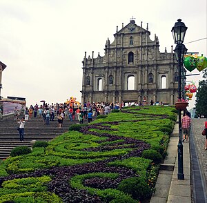
Fortaleza do Monte
Fort in Santo António, Macau, China
Distance: Approx. 240 meters
Latitude and longitude: 22.19711111,113.54242222
The Fortaleza do Monte (Portuguese for Mount Fortress, also Monte Forte; officially Fortaleza de Nossa Senhora do Monte de São Paulo, in English: Fortress of Our Lady of the Mount of St. Paul; Chinese: 大砲台; Cantonese Yale: daaih paau yìh) is a fort in Santo António in Macau. It is the historical military centre of Macau.

Zhongshan Island
River island on the west bank of the Pearl River Delta in Guangdong, China
Distance: Approx. 271 meters
Latitude and longitude: 22.19972222,113.54638889
Zhongshan Island, formerly also known as Macau Island or Xiangshan Island, is a river island on the west bank of the Pearl River Delta in Guangdong, China. This area is separated from the mainland by a narrow waterway, and has a population of about 2.8 million. At the southern tip of the island is the peninsular part of the Macao Special Administrative Region.
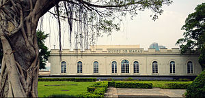
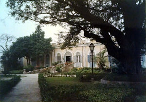
Macao Museum
Museum in Macau
Distance: Approx. 291 meters
Latitude and longitude: 22.197205,113.541684
The Macao Museum (Chinese: 澳門博物館; Portuguese: Museu de Macau) is a public museum located on the hill of the Fortaleza do Monte in Santo António, Macau SAR. The museum presents the history of the city and territory of the former Portuguese colony of Macau, now a special administrative region of the People's Republic of China. Planning for the museum started in April 1995, its construction began in September 1996. The museum was inaugurated on 18 April 1998.
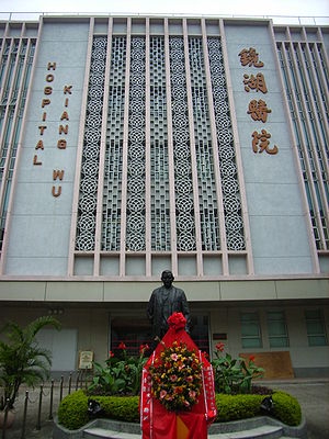
Kiang Wu Hospital
Hospital in São Lázaro, Macau, China
Distance: Approx. 163 meters
Latitude and longitude: 22.19861111,113.54242222
Kiang Wu Hospital (KWH; Chinese: 鏡湖醫院) is a private district general hospital is located in Santo António, Macau. It is one of the three hospitals in Macau. Founded in 1871, the hospital is run by the Kiang Wu Charitable Association and offered Chinese medical services.
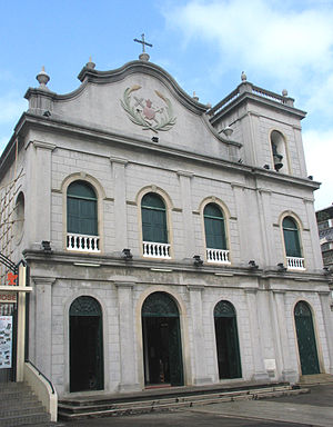
St. Lazarus' Church, Macau
Church in Macau, China
Distance: Approx. 211 meters
Latitude and longitude: 22.19722222,113.54527778
St. Lazarus' Church (Chinese: 望德聖母堂; Portuguese: Igreja de São Lázaro) is a historic church in São Lázaro, Macau, China. Built between 1557 and 1560, it is one of the oldest churches in Macau and located on Rua de João de Almeida.

Tap Seac Square
Public square in Macau, China
Distance: Approx. 326 meters
Latitude and longitude: 22.1981,113.5471
Tap Seac Square (Chinese: 塔石廣場; Portuguese: Praça do Tap Seac) is a major public square in São Lázaro, Macau, China. It stood on the site of a former stadium and was completed in 2007. Amongst others, the buildings of the Macau Central Library, the Cultural Institute and the Macau Historic Archives are located around the square.

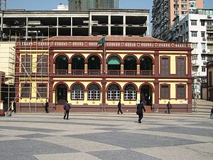
Fire Services Museum, Macau
Museum in Santo António, Macau, China
Distance: Approx. 166 meters
Latitude and longitude: 22.20011111,113.54347222
The Fire Services Museum (Chinese: 消防博物館; Portuguese: Museu dos Bombeiros) is a museum about firefighting in Santo António, Macau, China.

Archives of Macao
Archive in São Lázaro, Macau, China
Distance: Approx. 309 meters
Latitude and longitude: 22.19875,113.547
The Archives of Macao (Chinese: 澳門檔案館; Portuguese: Arquivo de Macau) is a general archive in São Lázaro, Macau. It collects, processes, protects and make available records pertaining Macau.
Tai Fung Tong Art House
Art center in São Lázaro, Macau, China
Distance: Approx. 211 meters
Latitude and longitude: 22.19697222,113.54483333
The Tai Fung Tong Art House (traditional Chinese: 大瘋堂藝舍; simplified Chinese: 大疯堂艺舍) is an arts center in São Lázaro, Macau, China.
Macao Central Library
Library of the Macao Public Library system, in São Lázaro, Macau
Distance: Approx. 341 meters
Latitude and longitude: 22.19868773,113.54730582
The Macao Central Library (Chinese: 澳門中央圖書館; Portuguese: Biblioteca Central de Macau) is a library of the Macao Public Library system, in São Lázaro (Saint Lazarus Parish), Macau.
Weather in this IP's area
scattered clouds
29 Celsius
35 Celsius
29 Celsius
30 Celsius
1005 hPa
84 %
1005 hPa
1002 hPa
10000 meters
3.6 m/s
30 degree
40 %
06:13:13
18:27:38