Country:
Region:
City:
Latitude and Longitude:
Time Zone:
Postal Code:
IP information under different IP Channel
ip-api
Country
Region
City
ASN
Time Zone
ISP
Blacklist
Proxy
Latitude
Longitude
Postal
Route
Luminati
Country
Region
eng
City
southampton
ASN
Time Zone
Europe/London
ISP
Talk Straight Ltd.
Latitude
Longitude
Postal
IPinfo
Country
Region
City
ASN
Time Zone
ISP
Blacklist
Proxy
Latitude
Longitude
Postal
Route
db-ip
Country
Region
City
ASN
Time Zone
ISP
Blacklist
Proxy
Latitude
Longitude
Postal
Route
ipdata
Country
Region
City
ASN
Time Zone
ISP
Blacklist
Proxy
Latitude
Longitude
Postal
Route
Popular places and events near this IP address
King Edward VI School, Southampton
Private day school in Hampshire, England
Distance: Approx. 744 meters
Latitude and longitude: 50.92277778,-1.41694444
King Edward VI School (also known as King Edward's, or KES) is a selective co-educational private school founded in Southampton, England, in 1553. The Senior and Sixth Form site is on Hill Lane, Southampton whilst the Preparatory School is located in Romsey. The school was founded at the request of William Capon, who bequeathed money in his will for a grammar school for the poor.

The Dell (Southampton)
Former English football stadium
Distance: Approx. 673 meters
Latitude and longitude: 50.91472222,-1.41305556
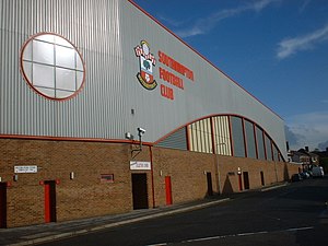
The Dell on Milton Road, Southampton, Hampshire, England was the home ground of Southampton F.C. between 1898 and 2001.

La Sainte Union College of Higher Education
Former teacher training college in Southampton
Distance: Approx. 713 meters
Latitude and longitude: 50.92234444,-1.41663889
La Sainte Union (LSU) in Southampton was a teacher training college. It was owned and run by the La Sainte Union des Sacrés Coeurs order of nuns, and this Catholic background was reflected in the student makeup. In addition to teacher training, LSU also provided first degree courses in the Humanities, particularly history (notably American and Soviet), art, English and foreign languages (B.A. Combined Studies, B.A. Modern Foreign Languages & European Studies, Theology).

Shirley, Southampton
Human settlement in England
Distance: Approx. 906 meters
Latitude and longitude: 50.9218,-1.4323
Shirley is a broad district and a former village on the western side of Southampton, in the ceremonial county of Hampshire, England. Shirley's main roles are retailing and residential. It is the most important suburban shopping area in the west of the city.

Freemantle
Human settlement in England
Distance: Approx. 659 meters
Latitude and longitude: 50.9117,-1.4265
Freemantle is a suburb and electoral ward in Southampton, England. There are similarly named places in Hampshire: notably Henry II's hunting lodge in Kingsclere; an area near Hannington; and Freemantle Common in Bitterne. These were formerly thought to be French names meaning "cold cloak", but are now known to derive from the word fromental, meaning a wheat-field.
Unity 101
Community radio station in Southampton, England
Distance: Approx. 344 meters
Latitude and longitude: 50.91622222,-1.417225
Unity 101 (previously known as Unity 24) is a community radio station based in Southampton, England, a voluntary organisation catering to the Asian and ethnic minority communities in the area. The station was previously only on the air for one month a year, but on 8 December 2005 began a five-year licence to broadcast permanently. The show's weekday lineup consists predominantly of Indian music in Hindi, Gujarati, Punjabi and English, with a 'Community Hour' of discussion from 3pm to 4pm.
County Ground, Southampton
Distance: Approx. 889 meters
Latitude and longitude: 50.91944444,-1.41
The County Ground in Southampton, England, was a cricket and football ground. It was the home of Hampshire County Cricket Club from the 1885 English cricket season until the 2000 English cricket season. The ground also served as the home ground for Southampton Football Club from 1896 to 1898.

Southampton Old Cemetery
Distance: Approx. 730 meters
Latitude and longitude: 50.9203,-1.4131
The cemetery has had various titles including The Cemetery by the Common, Hill Lane Cemetery and is currently known as Southampton Old Cemetery. An Act of Parliament was required in 1843 to acquire the land from Southampton Common. It covers an area of 27 acres (11 ha) and the total number of burials is estimated at 116,800.

Shirley Baptist Church, Southampton
Distance: Approx. 1022 meters
Latitude and longitude: 50.922937,-1.432976
Shirley Baptist Church is a Baptist church in Southampton. The main church building is situated along Church Street in the district of Shirley. Founded in 1852, the church is a member of the Baptist Union of Great Britain.

Christ Church, Freemantle
Distance: Approx. 730 meters
Latitude and longitude: 50.9115,-1.4279
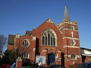
Christ Church is the parish church for Freemantle in Southampton. The church building is listed Grade II on the National Heritage List for England.
Hamble College of Air Training
Aviation school in Hampshire, England
Distance: Approx. 1008 meters
Latitude and longitude: 50.91704167,-1.43636389
Hamble College of Air Training was a flight training centre in Hampshire, England. During the late 1950s it became apparent that there was going to be a shortage of ex military pilots who would be available to crew British civil aircraft. The two (then) state owned airline corporations, British Overseas Airways Corporation (BOAC) and British European Airways (BEA), in collaboration with the Ministry of Aviation, proposed a flying school based loosely on the Royal Air Force's officer training college at Cranwell.

St Mark's Church of England School, Southampton
Voluntary controlled school in Southampton
Distance: Approx. 160 meters
Latitude and longitude: 50.91596347,-1.42373667
St Mark's Church of England School, formerly known as St Mark's Church of England Primary School, is a Church of England all-through school in Shirley, Southampton, England. St Mark's was a primary school but was demolished and renovated by Morgan Sindall to form an all-through school. The project started in 2020.
Weather in this IP's area
broken clouds
9 Celsius
8 Celsius
8 Celsius
10 Celsius
1014 hPa
95 %
1014 hPa
1012 hPa
6000 meters
2.06 m/s
260 degree
75 %
07:25:36
16:16:07