Country:
 USA
USARegion:
City:
Latitude and Longitude:
Time Zone:
Postal Code:
IP information under different IP Channel
ip-api
Country
Region
City
ASN
Time Zone
ISP
Blacklist
Proxy
Latitude
Longitude
Postal
Route
IPinfo
Country
Region
City
ASN
Time Zone
ISP
Blacklist
Proxy
Latitude
Longitude
Postal
Route
MaxMind
Country
Region
City
ASN
Time Zone
ISP
Blacklist
Proxy
Latitude
Longitude
Postal
Route
Luminati
Country
USRegion
ny
City
queens
ASN
Time Zone
America/New_York
ISP
SJU149068
Latitude
Longitude
Postal
db-ip
Country
Region
City
ASN
Time Zone
ISP
Blacklist
Proxy
Latitude
Longitude
Postal
Route
ipdata
Country
Region
City
ASN
Time Zone
ISP
Blacklist
Proxy
Latitude
Longitude
Postal
Route
Popular places and events near this IP address

St. John's University (New York City)
Catholic university in New York City, New York, U.S.
Distance: Approx. 394 meters
Latitude and longitude: 40.72194444,-73.79555556
St. John's University is a private Catholic university in Queens, New York City. It was founded in 1870 by the Congregation of the Mission (C.M., the Vincentian Fathers) with a mission to provide the youth of New York with a Catholic university education.
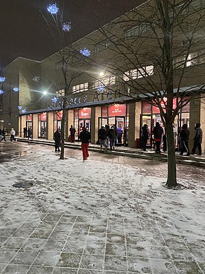
Carnesecca Arena
Venue in New York City
Distance: Approx. 254 meters
Latitude and longitude: 40.72416667,-73.79444444
Carnesecca Arena (formerly Alumni Hall) is a 5,602-seat multi-purpose arena in the borough of Queens in New York City, New York. It was built in 1961 and renamed in honor of Hall of Fame Coach Lou Carnesecca on November 23, 2004. It is the exclusive home to the St.
Thomas A. Edison High School (Queens)
Public school in New York City
Distance: Approx. 1089 meters
Latitude and longitude: 40.7159,-73.7993
Thomas A. Edison Career and Technical Education High School (often referred to locally simply as Edison) is a public secondary school in Queens's Jamaica Hills community in New York City. It is one of the few public high schools in New York City to offer vocational training programs as well as traditional college preparatory tracks and well known for its largely male population. The school is operated by the New York City Department of Education.

Jamaica High School
Public school in New York City
Distance: Approx. 1170 meters
Latitude and longitude: 40.7145,-73.7982
Jamaica High School was a four-year public high school in Jamaica, Queens, New York. It was operated by the New York City Department of Education. Jamaica High School was founded as the Union Free School in 1854, and located within a three-story wooden structure on what is now 161st Street.

Self-Transcendence 3100 Mile Race
World's longest certified footrace
Distance: Approx. 1138 meters
Latitude and longitude: 40.715556,-73.799653
The Self-Transcendence 3100 Mile Race is the world's longest certified footrace. In 1996 Sri Chinmoy created this event as a 2,700-mile (4,345 km) race. At the award ceremony that year he declared that the 1997 edition would be extended to 3,100 miles (4,989 km).

Jack Kaiser Stadium
Baseball stadium in New York City
Distance: Approx. 18 meters
Latitude and longitude: 40.723647,-73.791704
Jack Kaiser Stadium, originally known as The Ballpark at St. John's, is a baseball stadium located on the campus of St. John's University in the neighborhood of Hillcrest near the neighborhoods of Jamaica and Fresh Meadows in New York City.
St. John's University School of Law
Catholic law school in Jamaica, Queens, New York, US
Distance: Approx. 411 meters
Latitude and longitude: 40.724,-73.79636
St. John's University School of Law is a Roman Catholic law school in Jamaica, Queens, New York, United States, affiliated with St. John's University.

Belson Stadium
Stadium in Queens, New York, U.S.
Distance: Approx. 132 meters
Latitude and longitude: 40.724307,-73.792838
Belson Stadium is a 2,168-seat soccer-specific stadium located at Utopia Parkway and Union Turnpike in Queens, New York City, on the campus of St. John's University. It is the home of the St.

The Mary Louis Academy
Private, day, college-prep school in New York, United States
Distance: Approx. 1292 meters
Latitude and longitude: 40.7125,-73.7875
The Mary Louis Academy, also known as TMLA, is an all-girls private Catholic college-preparatory academy, located in Jamaica Estates, Queens, New York City. TMLA's 5-acre (20,000 m2) campus encompasses eight buildings situated on private grounds at the top of one of the highest hills in Queens, hence TMLA's interscholastic nickname "The Hilltoppers". The Mary Louis Academy was founded in 1936, by the Congregation of the Sisters of St.

Summit School (Queens)
Approved private, special education school in Queens, New York, United States
Distance: Approx. 1255 meters
Latitude and longitude: 40.72138889,-73.77694444
The Summit School is a state funding approved private, special education day school in Queens, New York, United States. Established in 1968, it operates two sites near the St. John's University campus; the Lower School, which educates elementary and middle school students, utilizes space in the Hillcrest Jewish Center in Utopia, and the Upper School serves high school students in Jamaica Estates.

Utopia Parkway (Queens)
Boulevard in Queens, New York
Distance: Approx. 661 meters
Latitude and longitude: 40.729472,-73.793333
Utopia Parkway is a major street in the New York City borough of Queens. Starting in the neighborhood of Beechhurst and ending in the Jamaica Estates neighborhood, the street connects Cross Island Parkway and Northern Boulevard in the north to Union Turnpike, Grand Central Parkway and Hillside Avenue in the south.

Hillcrest Veterans Square
Public park in Queens, New York
Distance: Approx. 1218 meters
Latitude and longitude: 40.721284,-73.805582
Hillcrest Veterans Square is a triangle-shaped public park located in Fresh Meadows, Queens, New York City. The square contains a monument erected by Hillcrest Post No. 1078 of the American Legion.
Weather in this IP's area
scattered clouds
12 Celsius
11 Celsius
9 Celsius
13 Celsius
1013 hPa
66 %
1013 hPa
1011 hPa
10000 meters
1.54 m/s
310 degree
40 %
07:00:14
18:24:02