Country:
 Israel
Region:
City:
Latitude and Longitude:
Time Zone:
Postal Code:
IP information under different IP Channel
ip-api
Country
Region
City
ASN
Time Zone
ISP
Blacklist
Proxy
Latitude
Longitude
Postal
Route
IPinfo
Country
Region
City
ASN
Time Zone
ISP
Blacklist
Proxy
Latitude
Longitude
Postal
Route
MaxMind
Country
Region
City
ASN
Time Zone
ISP
Blacklist
Proxy
Latitude
Longitude
Postal
Route
Luminati
Country
ILASN
Time Zone
Asia/Jerusalem
ISP
AVAYA
Latitude
Longitude
Postal
db-ip
Country
Region
City
ASN
Time Zone
ISP
Blacklist
Proxy
Latitude
Longitude
Postal
Route
ipdata
Country
Region
City
ASN
Time Zone
ISP
Blacklist
Proxy
Latitude
Longitude
Postal
Route
Popular places and events near this IP address

Tel Aviv
City in Israel
Distance: Approx. 614 meters
Latitude and longitude: 32.08,34.78
Tel Aviv-Yafo/Jaffa (Hebrew: תֵּל אָבִיב-יָפוֹ, romanized: Tēl ʾĀvīv-Yāfō, IPA: [tel aˈviv jaˈfo]; Arabic: تَلّ أَبِيب – يَافَا, romanized: Tall ʾAbīb-Yāfā), usually referred to as just Tel Aviv, is the most populous city in the Gush Dan metropolitan area of Israel. Located on the Israeli Mediterranean coastline and with a population of 474,530, it is the economic and technological center of the country and a global high tech hub. If East Jerusalem is considered part of Israel, Tel Aviv is the country's second-most-populous city, after Jerusalem; if not, Tel Aviv is the most populous city, ahead of West Jerusalem.

Herzliya Hebrew Gymnasium
High school in Tel Aviv, Israel
Distance: Approx. 341 meters
Latitude and longitude: 32.086975,34.78482778
The Herzliya Hebrew Gymnasium (Hebrew: הַגִּימְנַסְיָה הָעִבְרִית הֶרְצְלִיָּה, romanized: HaGimnasya Haivrit Herzliya, also known as Gymnasia Herzliya), originally known as HaGymnasia HaIvrit (lit. Hebrew High School) is a historic high school in Tel Aviv, Israel.
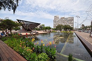
Rabin Square
Public city square in Tel Aviv, Israel
Distance: Approx. 511 meters
Latitude and longitude: 32.08083333,34.78055556
Rabin Square (Hebrew: כיכר רבין, romanized: Kikar Rabin), formerly Kings of Israel Square (Hebrew: כיכר מלכי ישראל, romanized: Kikar Malkhey Yisrael), is a main large public city square in the center of Tel Aviv, Israel. Over the years it has been the site of numerous political rallies, parades, and other public events. In 1995, the square was renamed 'Rabin Square' following the assassination of Yitzhak Rabin which occurred there on November 4, 1995.

Assassination of Yitzhak Rabin
1995 murder in Tel Aviv, Israel
Distance: Approx. 388 meters
Latitude and longitude: 32.08188889,34.78094444
The assassination of Yitzhak Rabin, the fifth prime minister of Israel, took place on 4 November 1995 (12 Marcheshvan 5756 on the Hebrew calendar) at 21:30, at the end of a rally in support of the Oslo Accords at the Kings of Israel Square in Tel Aviv. The assailant was Yigal Amir, an Israeli law student and ultranationalist who radically opposed prime minister Yitzhak Rabin's peace initiative, particularly the signing of the Oslo Accords.

Tel Aviv Zoo
Zoo in Tel Aviv, Israel
Distance: Approx. 336 meters
Latitude and longitude: 32.08249167,34.78048333
The Tel Aviv Zoo was a zoo founded in 1938 and located in central Tel Aviv. The zoo closed in 1980 and the animals were moved to the Zoological Center of Tel Aviv-Ramat Gan. The Gan Ha'Ir shopping mall now occupies the zoo's site.

Ibn Gabirol Street
Distance: Approx. 272 meters
Latitude and longitude: 32.08290278,34.78125556
Ibn Gabirol Street (Hebrew: רְחוֹב אִבְּן גַבִּירוֹל) (colloquially Ibn Gvirol or Even Gvirol) is a major street in Tel Aviv, Israel. Ibn Gabirol Street is named after the medieval Hebrew poet and philosopher Solomon ibn Gabirol. It carries traffic north and south, and is a busy residential and shopping street.

Hechal Yehuda Synagogue
Synagogue in Tel Aviv, Israel
Distance: Approx. 218 meters
Latitude and longitude: 32.08672778,34.78338056
The Hechal Yehuda Synagogue (Hebrew: בית הכנסת היכל יהודה, Beit haKnesset Hechal Yehuda), also commonly known as the Recanati synagogue (Hebrew: בית הכנסת רקנטי, Beit haKnesset Recanati), is often referred to as the Seashell Synagogue (Hebrew: בית הכנסת קונכית, Beit haKnesset Konkit, Greek: Συναγωγή Κοχύλι) because of its unusual shape resembling a seashell.

Al-Mas'udiyya
Place in Jaffa, Mandatory Palestine
Distance: Approx. 13 meters
Latitude and longitude: 32.08527778,34.78166667
Al-Mas'udiyya (also known as Summayl), was a Palestinian Arab village in the Jaffa Subdistrict. It was depopulated during the 1947–1948 Civil War in Mandatory Palestine on December 25, 1947. It was located 5 km northeast of Jaffa, situated 1.5 km south of the al-'Awja River.
Tel Aviv City Hall
Distance: Approx. 392 meters
Latitude and longitude: 32.08194444,34.78055556
Tel Aviv City Hall (Hebrew: בית עיריית תל אביב Beit Iriyat Tel Aviv) is the municipal government center of Tel Aviv, Israel. It houses the mayor's office, the meeting chambers and offices of the Tel Aviv City Council.
Café Apropo bombing
1997 bombing in Tel Aviv, Israel
Distance: Approx. 593 meters
Latitude and longitude: 32.08361111,34.77583333
The Café Apropo bombing was a Palestinian suicide bombing which occurred on 21 March 1997 in a coffee shop in Tel Aviv. Three women were killed in the attack and 48 were injured.

Embassy of Poland, Tel Aviv
Diplomatic mission
Distance: Approx. 480 meters
Latitude and longitude: 32.08194444,34.785
The Embassy of Poland in Tel Aviv (Hebrew: השגרירות של הרפובליקה של פולין בתל-אביב) is the diplomatic mission of Poland to Israel.

List of ambassadors of Romania to Israel
Distance: Approx. 376 meters
Latitude and longitude: 32.085923,34.777879
The Romanian ambassador in Tel Aviv is the official representative of the Government in Bucharest to the Government of Israel.
Weather in this IP's area
few clouds
23 Celsius
23 Celsius
21 Celsius
23 Celsius
1012 hPa
74 %
1012 hPa
1010 hPa
10000 meters
2.57 m/s
140 degree
20 %
06:27:20
18:41:58