149.37.1.204 - IP Lookup: Free IP Address Lookup, Postal Code Lookup, IP Location Lookup, IP ASN, Public IP
Country:
Region:
City:
Location:
Time Zone:
Postal Code:
IP information under different IP Channel
ip-api
Country
Region
City
ASN
Time Zone
ISP
Blacklist
Proxy
Latitude
Longitude
Postal
Route
Luminati
Country
ASN
Time Zone
America/Chicago
ISP
LEVEL3
Latitude
Longitude
Postal
IPinfo
Country
Region
City
ASN
Time Zone
ISP
Blacklist
Proxy
Latitude
Longitude
Postal
Route
IP2Location
149.37.1.204Country
Region
new york
City
schenectady
Time Zone
America/New_York
ISP
Language
User-Agent
Latitude
Longitude
Postal
db-ip
Country
Region
City
ASN
Time Zone
ISP
Blacklist
Proxy
Latitude
Longitude
Postal
Route
ipdata
Country
Region
City
ASN
Time Zone
ISP
Blacklist
Proxy
Latitude
Longitude
Postal
Route
Popular places and events near this IP address
Schenectady, New York
City in New York, United States
Distance: Approx. 238 meters
Latitude and longitude: 42.81416667,-73.93722222
Schenectady ( skə-NEK-tə-dee) is a city in Schenectady County, New York, United States, of which it is the county seat. As of the 2020 census, the city's population of 67,047 made it the state's ninth-most populous city and the twenty-fifth most-populous municipality. The city is in eastern New York, near the confluence of the Mohawk and Hudson rivers.

Schenectady station
Distance: Approx. 287 meters
Latitude and longitude: 42.8146,-73.9428
Schenectady station is an Amtrak intercity train station in Schenectady, New York. The station, constructed in 2018 is owned by the Capital District Transportation Authority which also owns Albany–Rensselaer station and Saratoga Springs station. Schenectady is served by five Amtrak routes.

Proctor's Theatre (Schenectady, New York)
Historic theatre in Schenectady, New York
Distance: Approx. 416 meters
Latitude and longitude: 42.81222222,-73.94194444
Proctor's Theatre (officially stylized as Proctors since 2007; however, the marquee retains the apostrophe) is a theatre and former vaudeville house located in Schenectady, New York, United States. Many famous artists have performed there, including Mariah Carey (whose 1993 top-rated Thanksgiving special was taped there), Britney Spears, Hal Holbrook, Ted Wiles, and George Burns, as well as many others. It has one of the largest movie screens in the Northeast.

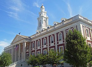
Schenectady City Hall
United States historic place
Distance: Approx. 181 meters
Latitude and longitude: 42.81388889,-73.93916667
Schenectady City Hall is the seat of government of the city of Schenectady, New York, United States. Designed by McKim, Mead, and White, the building was constructed between 1931 and 1933. It is located on the block between Clinton, Franklin, Jay and Liberty streets.

Foster Building
United States historic place
Distance: Approx. 462 meters
Latitude and longitude: 42.81138889,-73.94027778
The Foster Building, originally the Hotel Foster, is located on State Street (NY 5) in Schenectady, New York, United States. It is a commercial building in the Beaux-Arts architectural style. When built in 1907, it was the first building in the city to use terra cotta as its primary siding on the front facade, and the first built under the precepts of the City Beautiful movement.

United States Post Office (Schenectady, New York)
United States historic place
Distance: Approx. 100 meters
Latitude and longitude: 42.81472222,-73.93888889
The U.S. Post Office in Schenectady, in the U.S. state of New York, is located at Jay and Liberty streets just north of City Hall. It serves the 12305, 12307 and 12308 ZIP codes, which covers the city. It is a brick Classical Revival building erected in 1912 and added onto extensively in 1933.

Union Street Historic District (Schenectady, New York)
Historic district in New York, United States
Distance: Approx. 257 meters
Latitude and longitude: 42.81583333,-73.93638889
The Union Street Historic District extends along a section of that street in Schenectady, New York, United States. Covering roughly two miles (3.2 km) of both sides of the street, it includes 184 buildings in its 65 acres (26 ha). Over the course of the 19th century, the city's development followed Union, one of the major through roads to the east, as it industrialized and expanded out of its colonial core on the banks of the Mohawk River.

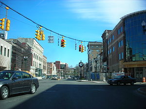
Downtown Schenectady
Neighborhood/Central business district in Capital District, New York, United States
Distance: Approx. 414 meters
Latitude and longitude: 42.8125,-73.9425
Downtown Schenectady is the central business district for the city of Schenectady, New York. It originated in the 1820s with the moving of the commercial and industrial interests east from the original 17th and 18th century settlement, spurred on by the development of the Erie Canal. Home to the headquarters and major manufacturing plants of two large corporations, General Electric and American Locomotive Company, Downtown Schenectady catered to tens of thousands of workers in its heyday.
H. S. Barney Building
Historic commercial building in New York, United States
Distance: Approx. 495 meters
Latitude and longitude: 42.81527778,-73.94555556
H. S. Barney Building is a historic department store complex located at Schenectady in Schenectady County, New York. The large commercial building consists of six sections constructed or acquired and linked between 1873 and 1923. It is predominantly brick in construction, but incorporates heavy timber framing, concrete, and limestone.
Central Fire Station (Schenectady, New York)
United States historic place
Distance: Approx. 612 meters
Latitude and longitude: 42.81333333,-73.94638889
Central Fire Station is a historic fire station located at Schenectady in Schenectady County, New York, USA. It was built between 1924 and 1929 and is a three-story, brick civic building in the Georgian Revival style. The front facade is dominated by a broad, five bay central pavilion. The first floor of the front facade is composed of five segmentally arched entrance bays faced with cast stone.
Edison Tech Center
Interactive learning center in Schenectady, New York
Distance: Approx. 299 meters
Latitude and longitude: 42.813941,-73.942478
The Edison Tech Center is an interactive learning center with a central emphasis on electricity and engineering. The organization was founded in 2001 under the name Edison Exploratorium, and changed to Edison Steinmetz Center and finally the Edison Tech Center in 2009. It is located at 136 Broadway, Schenectady, New York.

First Presbyterian Church (Schenectady, New York)
Church in New York, United States
Distance: Approx. 480 meters
Latitude and longitude: 42.81738889,-73.94477778
First Presbyterian Church in Schenectady, New York is a historic Presbyterian Church in America congregation. The roots of the congregation go back to the 1730s. Episcopalians and Presbyterians had used the St.
Weather in this IP's area
overcast clouds
-5 Celsius
-12 Celsius
-7 Celsius
-4 Celsius
1028 hPa
58 %
1028 hPa
1018 hPa
10000 meters
7.2 m/s
11.83 m/s
160 degree
100 %
