149.255.245.247 - IP Lookup: Free IP Address Lookup, Postal Code Lookup, IP Location Lookup, IP ASN, Public IP
Country:
Region:
City:
Location:
Time Zone:
Postal Code:
ISP:
ASN:
language:
User-Agent:
Proxy IP:
Blacklist:
IP information under different IP Channel
ip-api
Country
Region
City
ASN
Time Zone
ISP
Blacklist
Proxy
Latitude
Longitude
Postal
Route
db-ip
Country
Region
City
ASN
Time Zone
ISP
Blacklist
Proxy
Latitude
Longitude
Postal
Route
IPinfo
Country
Region
City
ASN
Time Zone
ISP
Blacklist
Proxy
Latitude
Longitude
Postal
Route
IP2Location
149.255.245.247Country
Region
al basrah
City
al faw
Time Zone
Asia/Baghdad
ISP
Language
User-Agent
Latitude
Longitude
Postal
ipdata
Country
Region
City
ASN
Time Zone
ISP
Blacklist
Proxy
Latitude
Longitude
Postal
Route
Popular places and events near this IP address

Al-Faw peninsula
Landform in southwest Iraq
Distance: Approx. 1020 meters
Latitude and longitude: 29.97444444,48.46416667
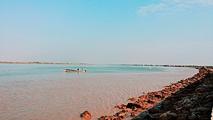
The Al-Faw peninsula (Arabic: شبه جزيرة الفاو; also transliterated as Fao or Fawr) is a peninsula in the Persian Gulf, located in the extreme southeast of Iraq. The marshy peninsula is 20 km (12 mi) southeast of Iraq's third largest city, Basra, and is part of a delta for the Shatt al-Arab (Arvand Rud) river, formed by the confluence of the major Euphrates and Tigris rivers. The al-Faw peninsula borders Iran to the northeast, with the cities of Abadan and Khorramshahr on the opposite side of the Shatt al-Arab, and Kuwait to the southwest, opposite from Bubiyan Island and Warbah Island, near the Iraqi city of Umm Qasr.

Al-Faw
Place in Al-Basrah, Iraq
Distance: Approx. 267 meters
Latitude and longitude: 29.97583333,48.47222222
Al-Fāw (Arabic: ٱلْفَاو; sometimes transliterated as Fao) is a port town on Al-Faw Peninsula in Iraq near the Shatt al-Arab and the Persian Gulf. The Al Faw Peninsula is part of the Basra Governorate.

First Battle of al-Faw
1986 battle in the Iran–Iraq War
Distance: Approx. 299 meters
Latitude and longitude: 29.9753,48.4725
The First Battle of al-Faw was a battle of the Iran–Iraq War, fought on the al-Faw peninsula between 10 February and 10 March 1986. The Iranian operation is considered to be one of Iran's greatest achievements in the Iran–Iraq War. The Iranians were able to capture the al-Faw peninsula, cutting off Iraqi access to the Persian Gulf in the process; this in turn hardened Iraqi attitudes to prosecute the war.

Battle of Al Faw (2003)
Engagement of the Iraq War
Distance: Approx. 299 meters
Latitude and longitude: 29.9753,48.4725
The Battle of Al Faw began on 20 March 2003 and continued for four days, as part of the 2003 invasion of Iraq. One of the initial objectives of the Coalition was to capture every GOPLAT (gas and oil platform) in the Al-Faw Peninsula before they could be sabotaged or destroyed by the Iraqi military. Doing so would also deny Iraq the ability to cause another ecological disaster, as it had done with the Kuwait oil fires and the Persian Gulf oil spill in 1991.
Arvandkenar
City in Khuzestan province, Iran
Distance: Approx. 4320 meters
Latitude and longitude: 29.97861111,48.51888889
Arvandkenar (Persian: اروندكنار) is a city in, and the capital of, Arvandkenar District of Abadan County, Khuzestan province, Iran. The city is a port 50 kilometres (31 mi) south of Abadan, and has oil reserves. Arvandkenar is the last port of Iran on the Arvand River (Arvand Rud).
Nahr-e Kut, Nasar
Village in Khuzestan, Iran
Distance: Approx. 4408 meters
Latitude and longitude: 30.01666667,48.46666667
Nahr-e Kut (Persian: نهركوت, also Romanized as Nahr-e Kūt; also known as Kūt) is a village in Nasar Rural District, Arvandkenar District, Abadan County, Khuzestan Province, Iran. At the 2006 census, its population was 196, in 39 families.
Farrokh Pey
Village in Khuzestan, Iran
Distance: Approx. 2648 meters
Latitude and longitude: 30,48.48333333
Farrokh Pey (Persian: فرخ پي; also known as Sa‘dūnī) is a village in Nasar Rural District, Arvandkenar District, Abadan County, Khuzestan Province, Iran. At the 2006 census, its population was 523, in 97 families.
Nahr-e Abu Felfel
Village in Khuzestan province, Iran
Distance: Approx. 2593 meters
Latitude and longitude: 30.00083333,48.47222222
Nahr-e Abu Felfel (Persian: نهرابوفلفل) is a village in Nasar Rural District of Arvandkenar District, Abadan County, Khuzestan province, Iran.
Nahr-e Abu Azim
Village in Khuzestan, Iran
Distance: Approx. 2648 meters
Latitude and longitude: 30,48.48333333
Nahr-e Abu Azim (Persian: نهرابوعظيم, also Romanized as Nahr-e Abū ‘Aẕīm; also known as Abū ‘Aẕīm) is a village in Nasar Rural District, Arvandkenar District, Abadan County, Khuzestan Province, Iran. At the 2006 census, its population was 308, in 48 families.
Nahr-e Ariz
Village in Khuzestan, Iran
Distance: Approx. 3894 meters
Latitude and longitude: 30.00611111,48.4975
Nahr-e Ariz (Persian: نهرعريض, also Romanized as Nahr-e ‘Arīẕ) is a village in Nasar Rural District, Arvandkenar District, Abadan County, Khuzestan Province, Iran. At the 2006 census, its population was 210, in 41 families.
Nahr-e Tolayeb
Village in Khuzestan, Iran
Distance: Approx. 3759 meters
Latitude and longitude: 29.99722222,48.50583333
Nahr-e Tolayeb (Persian: نهرطليب, also Romanized as Nahr-e Tolayeb and Nahr-e Ţalayeb) is a village in Nasar Rural District, Arvandkenar District, Abadan County, Khuzestan Province, Iran. At the 2006 census, its population was 230, in 43 families.
Rafi, Abadan
Village in Khuzestan, Iran
Distance: Approx. 3529 meters
Latitude and longitude: 30,48.5
Rafi (Persian: رفيع, also Romanized as Rafī‘) is a village in Nasar Rural District, Arvandkenar District, Abadan County, Khuzestan Province, Iran. At the 2006 census, its population was 193, in 40 families.
Weather in this IP's area
clear sky
16 Celsius
14 Celsius
16 Celsius
16 Celsius
1021 hPa
37 %
1021 hPa
1021 hPa
10000 meters
4.77 m/s
7.14 m/s
315 degree
10 %