149.255.210.246 - IP Lookup: Free IP Address Lookup, Postal Code Lookup, IP Location Lookup, IP ASN, Public IP
Country:
Region:
City:
Location:
Time Zone:
Postal Code:
ISP:
ASN:
language:
User-Agent:
Proxy IP:
Blacklist:
IP information under different IP Channel
ip-api
Country
Region
City
ASN
Time Zone
ISP
Blacklist
Proxy
Latitude
Longitude
Postal
Route
db-ip
Country
Region
City
ASN
Time Zone
ISP
Blacklist
Proxy
Latitude
Longitude
Postal
Route
IPinfo
Country
Region
City
ASN
Time Zone
ISP
Blacklist
Proxy
Latitude
Longitude
Postal
Route
IP2Location
149.255.210.246Country
Region
al basrah
City
basrah
Time Zone
Asia/Baghdad
ISP
Language
User-Agent
Latitude
Longitude
Postal
ipdata
Country
Region
City
ASN
Time Zone
ISP
Blacklist
Proxy
Latitude
Longitude
Postal
Route
Popular places and events near this IP address

Basra
Metropolis in Iraq
Distance: Approx. 3007 meters
Latitude and longitude: 30.515,47.81
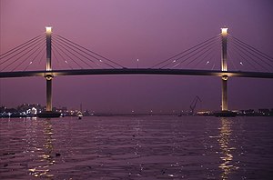
Al-Basrah (Arabic: ٱلْبَصْرَة, romanized: al-Baṣrah) is a port city in southern Iraq. It is the capital of the eponymous Basra Governorate, as well as the third largest city in Iraq overall, behind only Baghdad and Mosul. Located near the Iran–Iraq border at the north-easternmost extent of the Arabian Peninsula, the city is situated along the banks of the Shatt al-Arab that empties into the Persian Gulf.
Al-Mina'a Stadium
Stadium in Basra, Iraq
Distance: Approx. 2195 meters
Latitude and longitude: 30.552356,47.778155
Al Mina'a Stadium is a multi-use stadium in Basra, Iraq. It is currently used mostly for football matches and served as the home stadium of Al Minaa before the opening of Al-Minaa Olympic Stadium. The stadium holds 10,000 people.

Battle of Basra (2003)
Coalition victory in the invasion of Iraq
Distance: Approx. 4031 meters
Latitude and longitude: 30.5,47.8
The Battle of Basra lasted from 21 March to 6 April 2003 and was one of the first battles of the 2003 invasion of Iraq. The British 7 Armoured Brigade fought their way into Iraq's second-largest city, Basra, on 6 April coming under constant attack by the Iraqi Army 51st Division and Fedayeen Saddam, while elements of the Parachute Regiment cleared the 'old quarter' of the city that was inaccessible to vehicles. Entering Basra had only been achieved after two weeks of conflict, which included the biggest tank battle of the war by British forces when the Royal Scots Dragoon Guards destroyed 14 abandoned Iraqi tanks on the 27 March.
Battle of Basra (2008)
Battle of the Iraq War
Distance: Approx. 4031 meters
Latitude and longitude: 30.5,47.8
The Battle of Basra began on 25 March 2008, when the Iraqi Army launched an operation (code-named Saulat al-Fursan, meaning Operation Charge of the Knights in Arabic) to drive the Mahdi Army militia out of the southern Iraqi city of Basra. The operation was the first major operation to be planned and carried out by the Iraqi Army since the invasion of 2003. Coalition and Iraqi aircraft patrolled the skies above Basra providing intelligence and carrying out air strikes in support of Iraqi forces on the ground.
Shatt Al-Arab University College
Distance: Approx. 1033 meters
Latitude and longitude: 30.54416667,47.78833333
Shatt Al-Arab University College is a private Iraqi university established in 1993 in Basrah in the south of Iraq.
Al Maqal railway station
Railway station in Basrah, Iraq
Distance: Approx. 2813 meters
Latitude and longitude: 30.55992,47.78467
Al Maqal railway station is the main train station in Basrah. It links the rail network of the south to Baghdad and the north of Iraq.

Al-Minaa Olympic Stadium
Stadium in Basra, Iraq
Distance: Approx. 2190 meters
Latitude and longitude: 30.55233333,47.77822222
Al-Minaa Olympic Stadium is a multi-purpose stadium in Basra, Iraq which is used mostly for football matches and hosts the home matches of Al-Minaa SC, having replaced the club's old venue Al-Minaa Stadium. The stadium has a capacity of 30,000 spectators and was opened on 26 December 2022.
Al Maqal
Distance: Approx. 2407 meters
Latitude and longitude: 30.55648722,47.79026415
Al Maqal is a district of Basra, Iraq which lies in the north of the city centre, where the Shatt Al Arab Hotel, and Al-Maqal Port lie.

Siege of Basra
1987 battle of the Iran–Iraq War
Distance: Approx. 4031 meters
Latitude and longitude: 30.5,47.8
The siege of Basra, code-named Operation Karbala-5 (Persian: عملیات کربلای ۵) or The Great Harvest (Arabic: الحصاد الاكبر), was an offensive operation carried out by Iran in an effort to capture the Iraqi port city of Basra in early 1987. This battle, known for its extensive casualties and ferocious conditions, was the biggest battle of the war and proved to be the last major Iranian offensive. The Iranians failed to reach their objective.

Basra War Cemetery
British Commonwealth War Graves Commission cemetery in Basra, Iraq
Distance: Approx. 3043 meters
Latitude and longitude: 30.53094,47.8202
The Basra War Cemetery is a military cemetery in Basra, Iraq, built for soldiers killed during the Mesopotamian campaign in the First World War. In 1935 the site was cleared of gravestones due to their deterioration and a Memorial Screen Wall was installed with the names of the men buried there – none of which survive. Opposite lies the Indian Forces Cemetery.
Imam Mosa Al Kadhim Grand Mosque
Mosque in Basra, Iraq
Distance: Approx. 3817 meters
Latitude and longitude: 30.5011,47.7821
The Imam Mosa Al Kadhim Grand Mosque is a grand mosque located in the city of Basra, Iraq. Following partial destruction, in 2012 reconstruction of the mosque commenced. The mosque is located near the city of Mishraq and near Hayaniya.
Al-Bahri Stadium
Stadium in Iraq
Distance: Approx. 2245 meters
Latitude and longitude: 30.55075,47.80327778
Al-Bahri Stadium (Arabic: ملعب البحري) is a football specific stadium in Basra, Iraq. It is the new home of Al-Bahri SC, currently playing in the Iraqi First Division League. The stadium has a capacity of 7,000 spectators, fully seated and all sheltered.
Weather in this IP's area
clear sky
20 Celsius
19 Celsius
20 Celsius
20 Celsius
1022 hPa
34 %
1022 hPa
1022 hPa
10000 meters
3.6 m/s
260 degree
