149.255.124.250 - IP Lookup: Free IP Address Lookup, Postal Code Lookup, IP Location Lookup, IP ASN, Public IP
Country:
Region:
City:
Location:
Time Zone:
Postal Code:
ISP:
ASN:
language:
User-Agent:
Proxy IP:
Blacklist:
IP information under different IP Channel
ip-api
Country
Region
City
ASN
Time Zone
ISP
Blacklist
Proxy
Latitude
Longitude
Postal
Route
db-ip
Country
Region
City
ASN
Time Zone
ISP
Blacklist
Proxy
Latitude
Longitude
Postal
Route
IPinfo
Country
Region
City
ASN
Time Zone
ISP
Blacklist
Proxy
Latitude
Longitude
Postal
Route
IP2Location
149.255.124.250Country
Region
england
City
lymington
Time Zone
Europe/London
ISP
Language
User-Agent
Latitude
Longitude
Postal
ipdata
Country
Region
City
ASN
Time Zone
ISP
Blacklist
Proxy
Latitude
Longitude
Postal
Route
Popular places and events near this IP address

Lymington
Coastal town in Hampshire, England
Distance: Approx. 947 meters
Latitude and longitude: 50.75,-1.55
Lymington is a port town on the west bank of the Lymington River on the Solent, in the New Forest district of Hampshire, England. The town faces Yarmouth, Isle of Wight, to which there is a car ferry service operated by Wightlink. It is within the civil parish of Lymington and Pennington.

Lymington Town railway station
Railway station in the Hampshire, England
Distance: Approx. 632 meters
Latitude and longitude: 50.761,-1.537
Lymington Town railway station serves the town of Lymington in Hampshire, England. It is 97 miles 57 chains (157.3 km) down the line from London Waterloo and is the only intermediate station on the Lymington Branch Line from Brockenhurst. Celebrations were held at Lymington Town (as well as at Brockenhurst) in 2008 to mark the 150th anniversary of the line.

Lymington Pier railway station
Railway station in Hampshire, England
Distance: Approx. 1078 meters
Latitude and longitude: 50.758,-1.529
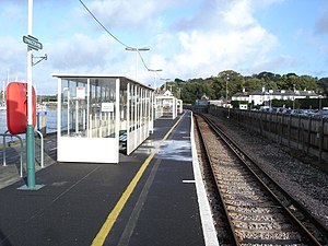
Lymington Pier railway station serves the harbour area of Lymington in Hampshire, England. It is 98 miles 15 chains (158.0 km) measured from London Waterloo and is the terminus of the Lymington Branch Line from Brockenhurst and provides a connection with ferry services to Yarmouth on the Isle of Wight. It has one platform.
Lymington Town F.C.
Association football club in England
Distance: Approx. 311 meters
Latitude and longitude: 50.75916667,-1.54805556
Lymington Town Football Club is a football club based in the coastal town of Lymington, Hampshire, England. Known as "The Linnets", they are currently members of the Wessex League Division One and play at the Sports Ground.

Lymington Hospital
Hospital in England
Distance: Approx. 625 meters
Latitude and longitude: 50.7609,-1.5516
Lymington Hospital was a consultant-led community hospital in Lymington, Hampshire. It was administered by New Forest Primary Care Trust before it was replaced by the Hampshire Primary Care Trust.

Walhampton
Hamlet in Hampshire, England
Distance: Approx. 1018 meters
Latitude and longitude: 50.7608,-1.5307
Walhampton is a hamlet in the New Forest National Park of Hampshire, England. It is in the civil parish of Boldre. It is approximately half a mile east of Lymington, on the east bank of the Lymington River.
Priestlands School
Academy in Lymington, Hampshire, England
Distance: Approx. 860 meters
Latitude and longitude: 50.753,-1.554
Priestlands School is a Mixed-sex education secondary school located in Pennington, Hampshire in southern England. The school serves an area that includes the villages of Beaulieu, Brockenhurst, East Boldre, Hordle, Norleywood, Pilley, South Baddesley, Sway and the towns of Lymington and Milford-on-Sea.

Church of St Thomas the Apostle, Lymington
Church in Lymington, United Kingdom
Distance: Approx. 63 meters
Latitude and longitude: 50.75755556,-1.54516667
The Church of St Thomas the Apostle in Lymington in Hampshire, is the main Anglican Church of England parish church for the town. There has been a church on the site for 800 years and the original foundations are believed to date to the reign of Henry III but was largely rebuilt in the 17th and 18th centuries.

St Barbe Museum & Art Gallery
Historical Museum in Hampshire, UK
Distance: Approx. 188 meters
Latitude and longitude: 50.7591,-1.5428
St Barbe Museum + Art Gallery is a local museum and art gallery in Lymington, Hampshire, England. Enclosed in the building is a small cafe called 'The Old School Cafe', a gift shop, multi-use room named 'The Mac Carthy Room', a museum showcasing artefacts and historical information about the Lymington and the New Forest, and a medium-sized gallery, used for art and historical exhibitions. St Barbe is situated within the New Forest, Lymington.
Lymington power station
Former coal-fired power station in Hampshire, England
Distance: Approx. 694 meters
Latitude and longitude: 50.7575,-1.53444444
Lymington power station supplied electricity to the town of Lymington, Hampshire and the surrounding area from 1899 to 1959. The electricity generating station was owned and operated by a succession of electricity companies prior to nationalisation of the British electricity supply industry in 1948. The station was initially coal-fired but later oil engines were installed.

Lymington Town Hall
Municipal building in Lymington, Hampshire, England
Distance: Approx. 345 meters
Latitude and longitude: 50.7605,-1.5464
Lymington Town Hall is a municipal building in Avenue Road in Lymington, a town in Hampshire, in England. The building currently accommodates the offices of Lymington and Pennington Town Council as well as the headquarters of the New Forest National Park.

Lymington Lifeboat Station
RNLI Lifeboat station in Hampshire, England
Distance: Approx. 1153 meters
Latitude and longitude: 50.75383333,-1.52911111
Lymington Lifeboat Station is located at the end of Bath Road, on the west bank of the Lymington River in Lymington, a port town on the Solent, in the New Forest district of Hampshire, England. An Inshore lifeboat was first stationed in Lymington by the Royal National Lifeboat Institution (RNLI) in May 1965. The station currently operates a B-class (Atlantic 85) Inshore lifeboat, David Bradley (B-882), on station since 2015.
Weather in this IP's area
overcast clouds
10 Celsius
7 Celsius
9 Celsius
10 Celsius
999 hPa
74 %
999 hPa
997 hPa
10000 meters
5.46 m/s
8.7 m/s
264 degree
100 %