149.248.73.54 - IP Lookup: Free IP Address Lookup, Postal Code Lookup, IP Location Lookup, IP ASN, Public IP
Country:
Region:
City:
Location:
Time Zone:
Postal Code:
IP information under different IP Channel
ip-api
Country
Region
City
ASN
Time Zone
ISP
Blacklist
Proxy
Latitude
Longitude
Postal
Route
Luminati
Country
Region
nc
City
charlotte
ASN
Time Zone
America/New_York
ISP
CYTRACOMLLC
Latitude
Longitude
Postal
IPinfo
Country
Region
City
ASN
Time Zone
ISP
Blacklist
Proxy
Latitude
Longitude
Postal
Route
IP2Location
149.248.73.54Country
Region
north carolina
City
charlotte
Time Zone
America/New_York
ISP
Language
User-Agent
Latitude
Longitude
Postal
db-ip
Country
Region
City
ASN
Time Zone
ISP
Blacklist
Proxy
Latitude
Longitude
Postal
Route
ipdata
Country
Region
City
ASN
Time Zone
ISP
Blacklist
Proxy
Latitude
Longitude
Postal
Route
Popular places and events near this IP address

American Legion Memorial Stadium
Stadium in Charlotte, North Carolina, USA
Distance: Approx. 412 meters
Latitude and longitude: 35.2182,-80.8283
American Legion Memorial Stadium is a 10,500-seat stadium located on 7th Street in the Elizabeth community of Charlotte, North Carolina. It is located on a complex with the Grady Cole Center. Both are located next to Central Piedmont Community College.
Grady Cole Center
Arena in North Carolina, United States
Distance: Approx. 412 meters
Latitude and longitude: 35.2182,-80.8283
Grady Cole Center is a small civic center located on the campus of Central Piedmont Community College in Charlotte, North Carolina. The 3,000 seat center is located near the city's center, and can host several types of events. It was built in 1954 to replace the Charlotte Armory Auditorium, which had been destroyed by fire.
Atrium Health Mercy
Hospital in North Carolina, United States
Distance: Approx. 831 meters
Latitude and longitude: 35.209986,-80.8208235
Atrium Health Mercy (formerly Mercy Hospital, later Carolinas Medical Center-Mercy) is a 185-bed adult health tertiary acute care facility located in the Elizabeth neighborhood of Charlotte, North Carolina. The hospital was established in 1906 by the Sisters of Mercy, and is the first Catholic hospital ever built in North Carolina. In 1995, the Sisters of Mercy sold the hospital to Carolinas Healthcare System, now Atrium Health.
King's College (Charlotte, North Carolina)
Distance: Approx. 553 meters
Latitude and longitude: 35.2133,-80.8222
King's College was a private for-profit college in Charlotte, North Carolina. It was founded in 1901 and over half of students came from the Charlotte area. There was also on-campus housing for students.

East Avenue Tabernacle Associate Reformed Presbyterian Church
Historic church in North Carolina, United States
Distance: Approx. 797 meters
Latitude and longitude: 35.21944444,-80.83444444
East Avenue Tabernacle Associate Reformed Presbyterian Church, also known as the Great Aunt Stella Center, is a historic Associate Reformed Presbyterian church located at 927 Elizabeth Street in Charlotte, Mecklenburg County, North Carolina. It was designed by architect James M. McMichael in a Classical Revival style. It consists of a two-story sanctuary, built in 1914, and a four-story educational wing added to the south side of the sanctuary in 1925.

Independence Park (Charlotte, North Carolina)
Park in Charlotte, North Carolina, United States
Distance: Approx. 530 meters
Latitude and longitude: 35.2155,-80.8224
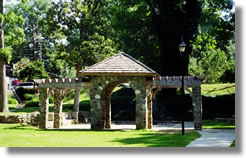
Independence Park is a 24-acre urban park at 300 Hawthorne Lane situated at the western end of the Elizabeth neighborhood in Charlotte, North Carolina. The park was created in 1924 at the urging of Charlotte industrialist Daniel Augustus Tompkins, founder of the Charlotte Observer, and is the oldest public park in Charlotte. It reopened in August 2023 after being closed for renovations that enhance accessibility and add permanent restrooms, among other improvements.

Midtown Park (Charlotte, North Carolina)
Distance: Approx. 852 meters
Latitude and longitude: 35.2108,-80.8363
Midtown Park is a one acre minipark at South Kings Drive and Pearl Park Way in Charlotte, North Carolina. Opened in the spring of 2012, it contains stonework and shade trees surrounding a rectangular lawn and is suitable for weddings as well as performance art and other public events. The park features several sculptures, including a seven foot diameter spherical metallic piece called the Braille Music Box by artists Po Shu Wang and Louise Bertelsen.

CPCC Central Campus station
Streetcar station in Charlotte, North Carolina.
Distance: Approx. 467 meters
Latitude and longitude: 35.2176665,-80.831473
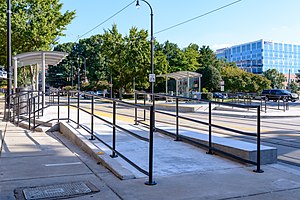
CPCC Central Campus is a streetcar station in Charlotte, North Carolina. The at-grade dual side platforms on Elizabeth Avenue are a stop along the CityLynx Gold Line and serves Central Piedmont Community College.

Elizabeth & Hawthorne station
Streetcar station in Charlotte, North Carolina.
Distance: Approx. 177 meters
Latitude and longitude: 35.2136281,-80.8264761
Elizabeth & Hawthorne is a streetcar station in Charlotte, North Carolina. The at-grade dual side platforms on Elizabeth Avenue are a stop along the CityLynx Gold Line and serves the Elizabeth neighborhood.

Hawthorne & 5th station
Streetcar station in Charlotte, North Carolina.
Distance: Approx. 335 meters
Latitude and longitude: 35.2137104,-80.8245482
Hawthorne & 5th is a streetcar station in Charlotte, North Carolina. The at-grade island platform on Hawthorne Lane is a stop along the CityLynx Gold Line and serves Novant Health Presbyterian Medical Center and the Elizabeth neighborhood.

Hawthorne & 8th station
Streetcar station in Charlotte
Distance: Approx. 653 meters
Latitude and longitude: 35.216409,-80.821311
Hawthorne & 8th is a streetcar station in Charlotte, North Carolina. The at-grade island platform on Hawthorne Lane is a stop along the CityLynx Gold Line, serving the Elizabeth neighborhood.

Cherry (Charlotte neighborhood)
Neighborhood in Mecklenburg County, North Carolina, United States
Distance: Approx. 594 meters
Latitude and longitude: 35.21154,-80.83354
Cherry is a historical African-American neighborhood in Charlotte, North Carolina. Adjacent to Uptown Charlotte, it is bounded within Little Sugar Creek, Kenilworth Avenue, John Belk Freeway, East 4th Street, Queens Road, and Henley Place.
Weather in this IP's area
broken clouds
6 Celsius
3 Celsius
6 Celsius
6 Celsius
1019 hPa
45 %
1019 hPa
992 hPa
10000 meters
5.93 m/s
13.84 m/s
297 degree
75 %
