149.248.73.131 - IP Lookup: Free IP Address Lookup, Postal Code Lookup, IP Location Lookup, IP ASN, Public IP
Country:
Region:
City:
Location:
Time Zone:
Postal Code:
ISP:
ASN:
language:
User-Agent:
Proxy IP:
Blacklist:
IP information under different IP Channel
ip-api
Country
Region
City
ASN
Time Zone
ISP
Blacklist
Proxy
Latitude
Longitude
Postal
Route
db-ip
Country
Region
City
ASN
Time Zone
ISP
Blacklist
Proxy
Latitude
Longitude
Postal
Route
IPinfo
Country
Region
City
ASN
Time Zone
ISP
Blacklist
Proxy
Latitude
Longitude
Postal
Route
IP2Location
149.248.73.131Country
Region
alabama
City
ozark
Time Zone
America/Chicago
ISP
Language
User-Agent
Latitude
Longitude
Postal
ipdata
Country
Region
City
ASN
Time Zone
ISP
Blacklist
Proxy
Latitude
Longitude
Postal
Route
Popular places and events near this IP address
Dale County, Alabama
County in Alabama, United States
Distance: Approx. 4486 meters
Latitude and longitude: 31.43333333,-85.6
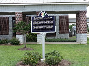
Dale County is a county located in the southeastern part of the U.S. state of Alabama. As of the 2020 census the population was 49,326. Its county seat and largest city is Ozark.

Ozark, Alabama
City in Alabama, United States
Distance: Approx. 866 meters
Latitude and longitude: 31.448169,-85.642009
Ozark is a city in and the county seat of Dale County, Alabama. As of the 2010 census, the population of the city was 14,907. Ozark is the principal city of the Ozark Micropolitan Statistical Area, as well as a part of the Dothan-Ozark Combined Statistical Area.
Ozark Civic Center
Distance: Approx. 1904 meters
Latitude and longitude: 31.45593,-85.63591
Ozark Civic Center is a 4,000-seat multipurpose arena located in Ozark, Alabama. It is primarily used for basketball, and was built in 1975. It is also used for conventions, concerts, trade shows and other events.
Carroll High School (Alabama)
Public school in Ozark, Alabama, United States
Distance: Approx. 2951 meters
Latitude and longitude: 31.46152,-85.62621
Carroll High School is located in Ozark, Alabama, United States. Ozark Schools is also one of three municipal school systems that take on-post Fort Novosel families at the secondary level.

Claybank Log Church
Historic church in Alabama, United States
Distance: Approx. 1553 meters
Latitude and longitude: 31.44666667,-85.66138889
Claybank Log Church is a historic church in Ozark, Alabama, United States. The building is the second church on the site, replacing a similar structure built in 1829. The current building was constructed by a Methodist minister, although the church was also used for various community functions.
J. D. Holman House
Historic house in Alabama, United States
Distance: Approx. 2225 meters
Latitude and longitude: 31.45972222,-85.63722222
The J. D. Holman House is a historic residence in Ozark, Alabama, United States. One of the most elaborate Neoclassical homes in the Wiregrass Region, it was built in 1912–13 for Jesse DeCosta Holman, a prominent local merchant. The house was listed on the National Register of Historic Places in 1982.
Dillard, Alabama
Unincorporated community in Alabama, United States
Distance: Approx. 9688 meters
Latitude and longitude: 31.51777778,-85.695
Dillard, also known as Dillards, is an unincorporated community in Dale County, Alabama, United States.
Ewell, Alabama
Unincorporated community in Alabama, United States
Distance: Approx. 7141 meters
Latitude and longitude: 31.42166667,-85.57472222
Ewell is an unincorporated community in Dale County, Alabama, United States. Ewell is located on Alabama State Route 27, 3.0 miles (4.8 km) southeast of Ozark.
Mabson, Alabama
Unincorporated community in Alabama, United States
Distance: Approx. 8458 meters
Latitude and longitude: 31.46833333,-85.56305556
Mabson is an unincorporated community in Dale County, Alabama, United States.
Confederate Monument (Ozark, Alabama)
Distance: Approx. 1984 meters
Latitude and longitude: 31.4584,-85.6404
The Confederate Monument, also known as the Dale County Confederate Soldiers Monument, is a Confederate memorial in Ozark, Alabama, in the United States. The monument was installed in 1910 by the Stonewall Jackson Chapter, United Daughters of the Confederacy No. 667 of Dale County, Alabama.
Murders of J.B. Beasley and Tracie Hawlett
1999 double murder in Alabama, US
Distance: Approx. 2154 meters
Latitude and longitude: 31.4525,-85.6278
The murders of J.B. Beasley and Tracie Hawlett were a double child murder that occurred in Ozark, Alabama, on August 1, 1999, in which two high school students named J.B Beasley and Tracie Hawlett—both 17—from Dothan, Alabama, disappeared after leaving their homes to celebrate Beasley's birthday on July 31, 1999. The next day, authorities found the girls' bodies in the trunk of Beasley's car in Ozark, Alabama. Beasley and Hawlett died from a gunshot to the head.
Weather in this IP's area
overcast clouds
17 Celsius
17 Celsius
16 Celsius
17 Celsius
1016 hPa
93 %
1016 hPa
1003 hPa
10000 meters
3.09 m/s
200 degree
100 %
