149.248.73.103 - IP Lookup: Free IP Address Lookup, Postal Code Lookup, IP Location Lookup, IP ASN, Public IP
Country:
Region:
City:
Location:
Time Zone:
Postal Code:
ISP:
ASN:
language:
User-Agent:
Proxy IP:
Blacklist:
IP information under different IP Channel
ip-api
Country
Region
City
ASN
Time Zone
ISP
Blacklist
Proxy
Latitude
Longitude
Postal
Route
db-ip
Country
Region
City
ASN
Time Zone
ISP
Blacklist
Proxy
Latitude
Longitude
Postal
Route
IPinfo
Country
Region
City
ASN
Time Zone
ISP
Blacklist
Proxy
Latitude
Longitude
Postal
Route
IP2Location
149.248.73.103Country
Region
florida
City
rockledge
Time Zone
America/New_York
ISP
Language
User-Agent
Latitude
Longitude
Postal
ipdata
Country
Region
City
ASN
Time Zone
ISP
Blacklist
Proxy
Latitude
Longitude
Postal
Route
Popular places and events near this IP address
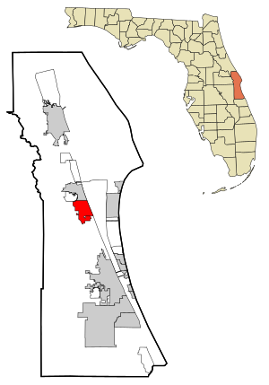
Brevard County, Florida
County in Florida, United States
Distance: Approx. 2795 meters
Latitude and longitude: 28.3,-80.7
Brevard County ( brə-VARD) is a county in the U.S. state of Florida. It is on the Atlantic coast of eastern Central Florida. As of the 2020 census, the population was 606,612, making it the 10th-most populated county in Florida.

Rockledge, Florida
City in Florida
Distance: Approx. 1529 meters
Latitude and longitude: 28.325,-80.73277778
Rockledge is the oldest city in Brevard County, Florida. The city's population was 27,678 at the 2020 Census, up from 24,926 at the 2010 United States Census, and is part of the Palm Bay−Melbourne−Titusville Metropolitan Statistical Area.

Barton Avenue Residential District
Historic district in Florida, United States
Distance: Approx. 2288 meters
Latitude and longitude: 28.33374444,-80.71873889
The Barton Avenue Residential District is a U.S. historic district (designated as such on August 21, 1992) located in Rockledge, Florida. The district runs from 11 through 59 Barton Avenue. It contains 41 historic buildings.

Rockledge Drive Residential District
Historic district in Florida, United States
Distance: Approx. 2049 meters
Latitude and longitude: 28.33055556,-80.7155
The Rockledge Drive Residential District is a U.S. historic district (designated as such on August 21, 1992) located in Rockledge, Florida. The district runs from 15 through 23 Rockledge Avenue, 219 through 1361 Rockledge Drive and 1 through 11 Orange Avenue. It contains 100 historic buildings, including the H. S. Williams House, also known as Lawndale.

Valencia Subdivision Residential District
Historic district in Florida, United States
Distance: Approx. 2556 meters
Latitude and longitude: 28.33660556,-80.72203611
The Valencia Subdivision Residential District is a historic district in Rockledge, Florida. It runs from 14 through 140 Valencia Road, 825 through 827 Osceola Drive and 24 through 28 Orange Avenue, encompasses approximately 100 acres (40 ha), and contains 54 historic buildings and 2 objects. On August 21, 1992, it was added to the U.S. National Register of Historic Places.

Marion S. Whaley Citrus Packing House
United States historic place
Distance: Approx. 1339 meters
Latitude and longitude: 28.31277778,-80.71027778
The Marion S. Whaley Citrus Packing House (also known as the Sullivan Brothers Victory Groves Citrus Packing House) was a historic site in Rockledge, Florida. It is located at 2275 U.S. 1. On April 8, 1993, it was added to the U.S. National Register of Historic Places.
Sawgrass Academy Middle
Defunct charter school in Florida, United States
Distance: Approx. 1918 meters
Latitude and longitude: 28.3033,-80.7395
Sawgrass Academy was a small charter school in Rockledge, Florida. The school served around 300 students. It shared two campuses, one for the 6th through 8th grade class located at Sawgrass, and the K through 5th grade located at the sister school, Osprey Elementary, at the same location.

H. S. Williams House
Building in Rockledge, Florida, United States
Distance: Approx. 2128 meters
Latitude and longitude: 28.331339,-80.71552
The H. S. Williams House, known as Lawndale, is a historic U.S. home that was located at 1219 Rockledge Drive, Rockledge, Florida. Hiram Smith Williams built the house in 1880 after moving to the area in 1874 from Alabama. A native of New Jersey, Williams had lived and traveled in the Midwest but settled in 1859 in Livingston, Alabama.
WLRQ-FM
Radio station in Cocoa, Florida
Distance: Approx. 4540 meters
Latitude and longitude: 28.27833333,-80.70083333
WLRQ-FM (99.3 MHz "Lite Rock 99.3") is a commercial radio station licensed to Cocoa, Florida, and serving the Space Coast including Melbourne and Brevard County. The station is owned by iHeartMedia, Inc.. It broadcasts an adult contemporary radio format, switching to Christmas music for much of November and December.

Rockledge High School
Public high school in Rockledge, Florida, USA
Distance: Approx. 3015 meters
Latitude and longitude: 28.34077778,-80.72436111
Rockledge High School is located in Rockledge, Florida, USA, and is part of the Brevard Public Schools District.

St. Mark's Episcopal Church (Cocoa, Florida)
Distance: Approx. 4431 meters
Latitude and longitude: 28.3535,-80.7248
St. Mark's Episcopal Church is a parish of the Episcopal Church in Cocoa, Brevard County, Florida, in the Episcopal Diocese of Central Florida. It is noted for its historic church building located at 4 Church Street, built circa 1886.

Cocoa Junior High School
United States historic place
Distance: Approx. 4719 meters
Latitude and longitude: 28.35405556,-80.73863889
Cocoa Junior High School is a historic school building in Cocoa, Florida (Brevard County). Built in 1923-24, it is one of the oldest remaining Rosenwald Schools in Florida. After the school closed in 1954, the building served as a community center and later as an African-American history museum.
Weather in this IP's area
overcast clouds
22 Celsius
22 Celsius
22 Celsius
22 Celsius
1015 hPa
65 %
1015 hPa
1014 hPa
10000 meters
2.86 m/s
5.56 m/s
265 degree
100 %
