Country:
Region:
City:
Latitude and Longitude:
Time Zone:
Postal Code:
IP information under different IP Channel
ip-api
Country
Region
City
ASN
Time Zone
ISP
Blacklist
Proxy
Latitude
Longitude
Postal
Route
Luminati
Country
ASN
Time Zone
Europe/Berlin
ISP
Deutsche Telekom AG
Latitude
Longitude
Postal
IPinfo
Country
Region
City
ASN
Time Zone
ISP
Blacklist
Proxy
Latitude
Longitude
Postal
Route
db-ip
Country
Region
City
ASN
Time Zone
ISP
Blacklist
Proxy
Latitude
Longitude
Postal
Route
ipdata
Country
Region
City
ASN
Time Zone
ISP
Blacklist
Proxy
Latitude
Longitude
Postal
Route
Popular places and events near this IP address
Monheim am Rhein
Town in North Rhine-Westphalia, Germany
Distance: Approx. 1108 meters
Latitude and longitude: 51.1,6.9
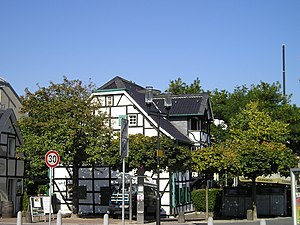
Monheim am Rhein (Limburgish: Monnem) is a town on the right (eastern) bank of the river Rhine in North Rhine-Westphalia, Germany. Monheim belongs to the district of Mettmann – with the southern suburbs of Düsseldorf to the north, and the Bergisches Land to the south. It consists of the city districts (from north to south) Baumberg (about one third) and Monheim (two thirds).
Langenfeld, Rhineland
Town in North Rhine-Westphalia, Germany
Distance: Approx. 3645 meters
Latitude and longitude: 51.11666667,6.95
Langenfeld (Ripuarian: Langefääl) is a town in North Rhine-Westphalia (Germany) in the district of Mettmann. The suburban city is located between Düsseldorf and Cologne. Langenfeld was formed from the two localities of Richrath and Reusrath and received city rights in 1948.
Baumberg
Distance: Approx. 3023 meters
Latitude and longitude: 51.1175,6.89111111
Baumberg (also Monheim-Baumberg) is part of the city of Monheim am Rhein in the district of Mettmann in North Rhine-Westphalia (Germany) at the southern border of Düsseldorf, placed on the eastern bank of the river Rhine. Baumberg consists of an area of about 6 km2, with about 14,000 residents in 2023 (one third of the 43,000 in Monheim am Rhein).

Hellerhof
City district of Düsseldorf, Germany
Distance: Approx. 4287 meters
Latitude and longitude: 51.13222222,6.90638889
Hellerhof is a quarter of the city of Düsseldorf, part of Borough 10. Düsseldorf-Hellerhof is in the far southeast part of Düsseldorf. It connects Düsseldorf with the towns of Langenfeld and Monheim am Rhein.

Düsseldorf-Hellerhof station
Railway station in Germany
Distance: Approx. 4399 meters
Latitude and longitude: 51.13333333,6.90833333
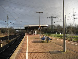
Düsseldorf-Hellerhof is a railway station situated at Hellerhof, Düsseldorf in western Germany. It is classified by Deutsche Bahn as a category 5 station. It is served by the S6 line of the Rhine-Ruhr S-Bahn at 20-minute intervals.

Langenfeld (Rheinland) station
Railway station in Langenfeld (Rheinland), Germany
Distance: Approx. 2044 meters
Latitude and longitude: 51.10273,6.93815
Langenfeld (Rheinland) station is located in the city of Langenfeld in the German state of North Rhine-Westphalia. It is on the Cologne–Duisburg line and is classified by Deutsche Bahn as a category 5 station. It is served by Rhine-Ruhr S-Bahn lines S 6 every 20 minutes and by a few services of S 68 (which start or finish in Langenfeld) in the peak hour.

Langenfeld-Berghausen station
Railway station in Langenfeld, Germany
Distance: Approx. 2722 meters
Latitude and longitude: 51.11724,6.924127
Langenfeld-Berghausen station is located in the city of Langenfeld in the German state of North Rhine-Westphalia. It is on the Cologne–Duisburg line and is classified by Deutsche Bahn as a category 5 station. It is served by Rhine-Ruhr S-Bahn lines S 6 every 20 minutes and by a few services of S 68 in the peak hour.

Leverkusen-Rheindorf station
Railway station in Leverkusen, Germany
Distance: Approx. 4855 meters
Latitude and longitude: 51.064216,6.96338
Leverkusen-Rheindorf station is located in the district of Rheindorf in the city of Leverkusen in the German state of North Rhine-Westphalia. It is on the Cologne–Duisburg line and is classified by Deutsche Bahn as a category 5 station. It is served by Rhine-Ruhr S-Bahn line S 6 every 20 minutes.

Dormagen Chempark station
Railway station in Germany
Distance: Approx. 5543 meters
Latitude and longitude: 51.077155,6.837869
Dormagen Chempark station is a station in the town of Dormagen in the German state of North Rhine-Westphalia. Chemiepark Dormagen is the location of a large Bayer works. The station is on the Lower Left Rhine Railway and it is classified by Deutsche Bahn as a category 6 station.

Galkhauser Bach
River in Germany
Distance: Approx. 4883 meters
Latitude and longitude: 51.1376,6.9064
Galkhauser Bach is a river of North Rhine-Westphalia, Germany.

Worringen
Stadtteil of Cologne in North Rhine-Westphalia, Germany
Distance: Approx. 4583 meters
Latitude and longitude: 51.06555556,6.865
Worringen is a Stadtteil (quarter) of the city of Cologne, Germany. Situated 15 km north of the city centre, on the left bank of the Rhine, it is part of the district of Chorweiler. In 1288, it was the site of the Battle of Worringen.

Friedenskirche (Monheim-Baumberg)
Protestant church
Distance: Approx. 2973 meters
Latitude and longitude: 51.118,6.8942
The Friedenskirche (Peace Church) is a Protestant church in Monheim-Baumberg, Schellingstraße 13, built from 1968 to 1974 according to the plans of Walter Maria Foerderer in the Brutalist style.
Weather in this IP's area
moderate rain
6 Celsius
3 Celsius
5 Celsius
7 Celsius
1011 hPa
91 %
1011 hPa
1006 hPa
10000 meters
3.65 m/s
10.71 m/s
226 degree
53 %
07:52:52
16:42:09

