Country:
Region:
City:
Latitude and Longitude:
Time Zone:
Postal Code:
IP information under different IP Channel
ip-api
Country
Region
City
ASN
Time Zone
ISP
Blacklist
Proxy
Latitude
Longitude
Postal
Route
Luminati
Country
ASN
Time Zone
Europe/Berlin
ISP
Bayer AG
Latitude
Longitude
Postal
IPinfo
Country
Region
City
ASN
Time Zone
ISP
Blacklist
Proxy
Latitude
Longitude
Postal
Route
db-ip
Country
Region
City
ASN
Time Zone
ISP
Blacklist
Proxy
Latitude
Longitude
Postal
Route
ipdata
Country
Region
City
ASN
Time Zone
ISP
Blacklist
Proxy
Latitude
Longitude
Postal
Route
Popular places and events near this IP address

Schering AG
Distance: Approx. 152 meters
Latitude and longitude: 52.53916667,13.36722222
Schering AG was a research-centered German multinational pharmaceutical company headquartered in Wedding, Berlin, which operated as an independent company from 1851 to 2006. In 2006, it was bought by Bayer AG and merged to form the Bayer subsidiary Bayer Schering Pharma AG, which was renamed Bayer HealthCare Pharmaceuticals in 2011. Schering was listed on the Frankfurt Stock Exchange and had 26,000 employees as of 2004.

Stadion der Weltjugend
Multi-use stadium in Berlin
Distance: Approx. 956 meters
Latitude and longitude: 52.53307222,13.37658333
Stadion der Weltjugend was a multi-use stadium in the locality of Mitte in the eponymous borough of Mitte in Berlin, Germany. It was inaugurated on 20 May 1950 by the First Secretary of the Socialist Unity Party, Walter Ulbricht for the first "Deutschlandtreffen ("German Festival") of the Free German Youth. The stadium was named after Walter Ulbricht.

Invalids' Cemetery
Cemetery in Berlin, Germany
Distance: Approx. 933 meters
Latitude and longitude: 52.53194444,13.37111111
The Invalids' Cemetery (German: Invalidenfriedhof) is one of the oldest cemeteries in Berlin. It was the traditional resting place of the Prussian Army, and is regarded as particularly important as a memorial to the German Wars of Liberation of 1813–15.

Berlin-Wedding station
Railway station in Berlin, Germany
Distance: Approx. 310 meters
Latitude and longitude: 52.5425,13.36611111
Berlin-Wedding is a station in the Wedding locality of Berlin and serves the S-Bahn lines S41 and S42 and the U-Bahn line U6.

Reinickendorfer Straße (Berlin U-Bahn)
Station of the Berlin U-Bahn
Distance: Approx. 109 meters
Latitude and longitude: 52.54,13.37027778
Reinickendorfer Straße is a Berlin U-Bahn station located on the U6.

Schwartzkopffstraße (Berlin U-Bahn)
Station of the Berlin U-Bahn
Distance: Approx. 796 meters
Latitude and longitude: 52.53527778,13.37722222
Schwartzkopffstraße is a Berlin U-Bahn station located on the U6 line.

Berlin Humboldthain station
Railway station in Mitte, Germany
Distance: Approx. 903 meters
Latitude and longitude: 52.545,13.37944444
Berlin Humboldthain station (German: Bahnhof Berlin Humboldthain) is a railway station in the city of Berlin, Germany. It is served by the Berlin S-Bahn lines S1,S2,S25 and S26. It is also served by local bus route 247.

Panke
River in Germany
Distance: Approx. 371 meters
Latitude and longitude: 52.53694444,13.3675
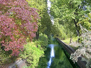
The Panke is a small river in Brandenburg and Berlin, a right tributary of the Spree, originating from the Barnim plateau. It has a length of 29 km, of which 20,2 are within the area of Berlin. Consequently, the Panke is the third longest river in the city after the Spree and the Havel.

Berlin–Spandau Ship Canal
Distance: Approx. 525 meters
Latitude and longitude: 52.5366,13.3637
The Berlin–Spandau Ship Canal, or Berlin-Spandauer Schifffahrtskanal in German, is a canal in Berlin, Germany. It was built between 1848 and 1859 to a plan created by Peter Joseph Lenné, and was formerly known as the Hohenzollern Canal or Hohenzollernkanal. The 12.2-kilometre (7.6 mi) long canal links the River Havel north of Spandau to the River Spree near the Hauptbahnhof in Berlin.

Prime Time Theater
Theater in Berlin
Distance: Approx. 447 meters
Latitude and longitude: 52.54316,13.36424
The Prime Time Theater is a modern Volkstheater ("People's Theater") in Berlin’s Wedding district. The name of the theater derives from the fact that the time the play starts marks the beginning of prime time.

Headquarters of the Federal Intelligence Service
Government facility housing Germany's intelligence agency (BND) in central Berlin
Distance: Approx. 886 meters
Latitude and longitude: 52.533889,13.376667
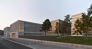
The Headquarters of the Federal Intelligence Service or the BND Headquarters (German: Zentrale des Bundesnachrichtendienstes, colloquially the BND-Zentrale) is the headquarters of the Federal Intelligence Service (BND) of Germany, and is located at the Chausseestraße in the Mitte district in the centre of Berlin. The building that houses its headquarters is the world's largest intelligence building, somewhat larger than the CIA headquarters at Langley.

St. Joseph, Wedding
Church in Berlin-Wedding, Germany
Distance: Approx. 574 meters
Latitude and longitude: 52.54388889,13.36277778
St. Joseph is a Catholic church and former parish in Berlin-Wedding, Germany, built from 1907 to 1909 to a design by Wilhelm Rincklake, revised by Wilhelm Frydag in Romanesque revival style. It seats 3000 people.
Weather in this IP's area
clear sky
6 Celsius
2 Celsius
5 Celsius
7 Celsius
1031 hPa
87 %
1031 hPa
1026 hPa
10000 meters
6.26 m/s
9.39 m/s
106 degree
9 %
07:16:15
16:24:23