149.233.3.33 - IP Lookup: Free IP Address Lookup, Postal Code Lookup, IP Location Lookup, IP ASN, Public IP
Country:
Region:
City:
Location:
Time Zone:
Postal Code:
ISP:
ASN:
language:
User-Agent:
Proxy IP:
Blacklist:
IP information under different IP Channel
ip-api
Country
Region
City
ASN
Time Zone
ISP
Blacklist
Proxy
Latitude
Longitude
Postal
Route
db-ip
Country
Region
City
ASN
Time Zone
ISP
Blacklist
Proxy
Latitude
Longitude
Postal
Route
IPinfo
Country
Region
City
ASN
Time Zone
ISP
Blacklist
Proxy
Latitude
Longitude
Postal
Route
IP2Location
149.233.3.33Country
Region
sachsen
City
gorlitz
Time Zone
Europe/Berlin
ISP
Language
User-Agent
Latitude
Longitude
Postal
ipdata
Country
Region
City
ASN
Time Zone
ISP
Blacklist
Proxy
Latitude
Longitude
Postal
Route
Popular places and events near this IP address

Görlitz
Town in Saxony, Germany
Distance: Approx. 284 meters
Latitude and longitude: 51.15277778,14.98722222
Görlitz ([ˈɡœʁlɪts] ; Upper Sorbian: Zhorjelc [ˈzhɔʁʲɛlts]; Polish: Zgorzelec; Czech: Zhořelec; East Lusatian: Gerlz, Gerltz, Gerltsch) is a town in the German state of Saxony. It is on the river Lusatian Neisse and is the largest town in Upper Lusatia as well as the second-largest town in the region of Lusatia after Cottbus. Görlitz is the easternmost town in Germany (the easternmost village being Zentendorf (Šćeńc)) and lies opposite the Polish town of Zgorzelec, which was the eastern part of Görlitz until 1945.

Zgorzelec
Place in Lower Silesian Voivodeship, Poland
Distance: Approx. 1501 meters
Latitude and longitude: 51.15,15.00833333
Zgorzelec ([zɡɔˈʐɛlɛt͡s] , German: Görlitz, Upper Sorbian: Zhorjelc [ˈzhɔʁʲɛlts], Lower Sorbian: Zgórjelc, Czech: Zhořelec) is a town in southwestern Poland with 30,374 inhabitants (2019). It lies in Lower Silesian Voivodeship. It is the seat of Zgorzelec County and of Gmina Zgorzelec (although it is not part of the territory of the latter, as the town is an urban gmina in its own right).

Battle of Moys
1757 battle
Distance: Approx. 466 meters
Latitude and longitude: 51.152324,14.993349
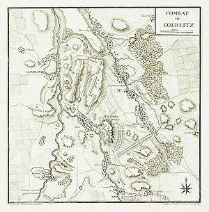
The Battle of Moys was fought on 7 September 1757 during the Third Silesian War (part of the Seven Years' War). A Prussian army of 13,000 men fought an Austrian army of double their size. The Prussians were defeated and their commander killed.

Senckenberg Museum for Natural History Görlitz
Natural history museum in Görlitz, Germany
Distance: Approx. 284 meters
Latitude and longitude: 51.15277778,14.98722222
The Senckenberg Museum for Natural History Görlitz or Senckenberg Museum für Naturkunde Görlitz (until 31 December 2008 State Museum of Natural History, German: Staatliches Museum für Naturkunde) in Görlitz, Germany is a natural history museum with focus on zoology, botany and geology. Since 2009, the museum has been part of the Senckenberg Gesellschaft für Naturforschung with headquarters in Frankfurt/Main. The main field of research is soil biology.

Roman Catholic Diocese of Görlitz
Catholic diocese in Germany
Distance: Approx. 1312 meters
Latitude and longitude: 51.145,14.9791
The Diocese of Görlitz (Latin: Dioecesis Gorlicensis) is a Latin Church diocese of the Catholic church in Germany.

Görlitz station
Railway station in Saxony, Germany
Distance: Approx. 1102 meters
Latitude and longitude: 51.14722222,14.97916667
Görlitz station is the central station of the city of Görlitz in the German state of Saxony. Of the original twelve station tracks only six are still in operation. Görlitz is also served by stations in Rauschwalde, Weinhübel and Hagenwerder.

St. Jakobus, Görlitz
Church in Görlitz, Germany
Distance: Approx. 1308 meters
Latitude and longitude: 51.1449,14.9795
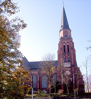
The cathedral of St. Jakobus (St. James) in Görlitz, Germany, is the cathedral of the Roman Catholic Diocese of Görlitz, dedicated to St.
Trams in Görlitz
Tram system in Görlitz, Saxony, Germany
Distance: Approx. 271 meters
Latitude and longitude: 51.15305556,14.98666667
The Görlitz tramway network (German: Straßenbahnnetz Görlitz) is a network of tramways forming part of the public transport system in Görlitz, a city in the federal state of Saxony, Germany. Opened in 1882, the network has been operated since 1996 by the Verkehrsgesellschaft Görlitz (VGG), since 2019 by the Görlitzer Verkehrsbetriebe, and is integrated in the Verkehrsverbund Oberlausitz-Niederschlesien (ZVON).

Görlitz Department Store
German retail store
Distance: Approx. 274 meters
Latitude and longitude: 51.1528,14.9876
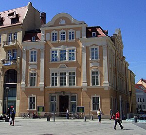
The Görlitz Department Store in Görlitz in the German state of Saxony is one of the best preserved department stores from the beginning of the 20th century. It is built in the Art Nouveau style and was operated as a department store until 15 August 2009. The city and a citizens' action group tried to revitalize the department store, which in 2012 housed only a beauty shop.

Görlitz Synagogue
Synagogue in Görlitz
Distance: Approx. 325 meters
Latitude and longitude: 51.15277778,14.99111111
The Görlitz Synagogue (German: Kulturforum Görlitzer Synagoge) is a Jewish congregation and synagogue, located on Otto-Müller-Straße, in Görlitz, Germany. Built between 1909 and 1911 in the Art Nouveau style, the synagogue was the main place of worship for the city's Ashkenazi Jewish community. Despite an arson attack, the synagogue was one of the few synagogues in the area to survive Kristallnacht, sustaining only minor damage.
Lower Market Square (Görlitz)
Square in Görlitz, Germany
Distance: Approx. 222 meters
Latitude and longitude: 51.15643424,14.99099621
The Lower Market Square is the central square in the historic town of Görlitz. The city's town hall and thus most of the administration have been located on this square since 1350. Many of the city's Renaissance-styled buildings were built here.
Upper Market Square (Görlitz)
Square in Görlitz, Germany
Distance: Approx. 88 meters
Latitude and longitude: 51.15525213,14.9872422
The Upper Market Square in Görlitz is the largest square in the historic part of the town. It was laid out in 1250 together with the Lower Market Square. Both are connected via the Bretheren Street (Brüderstraße).
Weather in this IP's area
scattered clouds
-1 Celsius
-4 Celsius
-1 Celsius
-1 Celsius
1035 hPa
86 %
1035 hPa
1006 hPa
10000 meters
2.63 m/s
4.12 m/s
207 degree
43 %


