149.23.61.116 - IP Lookup: Free IP Address Lookup, Postal Code Lookup, IP Location Lookup, IP ASN, Public IP
Country:
Region:
City:
Location:
Time Zone:
Postal Code:
ISP:
ASN:
language:
User-Agent:
Proxy IP:
Blacklist:
IP information under different IP Channel
ip-api
Country
Region
City
ASN
Time Zone
ISP
Blacklist
Proxy
Latitude
Longitude
Postal
Route
db-ip
Country
Region
City
ASN
Time Zone
ISP
Blacklist
Proxy
Latitude
Longitude
Postal
Route
IPinfo
Country
Region
City
ASN
Time Zone
ISP
Blacklist
Proxy
Latitude
Longitude
Postal
Route
IP2Location
149.23.61.116Country
Region
new york
City
holtsville
Time Zone
America/New_York
ISP
Language
User-Agent
Latitude
Longitude
Postal
ipdata
Country
Region
City
ASN
Time Zone
ISP
Blacklist
Proxy
Latitude
Longitude
Postal
Route
Popular places and events near this IP address

Farmingville, New York
Place in New York, United States
Distance: Approx. 3019 meters
Latitude and longitude: 40.8425,-73.04361111
Farmingville is a hamlet and census-designated place (CDP) in the town of Brookhaven, in Suffolk County, New York, United States. The population was 14,983 at the time of the 2020 census. The community serves as the town seat of Brookhaven.

Holbrook, New York
Hamlet and census-designated place in New York, United States
Distance: Approx. 3103 meters
Latitude and longitude: 40.79972222,-73.07555556
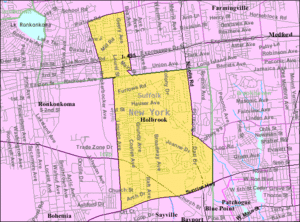
Holbrook is a hamlet and census-designated place (CDP) in Suffolk County, New York, United States. The population was 27,195 at the 2010 census. The community borders the eastern side of Long Island MacArthur Airport.

Holtsville, New York
Hamlet and census-designated place in New York, United States
Distance: Approx. 291 meters
Latitude and longitude: 40.81333333,-73.04722222
Holtsville is a hamlet and census-designated place (CDP) in Suffolk County, on Long Island, in New York, United States. The population was 19,714 at the 2010 census. The hamlet is mainly in the Town of Brookhaven, while the southwestern portion is in the Town of Islip.

WUSB (FM)
Radio station in New York, United States
Distance: Approx. 3020 meters
Latitude and longitude: 40.84222222,-73.03972222
WUSB (90.1 FM) is a non-commercial radio station licensed by the Federal Communications Commission (FCC) to Stony Brook, New York. The station is owned by the State University of New York, with studios located on the second floor of Stony Brook University's West Side Dining facility, and its transmitter is located in Farmingville, New York. WUSB is a free-form radio station, staffed by more than 150 volunteers who devote their time and energy for the love of music and free-form radio.
WBLI
Radio station in New York, United States
Distance: Approx. 3013 meters
Latitude and longitude: 40.84222222,-73.04027778
WBLI (106.1 FM) is a commercial radio station owned by Cox Radio and licensed to Patchogue, New York. It airs a top 40 (CHR) radio format. The station mainly serves Suffolk County, New York on Long Island.
WALK-FM
Hot adult contemporary radio station in Patchogue, New York
Distance: Approx. 3425 meters
Latitude and longitude: 40.84480556,-73.03313889
WALK-FM (97.5 FM) is a hot adult contemporary radio station licensed to Patchogue, New York, and serving Long Island. The station is owned by Connoisseur Media, with studios and offices located at Airport Plaza in Farmingdale, New York, and its transmitter located on Telescope Hill in Farmingville, New York.

Harold H. Malkmes Wildlife Education and Ecology Center
Park and zoo in Holtsville, New York, US
Distance: Approx. 1970 meters
Latitude and longitude: 40.79944444,-73.035
The Harold H. Malkmes Wildlife Education and Ecology Center is a park, zoo, and ecology site in Holtsville, New York, United States, operated by the Town of Brookhaven, and located on the site of a former landfill. The official address is 249 Buckley Road, although some of the land owned by the site extends along Blue Point Road and as far south as Woodside Avenue. The ecology center was named for former Town of Brookhaven Superintendent of Highways Harold H. Malkmes.
Holtsville station
Distance: Approx. 227 meters
Latitude and longitude: 40.81344444,-73.04433333
Holtsville was a station stop on the Greenport Branch of the Long Island Rail Road. It was located off the southeast corner of the Waverly Avenue grade crossing on the south side of the tracks between Long Island Avenue and Furrows Road in Holtsville, New York.
Holbrook station
Distance: Approx. 3105 meters
Latitude and longitude: 40.810272,-73.08133
Holbrook was a station stop along the Greenport Branch of the Long Island Rail Road. The most recent version was located along Coates Avenue and Railroad Avenue in Holbrook, New York.

Telescope Hill
Distance: Approx. 3418 meters
Latitude and longitude: 40.84472183,-73.033056
Telescope Hill, at 334 feet (102 m), is the highest point of elevation in the Town of Brookhaven, on Long Island, New York, United States. The hill is located at the end of Tower Hill Ave., on the border of the ZIP codes of the hamlets of Selden and Farmingville, and west of Bald Hill. Notably, Telescope Hill was the site of a fire observation station operated by the New York State Conservation Commission and later the Conservation Department from 1918 to 1959.
Bald Hill Schoolhouse
United States historic place
Distance: Approx. 2191 meters
Latitude and longitude: 40.835,-73.04277778
Bald Hill Schoolhouse is a historic one-room school building located at Farmingville in Suffolk County, New York. It was built in 1850 and is a small, one story, vernacular rural schoolhouse with Greek Revival style detailing. It measures approximately 18 feet by 28 feet.
Richard M. Flynn Power Plant
Distance: Approx. 1729 meters
Latitude and longitude: 40.81667778,-73.06555556
The Richard M. Flynn Power Plant is a power plant in Holtsville, in Suffolk County, on Long Island, in New York, United States. It is operated by the New York Power Authority (NYPA).
Weather in this IP's area
snow
2 Celsius
-2 Celsius
2 Celsius
2 Celsius
1003 hPa
98 %
1003 hPa
1001 hPa
4.06 m/s
6.7 m/s
34 degree
100 %


