149.23.4.155 - IP Lookup: Free IP Address Lookup, Postal Code Lookup, IP Location Lookup, IP ASN, Public IP
Country:
Region:
City:
Location:
Time Zone:
Postal Code:
IP information under different IP Channel
ip-api
Country
Region
City
ASN
Time Zone
ISP
Blacklist
Proxy
Latitude
Longitude
Postal
Route
Luminati
Country
Region
ny
City
smithtown
ASN
Time Zone
America/New_York
ISP
ZEBRA-TECHNOLOGIES-BGP-AS-NUMBER
Latitude
Longitude
Postal
IPinfo
Country
Region
City
ASN
Time Zone
ISP
Blacklist
Proxy
Latitude
Longitude
Postal
Route
IP2Location
149.23.4.155Country
Region
fryslan
City
heerenveen
Time Zone
Europe/Amsterdam
ISP
Language
User-Agent
Latitude
Longitude
Postal
db-ip
Country
Region
City
ASN
Time Zone
ISP
Blacklist
Proxy
Latitude
Longitude
Postal
Route
ipdata
Country
Region
City
ASN
Time Zone
ISP
Blacklist
Proxy
Latitude
Longitude
Postal
Route
Popular places and events near this IP address
Heerenveen
Town and municipality in Friesland, Netherlands
Distance: Approx. 829 meters
Latitude and longitude: 52.96666667,5.91666667
Heerenveen (Dutch pronunciation: [ˌɦeːrə(ɱ)ˈveːn] , West Frisian: It Hearrenfean [ət ˌjɛrn̩ˈfɪən] ) is a town and municipality in the province of Friesland (Fryslân), in the Northern Netherlands. In 2021, the town had a population of 29,790 (1 January) while the municipality had a population 50,859 (1 July).

Thialf
Ice rink in Heerenveen, the Netherlands
Distance: Approx. 2792 meters
Latitude and longitude: 52.9386,5.94201
Thialf (Dutch pronunciation: [ˈtijɑlf]) is an ice arena in Heerenveen, Netherlands. Thialf is used for long track speed skating, short track speed skating, ice hockey, figure skating, ice speedway, and non-sporting events. The outdoor rink was opened in 1967, and the indoor stadium was opened in 1986.
Abe Lenstra Stadion
Football stadium in Heerenveen, Netherlands
Distance: Approx. 1183 meters
Latitude and longitude: 52.95861111,5.93611111
Abe Lenstra Stadion (Dutch pronunciation: [ˌaːbə ˈlɛnstraː ˌstaːdijɔn]) is a football stadium, located in Heerenveen, Netherlands. It is currently used mostly as a home ground for Eredivisie club Heerenveen. The current capacity is 27,224.

Oranjewoud
Village in Friesland, Netherlands
Distance: Approx. 2652 meters
Latitude and longitude: 52.94583333,5.95111111
Oranjewoud (West Frisian: Oranjewâld, literally "Orange Forest") is a small village in the Netherlands. It is located in the municipality of Heerenveen, Friesland. Oranjewoud had a population of 1570 in January 2017.
Nieuweschoot
Village in Friesland, Netherlands
Distance: Approx. 2923 meters
Latitude and longitude: 52.93333333,5.925
Nieuweschoot (West Frisian: Nijskoat) is a village in Heerenveen in the province of Friesland, the Netherlands. It had a population of around 185 in January 2017.
Nijehaske
Neighbourhood and village in Friesland, Netherlands
Distance: Approx. 1700 meters
Latitude and longitude: 52.96111111,5.89333333
Nijehaske is a village in De Fryske Marren municipality, west of Heerenveen in the province of Friesland, the Netherlands. It had a population of around 55 in 2017. In 1934, most of Nijehaske was transferred to Heerenveen and has become a neighbourhood.

Oudehaske
Village in Friesland, Netherlands
Distance: Approx. 3127 meters
Latitude and longitude: 52.95583333,5.87222222
Oudehaske (West Frisian: Aldehaske) is a village in De Fryske Marren in the province of Friesland, the Netherlands. It had a population of around 1980 in 2017.
Heerenveen railway station
Railway station in the Netherlands
Distance: Approx. 257 meters
Latitude and longitude: 52.96055556,5.91527778
Heerenveen is the main railway station in Heerenveen, Netherlands. The station opened on 15 January 1868 and is on the Arnhem–Leeuwarden railway. The services are operated by Nederlandse Spoorwegen.
Welgelegen, Heerenveen
Dutch windmill built in 1849
Distance: Approx. 480 meters
Latitude and longitude: 52.96361111,5.91861111
Welgelegen (Dutch: [ˈʋɛlɣəˌleːɣə(n)]; "Well-situated") or Tjepkema's Molen (Dutch: [ˈtɕɛpkəmaːs ˈmoːlə(n)]; West Frisian: Tjepkema's Mole [ˈtjɛpkəmaːs ˈmoːlə]; "Tjepka's Mill") is a smock mill in Heerenveen, Friesland, Netherlands, which was built in 1849 and has been restored to working order. The mill is listed as a Rijksmonument, No. 21171.
SC Heerenveen (women)
Dutch women's football (soccer) club
Distance: Approx. 1694 meters
Latitude and longitude: 52.95616667,5.94322222
SC Heerenveen Vrouwen is a Dutch women's football (soccer) club based in Heerenveen that competes in the Vrouwen Eredivisie, the top women's league in the Netherlands. Several of the top Dutch women footballers, including Lieke Martens, Vivianne Miedema, and Sherida Spitse, have played for the club. The club peaked in the league table with a third place finish in the 2017–18 season.
Heerenveen IJsstadion railway station
Distance: Approx. 3180 meters
Latitude and longitude: 52.93527778,5.94416667
Heerenveen IJsstadion (English: Heerenveen Ice Stadium) is a small railway station located in Heerenveen, Netherlands. The station, located about 3.5 kilometer from Heerenveen railway station, was operated by Nederlandse Spoorwegen and was only serviced in the event of sporting events at Thialf, the ice arena in Heerenveen. Since 2015 there are no more trains serviced to this station due to the high costs.

Crackstate
Stins in Heerenveen, Netherlands
Distance: Approx. 307 meters
Latitude and longitude: 52.96111111,5.92194444
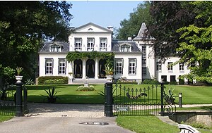
The Crackstate is a monumental stins in the Dutch town of Heerenveen, Friesland. It was built in 1648 by order of Johannes Sytzes Crack, the namesake of the estate. It is currently property of the municipality of Heerenveen and functions as wedding chapel.
Weather in this IP's area
light rain
8 Celsius
3 Celsius
7 Celsius
8 Celsius
1005 hPa
66 %
1005 hPa
1005 hPa
10000 meters
9.99 m/s
18.04 m/s
228 degree
100 %


