Country:
Region:
City:
Latitude and Longitude:
Time Zone:
Postal Code:
IP information under different IP Channel
ip-api
Country
Region
City
ASN
Time Zone
ISP
Blacklist
Proxy
Latitude
Longitude
Postal
Route
Luminati
Country
Region
cm
City
villacanas
ASN
Time Zone
Europe/Madrid
ISP
Gestioniza Infraestructuras S.L.
Latitude
Longitude
Postal
IPinfo
Country
Region
City
ASN
Time Zone
ISP
Blacklist
Proxy
Latitude
Longitude
Postal
Route
db-ip
Country
Region
City
ASN
Time Zone
ISP
Blacklist
Proxy
Latitude
Longitude
Postal
Route
ipdata
Country
Region
City
ASN
Time Zone
ISP
Blacklist
Proxy
Latitude
Longitude
Postal
Route
Popular places and events near this IP address
San Juan del Rebollar
Distance: Approx. 6924 meters
Latitude and longitude: 41.75,-6.35
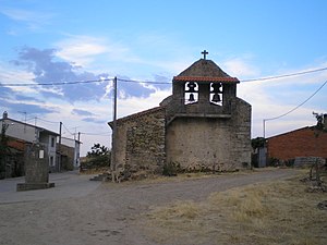
San Juan del Rebollar is a small town of the province of Zamora, in north-western Spain. It is around 60 km (37 mi) from the city of Zamora. It is a typical countryside Spanish village, consisting basically of a number of houses around a central square.

Rábano de Aliste
Place in Castile and León, Spain
Distance: Approx. 635 meters
Latitude and longitude: 41.75,-6.43333333
Rábano de Aliste is a municipality located in the province of Zamora, Castile and León, Spain. According to the 2004 census (INE), the municipality has a population of 450 inhabitants.
San Vitero
Place in Castile and León, Spain
Distance: Approx. 8149 meters
Latitude and longitude: 41.78333333,-6.35
San Vitero is a municipality located in the province of Zamora, Castile and León, Spain. According to the 2004 census (INE), the municipality has a population of 677 inhabitants.

Trabazos
Municipality in Castile and León, Spain
Distance: Approx. 4741 meters
Latitude and longitude: 41.7469,-6.49
The municipality of Trabazos (1,023 inhabitants in 2009; 9,345 ha) is located in the west of the Zamora Province, on the border with Portugal, 75 km from the provincial capital. The municipality is made of the five villages of Latedo, Nuez de Aliste, San Martín del Pedroso, Trabazos and Villarino Tras la Sierra.

Viñas
Municipality in Castile and León, Spain
Distance: Approx. 4503 meters
Latitude and longitude: 41.7731,-6.4711
Viñas is a municipality located in the province of Zamora, Castile and León, Spain. According to the 2004 census (INE), the municipality had a population of 259 inhabitants.
Santa Ana, Zamora
Place in Castile and León, Spain
Distance: Approx. 6292 meters
Latitude and longitude: 41.68972222,-6.41333333
Santa Ana is a locality located within the municipality of Alcañices, province of Zamora, Castile and León, Spain. According to the 2014 census (INE) the locality has a population of 20 inhabitants.
Alcorcillo
Place in Castile and León, Spain
Distance: Approx. 5506 meters
Latitude and longitude: 41.71861111,-6.37638889
Alcorcillo is a locality in the municipality of Alcañices, province of Zamora, Castile and León, Spain. According to the 2014 census (INE), the locality has a population of 98 inhabitants.
Weather in this IP's area
overcast clouds
9 Celsius
8 Celsius
9 Celsius
9 Celsius
1019 hPa
84 %
1019 hPa
925 hPa
10000 meters
3.24 m/s
7.39 m/s
51 degree
100 %
08:15:29
18:05:32
