149.200.250.37 - IP Lookup: Free IP Address Lookup, Postal Code Lookup, IP Location Lookup, IP ASN, Public IP
Country:
Region:
City:
Location:
Time Zone:
Postal Code:
IP information under different IP Channel
ip-api
Country
Region
City
ASN
Time Zone
ISP
Blacklist
Proxy
Latitude
Longitude
Postal
Route
Luminati
Country
Region
am
City
amman
ASN
Time Zone
Asia/Amman
ISP
Jordan Data Communications Company LLC
Latitude
Longitude
Postal
IPinfo
Country
Region
City
ASN
Time Zone
ISP
Blacklist
Proxy
Latitude
Longitude
Postal
Route
IP2Location
149.200.250.37Country
Region
jarash
City
al mansurah
Time Zone
Asia/Amman
ISP
Language
User-Agent
Latitude
Longitude
Postal
db-ip
Country
Region
City
ASN
Time Zone
ISP
Blacklist
Proxy
Latitude
Longitude
Postal
Route
ipdata
Country
Region
City
ASN
Time Zone
ISP
Blacklist
Proxy
Latitude
Longitude
Postal
Route
Popular places and events near this IP address

Penuel
Biblical place
Distance: Approx. 2856 meters
Latitude and longitude: 32.18333333,35.7
Penuel (or Pniel, Pnuel; Hebrew: פְּנוּאֵל Pənūʾēl) is a place described in the Hebrew Bible as being not far from Succoth, on the east of the Jordan River and south of the river Jabbok in present-day Jordan. Penuel is mentioned in the Book of Genesis as the site of Jacob's struggle with the angel. In 1 Kings, it is mentioned as a capital for Jeroboam, first king of the northern Kingdom of Israel, which he fortified.

King Talal Dam
Dam in northern Jordan
Distance: Approx. 8082 meters
Latitude and longitude: 32.19,35.80138889
The King Talal Dam is a large dam in the hills of northern Jordan, across the Zarqa River. The dam was started in 1971, with the original construction being completed in 1978 at a height of 92.5 meters. The original dam cost $46 million and was partially funded by a $16.8 million loan from the Arab Fund for Economic and Social Development and a $5.6 million grant from the Abu Dhabi Fund.
Tell Hammeh
Archaeological site in Jordan
Distance: Approx. 6534 meters
Latitude and longitude: 32.19472222,35.64888889
Tell Hammeh (Arabic: تل حمة) is a relatively small tell in the central Jordan Valley, Hashemite Kingdom of Jordan, located where the Zarqa River valley opens into the Jordan Valley. It is the site of some of the earliest bloomery smelting of iron, from around 930 BC. It is close to several of the larger tells in this part of the Jordan Valley (e.g. Tell Deir 'Alla, Tell al-Sa'idiyeh) as well as to the natural resources desirable in metal production: access to water, outcrops of marly clays (see Veldhuijzen 2005b, 297), and above all the only iron ore deposit of the wider region at Mugharet al-Warda.
Husainyyat
Village in Jordan
Distance: Approx. 8825 meters
Latitude and longitude: 32.25583333,35.78861111
Husainyyat (Arabic: الحسينيات) is a village in the northern portion of Jordan, lying between Ajlun and Jerash. It has an average elevation of 965 meters above the sea level.

Dibbeen Forest Reserve
Distance: Approx. 9413 meters
Latitude and longitude: 32.2417,35.807
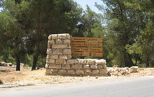
Dibeen Forest Reserve is a nature reserve located in the north-west of Jordan. It is situated just south of the Roman site of Jerash and covers an area of 8.5 square kilometres (3.3 sq mi) of rolling hills covered with pine–oak habitat. This area houses the largest Aleppo Pines one of the oldest and naturally grown habitats in Jordan.
Zarqa River
Jordanian river near Amman, tributary of the lower Jordan River
Distance: Approx. 8073 meters
Latitude and longitude: 32.19166667,35.80166667
The Zarqa River (Arabic: نهر الزرقاء, Nahr az-Zarqāʾ, lit. "the River of the Blue [City]") is the second largest tributary of the lower Jordan River, after the Yarmouk River. It is the third largest river in the region by annual discharge and its watershed encompasses the most densely populated areas east of the Jordan River.

Tulul adh-Dhahab
Archaeological site in Jordan
Distance: Approx. 3566 meters
Latitude and longitude: 32.18563889,35.68661111
The Tulul adh-Dhahab (Arabic: تلول الذهب; lit. "the hills of gold") is an archaeological site in Jordan. The site features two neighboring tells, separated by the Zarqa River (the biblical River Jabbok), an affluent of the Jordan River.
Safina, Jordan
Place in Ajloun Governorate, Jordan
Distance: Approx. 5559 meters
Latitude and longitude: 32.25388889,35.70944444
As-Safena (Arabic: السفينة) (al-Sāfinah) is a small village of approximately 1,584 people in the western Ajloun region of north Jordan. It is located in a remote, mountainous area about 10 km from the city of Ajloun. Safena comes from the Arabic word for ship, because the mountain the village stands on looks like a ship.
Amathus, Transjordan
Distance: Approx. 3562 meters
Latitude and longitude: 32.1856,35.6867
Amathus (Ancient Greek: Ἀμαθοῦς or τὰ Ἀμαθά; in Eusebius, Ἀμμαθοὺς. Hebrew: עמתו was a fortified city east of the Jordan River, in modern-day Jordan.
Mosque of Abu Ubaidah Amer ibn al-Jarrah
Mosque in Deir Alla, Jordan
Distance: Approx. 9547 meters
Latitude and longitude: 32.2270325,35.6195265
The Mosque of Abu Ubaidah Amer ibn al-Jarrah (Arabic: مسجد أبي عبيدة عامر بن الجراح) is a historic mosque and mausoleum located in the town of Deir Alla, Jordan. It contains the purported tomb of Abu Ubayda ibn al-Jarrah, one of the Sahabah and a military commander of the Rashidun Caliphate.

Rajeb
Town in Ajloun Governorate, known as Ragaba/Regev in antiquity
Distance: Approx. 4539 meters
Latitude and longitude: 32.23333333,35.68333333
Rajeb or Rajib (Arabic: راجب) is a village in the Ajloun Governorate in northwestern Jordan. In classical sources, Ar Rajib is known as Reğeb (Ragaba).
Weather in this IP's area
broken clouds
13 Celsius
12 Celsius
13 Celsius
13 Celsius
1023 hPa
43 %
1023 hPa
952 hPa
10000 meters
6.07 m/s
8.16 m/s
100 degree
55 %


