149.200.150.182 - IP Lookup: Free IP Address Lookup, Postal Code Lookup, IP Location Lookup, IP ASN, Public IP
Country:
Region:
City:
Location:
Time Zone:
Postal Code:
ISP:
ASN:
language:
User-Agent:
Proxy IP:
Blacklist:
IP information under different IP Channel
ip-api
Country
Region
City
ASN
Time Zone
ISP
Blacklist
Proxy
Latitude
Longitude
Postal
Route
db-ip
Country
Region
City
ASN
Time Zone
ISP
Blacklist
Proxy
Latitude
Longitude
Postal
Route
IPinfo
Country
Region
City
ASN
Time Zone
ISP
Blacklist
Proxy
Latitude
Longitude
Postal
Route
IP2Location
149.200.150.182Country
Region
irbid
City
kurayyimah
Time Zone
ISP
Language
User-Agent
Latitude
Longitude
Postal
ipdata
Country
Region
City
ASN
Time Zone
ISP
Blacklist
Proxy
Latitude
Longitude
Postal
Route
Popular places and events near this IP address
Jordan Rift Valley
Geographic region in the Levant
Distance: Approx. 5320 meters
Latitude and longitude: 32.31722222,35.57
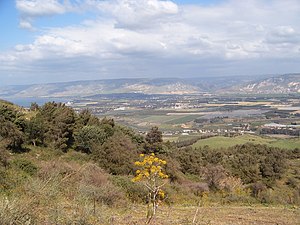
The Jordan Rift Valley, also Jordan Valley (Hebrew: בִּקְעָת הַיַרְדֵּן Bīqʿāt haYardēn, Arabic: الغور Al-Ghor or Al-Ghawr), is an elongated endorheic basin located in modern-day Israel, Jordan and the West Bank, Palestine. This geographic region includes the entire length of the Jordan River – from its sources, through the Hula Valley, the Korazim block, the Sea of Galilee, the (Lower) Jordan Valley, all the way to the Dead Sea, the lowest land elevation on Earth – and then continues through the Arabah depression, the Gulf of Aqaba whose shorelines it incorporates, until finally reaching the Red Sea proper at the Straits of Tiran.

Deir Alla
City in Balqa Governorate, Jordan
Distance: Approx. 9748 meters
Latitude and longitude: 32.18888889,35.60305556
Deir Alla (Arabic: دير علا) is the site of an ancient Near Eastern town in Balqa Governorate, Jordan. The Deir Alla Inscription, datable to ca. 840–760 BCE, was found here.

Hemdat
Israeli settlement in the West Bank
Distance: Approx. 7344 meters
Latitude and longitude: 32.25194444,35.52694444
Hemdat (Hebrew: חֶמְדָּת) is a community Israeli settlement in the West Bank located near the Palestinian hamlet of Khirbet Makhoul, in the Jordan River Valley on a plain at an altitude of 178 metres along the Allon Road in the municipal jurisdiction of the Bik'at HaYarden Regional Council. Other Israeli settlements in the area are Ro'i and Beka'ot. The closest city, Beit Shean, is a thirty-minute drive north of Hemdat.

Jordan Valley
Rift valley in Israel, Palestine and Jordan
Distance: Approx. 5320 meters
Latitude and longitude: 32.31722222,35.57
The Jordan Valley (Arabic: غَوْر الأُرْدُنّ, romanized: Ghawr al-Urdunn; Hebrew: עֵמֶק הַיַרְדֵּן, romanized: Emek HaYarden) forms part of the larger Jordan Rift Valley. Unlike most other river valleys, the term "Jordan Valley" often applies just to the lower course of the Jordan River, from the spot where it exits the Sea of Galilee in the north, to the end of its course where it flows into the Dead Sea in the south. In a wider sense, the term may also cover the Dead Sea basin and the Arabah valley, which is the rift valley segment beyond the Dead Sea and ending at Aqaba/Eilat, 155 km (96 mi) farther south.

Al Wahadinah
Place in Ajloun Governorate, Jordan
Distance: Approx. 7002 meters
Latitude and longitude: 32.32611111,35.645
Al Wahadinah (الوهادنه), Khirbet Mar Elias or Khirbet al Wahadneh is a village in the Ajloun Governorate, Jordan. Along with Al Hashimiyya and Halawah, it makes up the Ash Shefa Municipality. It has a large Christian population and contains both a Catholic and an Eastern Orthodox church.
Mosque of Abu Ubaidah Amer ibn al-Jarrah
Mosque in Deir Alla, Jordan
Distance: Approx. 5813 meters
Latitude and longitude: 32.2270325,35.6195265
The Mosque of Abu Ubaidah Amer ibn al-Jarrah (Arabic: مسجد أبي عبيدة عامر بن الجراح) is a historic mosque and mausoleum located in the town of Deir Alla, Jordan. It contains the purported tomb of Abu Ubayda ibn al-Jarrah, one of the Sahabah and a military commander of the Rashidun Caliphate.

Rajeb
Town in Ajloun Governorate, known as Ragaba/Regev in antiquity
Distance: Approx. 9242 meters
Latitude and longitude: 32.23333333,35.68333333
Rajeb or Rajib (Arabic: راجب) is a village in the Ajloun Governorate in northwestern Jordan. In classical sources, Ar Rajib is known as Reğeb (Ragaba).
Weather in this IP's area
overcast clouds
14 Celsius
12 Celsius
14 Celsius
14 Celsius
1020 hPa
50 %
1020 hPa
996 hPa
10000 meters
2.96 m/s
3.58 m/s
44 degree
97 %

