Country:
Region:
City:
Latitude and Longitude:
Time Zone:
Postal Code:
IP information under different IP Channel
ip-api
Country
Region
City
ASN
Time Zone
ISP
Blacklist
Proxy
Latitude
Longitude
Postal
Route
Luminati
Country
Region
ma
ASN
Time Zone
America/New_York
ISP
Cato Networks Ltd
Latitude
Longitude
Postal
IPinfo
Country
Region
City
ASN
Time Zone
ISP
Blacklist
Proxy
Latitude
Longitude
Postal
Route
db-ip
Country
Region
City
ASN
Time Zone
ISP
Blacklist
Proxy
Latitude
Longitude
Postal
Route
ipdata
Country
Region
City
ASN
Time Zone
ISP
Blacklist
Proxy
Latitude
Longitude
Postal
Route
Popular places and events near this IP address
Meadows Place, Texas
City in Texas, United States
Distance: Approx. 185 meters
Latitude and longitude: 29.64972222,-95.58861111
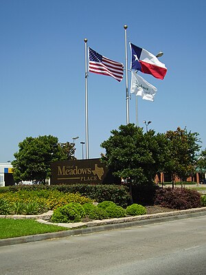
Meadows Place is a city located in Fort Bend County in the U.S. state of Texas within the Houston–Sugar Land–Baytown metropolitan area. As of the 2020 U.S. Census, the city population was 4,767. Meadows Place was part of Stafford's extraterritorial jurisdiction prior to incorporation on November 14, 1983.
Stafford, Texas
City in Texas, United States
Distance: Approx. 3850 meters
Latitude and longitude: 29.62416667,-95.56333333
Stafford is a city in the U.S. state of Texas, in the Houston–The Woodlands–Sugar Land metropolitan area. The city is mostly in Fort Bend County, with a small part in Harris County. As of the 2020 census, Stafford's population was 17,666, down from 17,693 at the 2010 census.
Dulles High School (Sugar Land, Texas)
Public school in Sugar Land, Texas, United States
Distance: Approx. 3463 meters
Latitude and longitude: 29.62037,-95.58418
John Foster Dulles High School, more commonly known as Dulles High School, is a high school in Sugar Land, Texas. It was the first site purchase and new build, in the 1950s, of the newly formed Fort Bend Independent School District, which held its first graduation in 1960. The first class to graduate from Dulles itself was 1962.

Kempner High School
Public secondary school in Sugar Land, Texas, United States
Distance: Approx. 5692 meters
Latitude and longitude: 29.64333333,-95.64611111
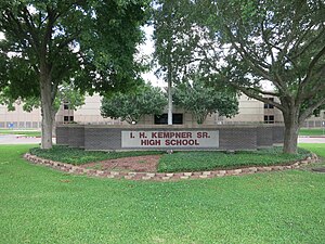
I.H. Kempner High School, better known simply as Kempner High School, is a public high school in Sugar Land, Texas and a part of the Fort Bend Independent School District (FBISD). A small portion of the City of Houston is in the school's boundary. It also includes the former census-designated place of Town West (Townewest).
Wilcrest Baptist Church
Distance: Approx. 5682 meters
Latitude and longitude: 29.6998,-95.5697
Wilcrest Baptist Church is a Baptist church in Houston Texas. It is affiliated with the Southern Baptist Convention.
Forum Park, Houston
Distance: Approx. 3811 meters
Latitude and longitude: 29.67,-95.555
Forum Park is a community in Houston, Texas. It is bounded by Texas State Highway Beltway 8, U.S. Route 59 (Southwest Freeway), and Bissonnet Road. A portion of the community resides in the Greater Sharpstown district.
Harmony Public Schools
Charter management organization in Texas, US
Distance: Approx. 4501 meters
Latitude and longitude: 29.6825,-95.5584
Harmony Public Schools is the largest charter management organization in Texas with seventy three campuses serving students in kindergarten through 12th grade.
Westwood (subdivision), Houston
Distance: Approx. 4183 meters
Latitude and longitude: 29.6775,-95.557
Westwood is a residential subdivision in Southwest Houston, Texas. The subdivision is bounded by the 610 Loop, the Union Pacific railroad tracks, Stella Link Road, and Willowbend Boulevard. It has about 800 houses.

Sugar Land Quan Am
The Sugar Land Quan Am Statue
Distance: Approx. 3588 meters
Latitude and longitude: 29.670853,-95.617491
The Sugar Land Quan Âm is a cast concrete statue in Chùa Việt Nam (English: Vietnamese Buddhist Center) in Sugar Land, Texas, just outside of Houston. The sculpture depicts the bodhisattva Avalokiteśvara in female form standing on a lotus pedestal. She may also be commonly known by her Chinese name Guanyin.
Fort Bend Christian Academy
Private, co-educational, non-profit school in the United States
Distance: Approx. 3535 meters
Latitude and longitude: 29.6301,-95.6152
Fort Bend Christian Academy (FBCA) is a private PK-12 Christian school with two campuses in Sugar Land, Texas in the Houston metropolitan area. With two campuses, the North Campus houses upper school (9th - 12th Grade) while the South Campus houses lower school (PreK - 4th Grade) and middle school (5th - 8th Grade). FBCA pursues a mission "to equip students to thrive spiritually, academically, socially, emotionally, and physically" through weekly chapel, maintaining a 10:1 student-to-teacher ratio in the upper school and providing a wide variety of honors and AP courses.
M. R. Wood Alternative Education Center
School
Distance: Approx. 5509 meters
Latitude and longitude: 29.6260483,-95.636964
M. R. Wood Alternative Education Center (MRW), also known as the M. R. Wood Center for Learning, was an alternative school in Sugar Land, Texas and a part of the Fort Bend Independent School District (FBISD). It was in proximity to the Imperial Sugar plant.
Town West, Texas
Distance: Approx. 4400 meters
Latitude and longitude: 29.66388889,-95.63111111
Townewest is an unincorporated area in Fort Bend County, Texas, United States. As Town West, it is a former census-designated place, active as of the 1990 U.S. Census. By the 2000 U.S. Census, it was no longer listed.
Weather in this IP's area
clear sky
16 Celsius
15 Celsius
14 Celsius
17 Celsius
1018 hPa
67 %
1018 hPa
1015 hPa
10000 meters
7.72 m/s
10.8 m/s
330 degree
06:51:34
17:25:01


