Country:
 Germany
Region:
City:
Latitude and Longitude:
Time Zone:
Postal Code:
IP information under different IP Channel
ip-api
Country
Region
City
ASN
Time Zone
ISP
Blacklist
Proxy
Latitude
Longitude
Postal
Route
IPinfo
Country
Region
City
ASN
Time Zone
ISP
Blacklist
Proxy
Latitude
Longitude
Postal
Route
MaxMind
Country
Region
City
ASN
Time Zone
ISP
Blacklist
Proxy
Latitude
Longitude
Postal
Route
Luminati
Country
DERegion
bw
City
niedereschach
ASN
Time Zone
Europe/Berlin
ISP
Vodafone GmbH
Latitude
Longitude
Postal
db-ip
Country
Region
City
ASN
Time Zone
ISP
Blacklist
Proxy
Latitude
Longitude
Postal
Route
ipdata
Country
Region
City
ASN
Time Zone
ISP
Blacklist
Proxy
Latitude
Longitude
Postal
Route
Popular places and events near this IP address
Ludwigsburg (district)
District in Baden-Württemberg, Germany
Distance: Approx. 5447 meters
Latitude and longitude: 48.9,9.2
Landkreis Ludwigsburg is a Landkreis (district) in the middle of Baden-Württemberg, Germany. Neighboring districts are (from north clockwise) Heilbronn, Rems-Murr-Kreis, the district-free city Stuttgart, and the districts Böblingen and Enz-Kreis.
Mercedes-AMG
High-performance subsidiary of Mercedes-Benz AG
Distance: Approx. 5684 meters
Latitude and longitude: 48.9186739,9.3232478
Mercedes-AMG GmbH, commonly known as AMG (Aufrecht, Melcher, Großaspach), is the high-performance subsidiary of Mercedes-Benz AG. AMG independently hires engineers and contracts with manufacturers to customize Mercedes-Benz AMG vehicles. The company has its headquarters in Affalterbach, Baden-Württemberg, Germany. AMG was originally an independent engineering firm specializing in performance improvements for Mercedes-Benz vehicles.

Remseck
Town in Baden-Württemberg, Germany
Distance: Approx. 1552 meters
Latitude and longitude: 48.86888889,9.27638889
Remseck am Neckar (German: [ˈʁɛmsˌʔɛk] ) is a town in the district of Ludwigsburg, Baden-Württemberg, Germany. It is situated at the confluence of the rivers Rems and Neckar, about 12 km northeast of Stuttgart, and 7 km southeast of Ludwigsburg. The town was formed on January 1, 1975, initially under the name Aldingen am Neckar.
Pattonville
Neighborhood in Baden-Württemberg, Germany
Distance: Approx. 3435 meters
Latitude and longitude: 48.87333333,9.22416667
Pattonville is a neighborhood in Baden-Württemberg, Germany, northeast of Stuttgart, with the unusual distinction of being a former United States military housing complex, as few U.S. installations returned to German control have been maintained in their former form.
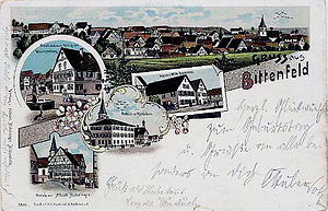
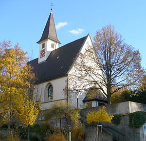
Bittenfeld
Distance: Approx. 3478 meters
Latitude and longitude: 48.88333333,9.31666667
Bittenfeld is an incorporated (1975) town located in the northernmost quarter of Waiblingen in the Rems-Murr-Kreis in Baden-Württemberg. Its population is approximately 4,300 inhabitants.
Hohenacker
Distance: Approx. 3753 meters
Latitude and longitude: 48.86722222,9.31527778
Hohenacker, once a town, is now part of Waiblingen, Baden-Württemberg, Germany.

Rems (river)
River in Germany
Distance: Approx. 1018 meters
Latitude and longitude: 48.87361111,9.27472222
The Rems is a right tributary of the Neckar in eastern Baden-Württemberg, Germany. It is 78 km long. It upsprings at Essingen, near Aalen.

Stuttgart American High School
Secondary school in Germany
Distance: Approx. 3614 meters
Latitude and longitude: 48.875,9.221
Stuttgart American High School in West Germany was first located at Robinson Barracks (old SA (SturmAbteilung) barracks), north of Stuttgart, from fall 1953 to spring 1955. That fall, the school moved a few miles northeast and opened at Pattonville, a new U.S. military housing complex just southeast of Ludwigsburg, with 300 students and 35 graduating seniors. For school years 1956/57/58, it was a secondary school (grades 7–12).

Lemberg (Affalterbach)
Distance: Approx. 4942 meters
Latitude and longitude: 48.91805556,9.30861111
Lemberg (Affalterbach) is a hill, 365 metres high, in Baden-Württemberg, Germany.

Feuerbach (Neckar)
River in Germany
Distance: Approx. 5264 meters
Latitude and longitude: 48.8413,9.2326
Feuerbach (in its upper course: Metzgerbach) is a river of Baden-Württemberg, Germany. It passes northwest of Stuttgart, and flows into the Neckar in the Stadtteil Stuttgart-Mühlhausen.

Zipfelbach (Neckar)
River in Germany
Distance: Approx. 2269 meters
Latitude and longitude: 48.9009,9.2576
Zipfelbach is a river of Baden-Württemberg, Germany. It is a right tributary of the Neckar near Ludwigsburg.

Schlosstheater Ludwigsburg
Theater of Ludwigsburg Palace in Ludwigsburg, Germany
Distance: Approx. 5631 meters
Latitude and longitude: 48.89777778,9.19611111
Schlosstheater Ludwigsburg is a theatre in Ludwigsburg, Baden-Württemberg, Germany.
Weather in this IP's area
clear sky
23 Celsius
22 Celsius
21 Celsius
23 Celsius
1018 hPa
47 %
1018 hPa
992 hPa
10000 meters
3.13 m/s
6.26 m/s
107 degree
07:05:33
19:27:48