Country:
Region:
City:
Latitude and Longitude:
Time Zone:
Postal Code:
IP information under different IP Channel
ip-api
Country
Region
City
ASN
Time Zone
ISP
Blacklist
Proxy
Latitude
Longitude
Postal
Route
Luminati
Country
Region
bw
City
wehr
ASN
Time Zone
Europe/Berlin
ISP
Vodafone GmbH
Latitude
Longitude
Postal
IPinfo
Country
Region
City
ASN
Time Zone
ISP
Blacklist
Proxy
Latitude
Longitude
Postal
Route
db-ip
Country
Region
City
ASN
Time Zone
ISP
Blacklist
Proxy
Latitude
Longitude
Postal
Route
ipdata
Country
Region
City
ASN
Time Zone
ISP
Blacklist
Proxy
Latitude
Longitude
Postal
Route
Popular places and events near this IP address

Hausen im Wiesental
Municipality in Baden-Württemberg, Germany
Distance: Approx. 3324 meters
Latitude and longitude: 47.68138889,7.84055556
Hausen im Wiesental is a village in the Lörrach district of Baden-Württemberg, Germany. It is famous for the dialectal poet Johann Peter Hebel who lived in Hausen for many years. The eminent expressionistic painter August Babberger was born in Hausen in 1885.

Schopfheim
Town in Baden-Württemberg, Germany
Distance: Approx. 717 meters
Latitude and longitude: 47.65,7.81666667
Schopfheim is a town in the district of Lörrach in Baden-Württemberg, Germany. It is situated on the river Wiese, 10 km north of Rheinfelden, and 13 km east of Lörrach. The town is the birthplace of Gisela Oeri, Max Picard, and Arno Villringer.

Maulburg
Municipality in Baden-Württemberg, Germany
Distance: Approx. 3523 meters
Latitude and longitude: 47.645,7.77944444
Maulburg is a municipality in the district of Lörrach in Baden-Württemberg in Germany.

Hohe Flum
Distance: Approx. 3156 meters
Latitude and longitude: 47.62666667,7.81111111
Hohe Flum is a mountain of Baden-Württemberg, Germany.

Dinkelberg
Hill range in Germany
Distance: Approx. 3156 meters
Latitude and longitude: 47.62667,7.81111
The Dinkelberg is a partially forested hill range, up to 536.2 m above sea level (NHN), about 145 km2 in area, in the High Rhine region of Germany. It lies within the counties of Lörrach and Waldshut in the German state of Baden-Württemberg and the Swiss canton of Basel-Stadt. It is on the southwestern edge of the , from which it is geologically distinct.
Eichener See
Lake in Lörrach, Baden-Württemberg, Germany
Distance: Approx. 2977 meters
Latitude and longitude: 47.644734,7.862209
The Eichener See ("Lake Eichen"), known in the Alemannic dialect as the Eiemer See, near Eichen in the Baden-Württemberg county of Lörrach is a periodic (astatic) karst lake in the Southern Black Forest in Germany. The lake, which only contains water when there is a high water table, lies in a hollow, a muschelkalk-karst basin. It has no surface inflow, its outflows are partly subterranean and partly through evaporation.

Maulburg station
Railway station in Maulburg, Germany
Distance: Approx. 3455 meters
Latitude and longitude: 47.64437389,7.78066194
Maulburg station (German: Bahnhof Maulburg) is a railway station in the municipality of Maulburg, in Baden-Württemberg, Germany. It is located on standard gauge Wiese Valley Railway of Deutsche Bahn.

Schopfheim West station
Railway station in Schopfheim, Germany
Distance: Approx. 1938 meters
Latitude and longitude: 47.64554111,7.801715
Schopfheim West station (German: Bahnhof Schopfheim West) is a railway station in the municipality of Schopfheim, in Baden-Württemberg, Germany. It is located on standard gauge Wiese Valley Railway of Deutsche Bahn.

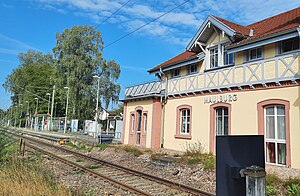
Schopfheim station
Railway station in Schopfheim, Germany
Distance: Approx. 636 meters
Latitude and longitude: 47.64793889,7.82276111
Schopfheim station (German: Bahnhof Schopfheim) is a railway station in the municipality of Schopfheim, in Baden-Württemberg, Germany. It is located on standard gauge Wiese Valley Railway of Deutsche Bahn. It was formerly the site of the junction with the Wehra Valley Railway to Bad Säckingen.
Schopfheim-Schlattholz station
Railway station in Germany
Distance: Approx. 647 meters
Latitude and longitude: 47.65388889,7.83330556
Schopfheim-Schlattholz station (German: Bahnhof Schopfheim-Schlattholz) is a railway station in the municipality of Schopfheim, in Baden-Württemberg, Germany. It is located on standard gauge Wiese Valley Railway of Deutsche Bahn. The station opened on 9 December 2017.

Fahrnau station
Railway station in Schopfheim, Germany
Distance: Approx. 1423 meters
Latitude and longitude: 47.66156,7.839425
Fahrnau station (German: Bahnhof Fahrnau) is a railway station in the municipality of Schopfheim, in Baden-Württemberg, Germany. It is located on standard gauge Wiese Valley Railway of Deutsche Bahn.

Hausen-Raitbach station
Railway station in Hausen im Wiesental, Germany
Distance: Approx. 3289 meters
Latitude and longitude: 47.67931,7.84604111
Hausen-Raitbach station (German: Bahnhof Hausen-Raitbach) is a railway station in the municipality of Hausen im Wiesental, in Baden-Württemberg, Germany. It is located on standard gauge Wiese Valley Railway of Deutsche Bahn.
Weather in this IP's area
broken clouds
7 Celsius
6 Celsius
5 Celsius
8 Celsius
1029 hPa
96 %
1029 hPa
978 hPa
10000 meters
1.38 m/s
1.26 m/s
117 degree
70 %
07:23:53
17:01:07
