149.154.8.128 - IP Lookup: Free IP Address Lookup, Postal Code Lookup, IP Location Lookup, IP ASN, Public IP
Country:
Region:
City:
Location:
Time Zone:
Postal Code:
IP information under different IP Channel
ip-api
Country
Region
City
ASN
Time Zone
ISP
Blacklist
Proxy
Latitude
Longitude
Postal
Route
Luminati
Country
Region
mi
City
lansing
ASN
Time Zone
America/Detroit
ISP
AS-CMN
Latitude
Longitude
Postal
IPinfo
Country
Region
City
ASN
Time Zone
ISP
Blacklist
Proxy
Latitude
Longitude
Postal
Route
IP2Location
149.154.8.128Country
Region
michigan
City
lansing
Time Zone
America/Detroit
ISP
Language
User-Agent
Latitude
Longitude
Postal
db-ip
Country
Region
City
ASN
Time Zone
ISP
Blacklist
Proxy
Latitude
Longitude
Postal
Route
ipdata
Country
Region
City
ASN
Time Zone
ISP
Blacklist
Proxy
Latitude
Longitude
Postal
Route
Popular places and events near this IP address

Lansing, Michigan
Capital city of Michigan, United States
Distance: Approx. 1674 meters
Latitude and longitude: 42.71416667,-84.56
Lansing () is the capital of the U.S. state of Michigan and the most populous city in Ingham County. It is mostly in the county, although portions of the city extend west into Eaton County and north into Clinton County. The 2020 census placed the city's population at 112,644, making it the sixth most populous city in Michigan.
Michigan Library Association
Professional association for librarians in Michigan
Distance: Approx. 2192 meters
Latitude and longitude: 42.685446,-84.53416
The Michigan Library Association is a United States professional association headquartered in Lansing, Michigan that advocates for libraries in Michigan on behalf of the state's residents. Founded in 1891 its members are more than 2,700 individuals and organizations from public, school, academic, cooperative, private and special libraries. With a mission to lead the advancement of all Michigan libraries through advocacy, education and engagement, the Michigan Library Association (MLA) is Michigan's oldest and largest library association and has advocated for libraries on behalf of the state's residents for more than 130 years.

Everett High School (Michigan)
High school in Lansing, Michigan
Distance: Approx. 1444 meters
Latitude and longitude: 42.69222222,-84.55611111
Everett High School is a public, magnet high school located on the south side of Lansing, Michigan.

Lansing–East Lansing metropolitan area
Metropolitan Area in Michigan, United States
Distance: Approx. 2275 meters
Latitude and longitude: 42.72288889,-84.55269444
The Lansing–East Lansing Metropolitan Statistical Area is a metropolitan area located in Central Michigan defined by the Office of Management and Budget, and encompassing the counties of Eaton, Clinton, and Ingham. The region is colloquially referred to as "Mid" or Central Michigan, and less often as "Greater Lansing" or the "Capital Area". As of the 2020 census, the MSA had a population of 473,203.

McLaren–Greater Lansing Hospital
Hospital in Michigan, United States
Distance: Approx. 766 meters
Latitude and longitude: 42.7038,-84.5556
McLaren Greater Lansing, is a tertiary teaching facility with 240 acute care beds, located in Lansing, Michigan on the southern edge of the Michigan State University campus. Among its services are a Level III Trauma Center/Emergency Department, Orthopedic and Sports Medicine Institute, cardiac programs, medical/surgical units, and women and children's health services including a birthing center. Also located at the healthcare campus is the Karmanos Cancer Institute at McLaren Greater Lansing and Outpatient Care Center.

REO Town
Neighborhood in Ingham, Michigan, United States
Distance: Approx. 1672 meters
Latitude and longitude: 42.717,-84.5537
REO Town is a district in Lansing, Michigan, United States, located south of downtown. The neighborhood is bordered by West Malcolm X Street to the north; South Cedar Street BL I-96 to the east; West Mount Hope Avenue to the south; and Townsend Street, the Grand River, and South Martin Luther King Jr. Boulevard to the west.

Walter H. French Junior High School
United States historic place
Distance: Approx. 954 meters
Latitude and longitude: 42.7114,-84.5486
The Walter French Junior High School, formerly known as the Walter French Academy or the Walter French Academy of Business and Technology, is a three-story school building located at the corner of Mount Hope and Cedar in Lansing, Michigan. It was listed on the National Register of Historic Places in 2014.

Lansing station (Canadian National Railway)
Distance: Approx. 1877 meters
Latitude and longitude: 42.71944444,-84.55138889
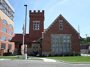
The Grand Trunk Western station was a historic railroad station in Lansing, Michigan. The station was listed as a Michigan State Historic Site in 1978, and it was added to the National Register of Historic Places in 1980.

Sycamore Creek (Michigan)
River in Michigan, United States
Distance: Approx. 1929 meters
Latitude and longitude: 42.7142018,-84.5283112
Sycamore Creek is a tributary of the Red Cedar River in the state of Michigan in the United States. The stream is 26.5 miles (42.6 km) long and drains an area of 106.1 square miles (275 km2) on the central Lower Peninsula, in and around the city of Lansing. Via the Red Cedar River, it is part of the watershed of the Grand River, which flows to Lake Michigan.

J.H. Moores Memorial Natatorium
United States historic place
Distance: Approx. 1758 meters
Latitude and longitude: 42.71694444,-84.55638889
The J.H. Moores Memorial Natatorium, also known as the Moores Park Pool, is a natatorium located at 2700 Moores River Drive in Lansing, Michigan. It was listed on the National Register of Historic Places in 1985. The pool at Moores Park was the prototype of what became known as the "Bintz Pool," an oval structure located entirely above ground, which was particularly suited to urban areas.

Barnes Avenue School
United States historic place
Distance: Approx. 2155 meters
Latitude and longitude: 42.71527778,-84.56666667
Barnes Avenue School is a school building located at 1028 West Barnes Avenue in Lansing, Michigan. It was listed on the National Register of Historic Places in 2023.

Washington Apartments (Lansing, Michigan)
United States historic place
Distance: Approx. 2310 meters
Latitude and longitude: 42.72333333,-84.55194444
Washington Apartments is an apartment building located at 927 South Washington Avenue in Lansing, Michigan. It was listed on the National Register of Historic Places in 2024.
Weather in this IP's area
overcast clouds
-2 Celsius
-7 Celsius
-2 Celsius
-1 Celsius
1019 hPa
82 %
1019 hPa
986 hPa
10000 meters
5.66 m/s
270 degree
100 %