149.154.8.104 - IP Lookup: Free IP Address Lookup, Postal Code Lookup, IP Location Lookup, IP ASN, Public IP
Country:
Region:
City:
Location:
Time Zone:
Postal Code:
ISP:
ASN:
language:
User-Agent:
Proxy IP:
Blacklist:
IP information under different IP Channel
ip-api
Country
Region
City
ASN
Time Zone
ISP
Blacklist
Proxy
Latitude
Longitude
Postal
Route
db-ip
Country
Region
City
ASN
Time Zone
ISP
Blacklist
Proxy
Latitude
Longitude
Postal
Route
IPinfo
Country
Region
City
ASN
Time Zone
ISP
Blacklist
Proxy
Latitude
Longitude
Postal
Route
IP2Location
149.154.8.104Country
Region
michigan
City
wyoming
Time Zone
America/Detroit
ISP
Language
User-Agent
Latitude
Longitude
Postal
ipdata
Country
Region
City
ASN
Time Zone
ISP
Blacklist
Proxy
Latitude
Longitude
Postal
Route
Popular places and events near this IP address
Lee High School (Wyoming, Michigan)
School in Wyoming, Michigan, United States
Distance: Approx. 2067 meters
Latitude and longitude: 42.9316,-85.7003
Lee High School is a high school in Wyoming, Michigan (U.S.) that is part of the Godfrey-Lee Public Schools school district.
WYCE
Radio station in Wyoming, Michigan
Distance: Approx. 1825 meters
Latitude and longitude: 42.912,-85.683
WYCE (88.1 FM) is an American community radio station, broadcasting a noncommercial, Triple A format. The station's music is programmed by volunteers, drawing from a diverse library of eclectic music, primarily folk, rock, blues, worldbeat and jazz music, with some emphasis on local musicians.

Norton Mound group
Archaeological site in Michigan, United States
Distance: Approx. 2917 meters
Latitude and longitude: 42.93658056,-85.72198056
The Norton Mound group, (also known as Norton Mound Site (20KT1) and Hopewell Indian Mounds Park), is a prehistoric Goodall focus mounds site in Wyoming, Michigan that is under the protection of the Grand Rapids Public Museum.
Studio 28
Former movie theater in Wyoming, Michigan, United States
Distance: Approx. 511 meters
Latitude and longitude: 42.91241,-85.69918
Studio 28 was a cinema multiplex located on 28th Street in Wyoming, Michigan, operational from 1965 to 2008. Expanding to a maximum of 20 screens, it was the first megaplex, and was once the largest multi-screen cinema complex in the world. Opened by cinema pioneer Jack Loeks, eventually becoming the flagship of Jack Loeks Theatres, Inc., a.k.a.
Kent Trails
Distance: Approx. 3056 meters
Latitude and longitude: 42.89408,-85.73192
Kent Trails is a fifteen-mile rail trail in Kent County, Michigan that runs through the cities of Grand Rapids, Grandville, Walker, Wyoming and Byron Township and is part of a network of trails in and around Grand Rapids. It runs north and south from John Ball Park in Grand Rapids to 84th Street in Byron Township, with an extension that runs east/west along 76th Street and north/south from 76th Street to Douglas Walker Park on 84th Street.

Chicago Drive Bridge
United States historic place
Distance: Approx. 2900 meters
Latitude and longitude: 42.93583333,-85.68722222
The Chicago Drive Bridge, also known as the Business Route M-21–Plaster Creek Bridge, is a bridge in Wyoming, Michigan, carrying Business Spur I-196 (BS I-196) over Plaster Creek. It was listed on the National Register of Historic Places in 1999.

Alabastine Mine
Mine in Wyoming, Michigan, U.S.
Distance: Approx. 3139 meters
Latitude and longitude: 42.94138889,-85.70058889
The Alabastine Mine is an underground gypsum mine in Wyoming, Michigan, originally dug by hand in 1907. The mine once included an underground stable for the mules used to haul the gypsum.
Domtar mine
Mine in Walker, Michigan, Michigan, U.S.A.
Distance: Approx. 1553 meters
Latitude and longitude: 42.9,-85.7
The Domtar Mine, formed from the consolidation of Grand Rapids Gypsum Company mines 1 & 2, is an inactive underground gypsum mine in Walker, a suburb of Grand Rapids, Michigan.

Wyoming High School (Michigan)
Public, coeducational high school in Wyoming, Michigan, United States
Distance: Approx. 664 meters
Latitude and longitude: 42.90972222,-85.69888889
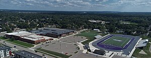
Wyoming High School is a public high school located in Wyoming, Michigan and is part of the Wyoming Public Schools District in Kent County, Michigan.
West Michigan Lutheran High School
Private school in Wyoming, Michigan, United States
Distance: Approx. 2506 meters
Latitude and longitude: 42.9002,-85.6804
West Michigan Lutheran High School is a Lutheran high school in Wyoming, Michigan, United States. It was started in the fall of 2004 with 10 students who were freshmen and sophomores. Its first location was in the Ministry Center Building of St.

Rogers Plaza
Shopping mall in Michigan, U.S.
Distance: Approx. 1205 meters
Latitude and longitude: 42.9123,-85.6906
Rogers Plaza also referred to as Rogers Plaza Town Center since 2002 is an enclosed shopping mall in Wyoming, Michigan, United States, a suburb of Grand Rapids, Michigan. Opened in 1961, it was the first shopping mall in Western Michigan and the first enclosed one in the state of Michigan. The center features Ross Dress For Less, Ollie's Bargain Outlet and B2 Outlet among its major stores.

The Potter's House (school)
Distance: Approx. 3022 meters
Latitude and longitude: 42.936975,-85.686921
The Potter's House is a K-12 private Christian school in Michigan. The elementary and middle school campus is in Grand Rapids and the high school campus is in Wyoming. As of 2017 the superintendent is John Booy.
Weather in this IP's area
overcast clouds
-3 Celsius
-9 Celsius
-3 Celsius
-3 Celsius
1013 hPa
91 %
1013 hPa
985 hPa
10000 meters
4.48 m/s
11.46 m/s
189 degree
99 %